 地图
地图  地图集
地图集  珍本
珍本  版画
版画  天文仪器
天文仪器 注册以了解我们最新的收购、展览和活动


地址
纽约
PO Box 329, Larchmont, NY, USA
开放时间,伦敦画廊
周一至周五:10:00-18:00
周六请预约
公休日:所有银行假日以及 8月1日至31日
营业时间,纽约
仅限预约

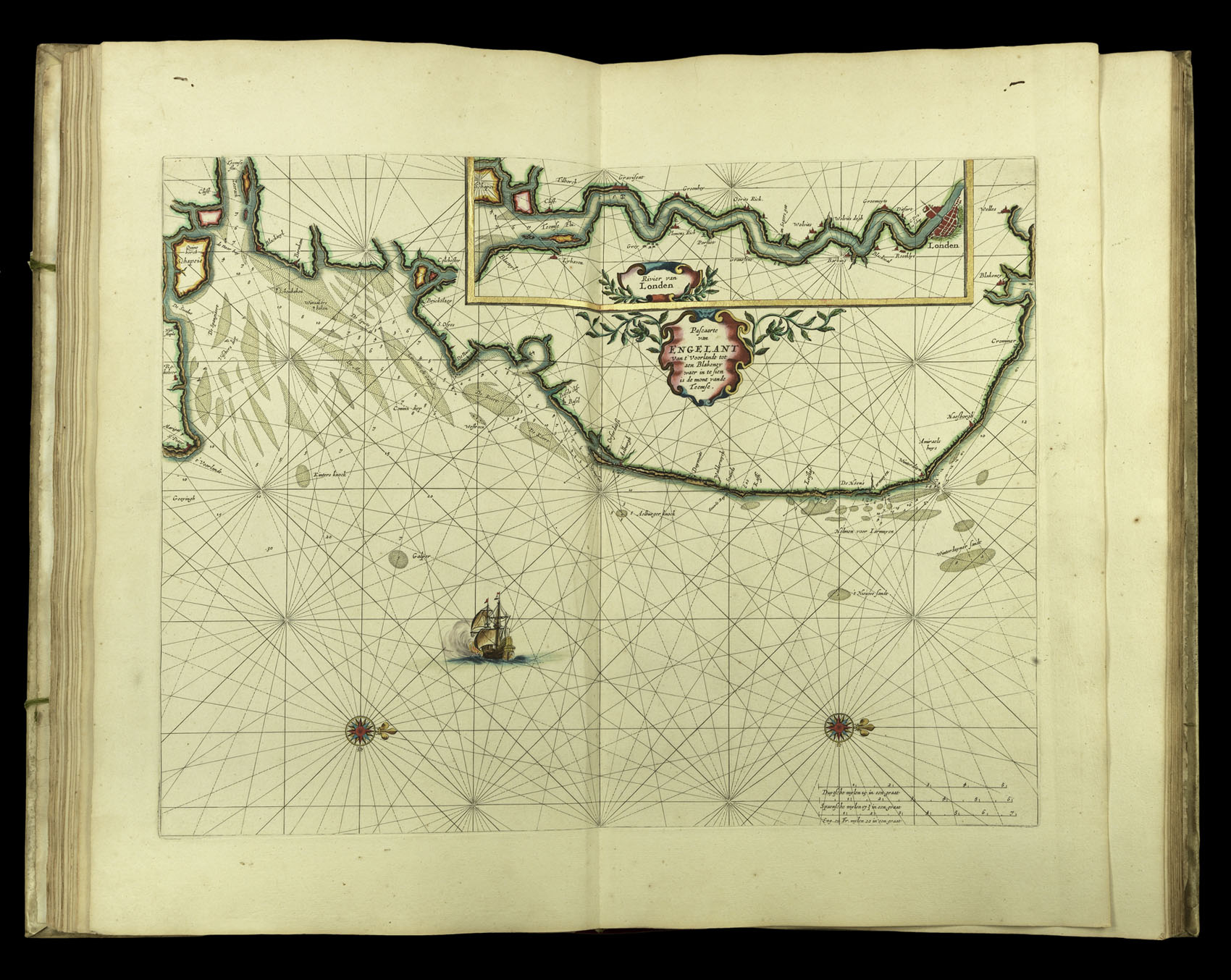
West coast of England
Pascaarte van Engelant Van t'Voorlandt tot aen Blakeney waer in te sien is de mont vande Teemse
- 作者: GOOS, Pieter
- 出版地: Amsterdam
- 出版商: Pieter Goos
- 发布日期: 1666
- 物理描述: Engraved map in original outline hand-colour heightened in gold
- 库存参考: 3859
笔记
A chart of the west coast of England and the mouth of the Thames, including the Isle of Sheppey. The inset map shows the course of the River Thames and London.
参考书目
- Burden 388
- Koeman Goos 1B
- NMM 3:92.
相关项目


/
请注册以了解最新珍品、展览和活动信息
地址
纽约
PO Box 329, Larchmont, NY, USA
开放时间,伦敦画廊
周一至周五:10:00-18:00
周六请预约
公休日:所有银行假日以及 8月1日至31日
营业时间,纽约
仅限预约