 地图
地图  地图集
地图集  珍本
珍本  版画
版画  天文仪器
天文仪器 注册以了解我们最新的收购、展览和活动


地址
纽约
PO Box 329, Larchmont, NY, USA
开放时间,伦敦画廊
周一至周五:10:00-18:00
周六请预约
公休日:所有银行假日以及 8月1日至31日
营业时间,纽约
仅限预约

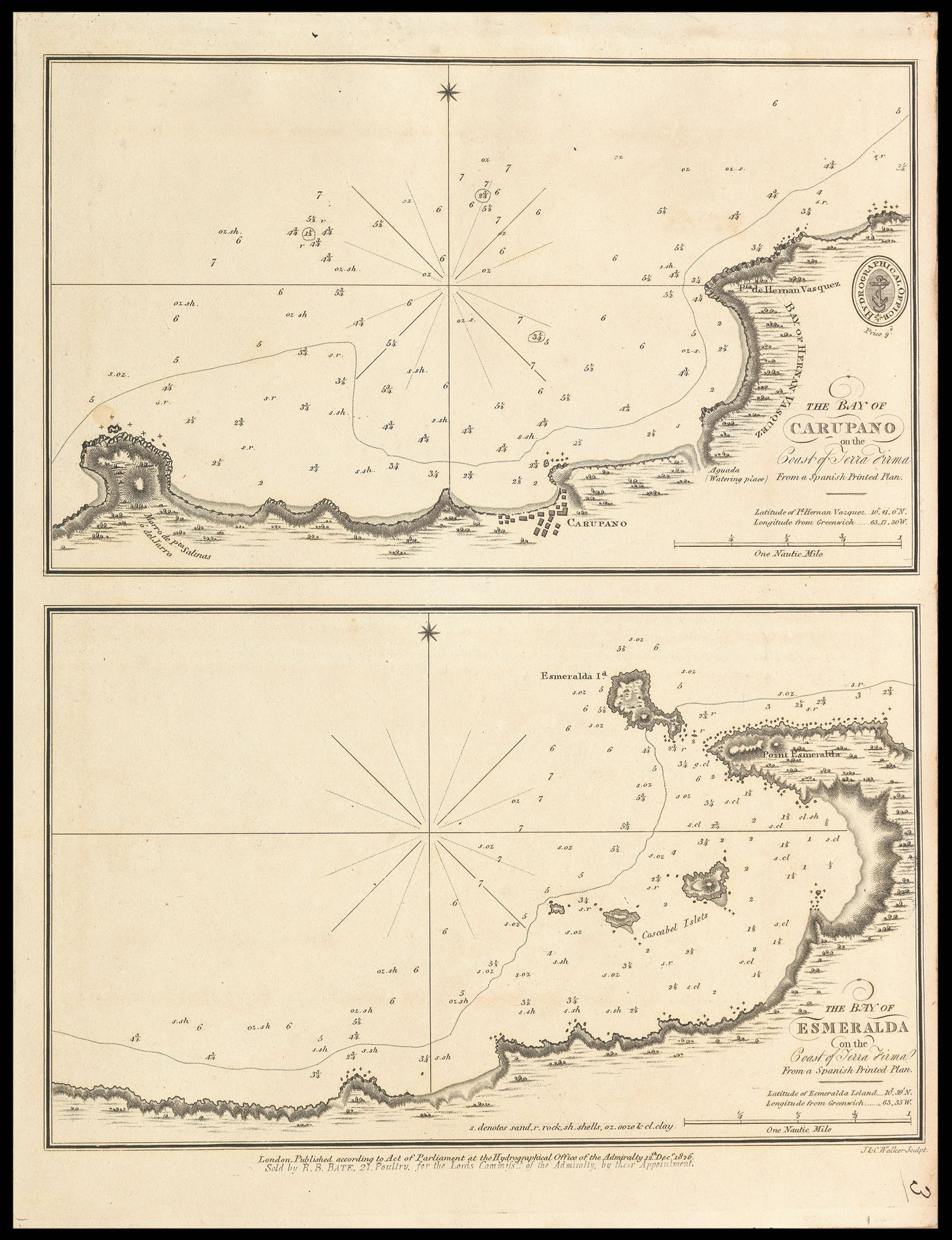
The Bay of Carupano on the Coast of Terra Firma; The Bay of Esmerelda on the Coast of Terra Firma
- 作者: WALKER, John & Charles
- 出版地: London
- 出版商: Hydrographical Office of the Admiralty
- 发布日期: 12th Dec 1826.
- 物理描述: Two engraved charts on one mapsheet.
- 方面: 142 by 238mm. (5.5 by 9.25 inches).
- 库存参考: 11600
笔记
Rare admiralty chart of the the Bays of Carupano and Esmeralda from the Venezuelan coast.
The title states that the chart was copied from a ‘Spanish printed Plan’, this refers to the ‘Portulano de la America Setentrional’ a work published by the Spanish Admiralty in 1809, and containing 111 charts of the Caribbean and Gulf of Mexico. A second edition of the pilot was published in 1818 with 121 charts.
John and Charles Walker, founding members of the Royal Geographic Society, were leading mapmakers and engravers working in London in the first half of the nineteenth century. They are known to have produced numerous charts for James Horsburgh and the Admiralty.
相关项目


请注册以了解最新珍品、展览和活动信息
地址
纽约
PO Box 329, Larchmont, NY, USA
开放时间,伦敦画廊
周一至周五:10:00-18:00
周六请预约
公休日:所有银行假日以及 8月1日至31日
营业时间,纽约
仅限预约