 地图
地图  地图集
地图集  珍本
珍本  版画
版画  天文仪器
天文仪器 注册以了解我们最新的收购、展览和活动


地址
纽约
PO Box 329, Larchmont, NY, USA
开放时间,伦敦画廊
周一至周五:10:00-18:00
周六请预约
公休日:所有银行假日以及 8月1日至31日
营业时间,纽约
仅限预约

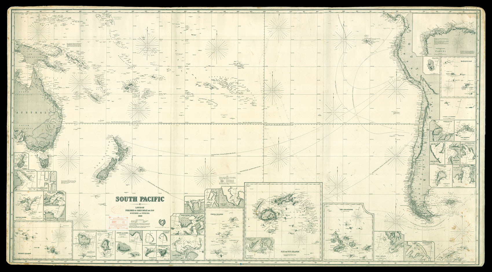
South Pacific Ocean
- 作者: IMRAY, James
- 出版地: London
- 出版商: James Imray & Son, Hydrographers
- 发布日期: 1869.
- 物理描述: Engraved chart on three joined sheets, backed on blue paper, 36 inset charts.
- 方面: 1020 by 1870mm. (40.25 by 73.5 inches).
- 库存参考: 11977
笔记
Large general chart of the South Pacific.
The map stretches from Papua New Guinea and Eastern Australia to Western South America. The inset maps show the most important ports and islands, and throughout the chart there are notes clarifying certain names and details. There are four routes marked in pencil starting from the Northern part of the ocean and going towards South America, where they make a turn around its tip. The pencil markings indicate that the chart was used at sea.
James Imray (1803-1870), worked originally in the stationery and account book publishing business. In 1836 Imray joined with Michael Blachford. The partnership flourished and soon began to compete with the larger firm of Norie and Wilson. In 1846 Imray bought out Blachford, and the company survived, led by his descendants, into the twentieth century, when it merged with Norie and Wilson.
相关项目


请注册以了解最新珍品、展览和活动信息
地址
纽约
PO Box 329, Larchmont, NY, USA
开放时间,伦敦画廊
周一至周五:10:00-18:00
周六请预约
公休日:所有银行假日以及 8月1日至31日
营业时间,纽约
仅限预约