 地图
地图  地图集
地图集  珍本
珍本  版画
版画  天文仪器
天文仪器 注册以了解我们最新的收购、展览和活动


地址
纽约
PO Box 329, Larchmont, NY, USA
开放时间,伦敦画廊
周一至周五:10:00-18:00
周六请预约
公休日:所有银行假日以及 8月1日至31日
营业时间,纽约
仅限预约

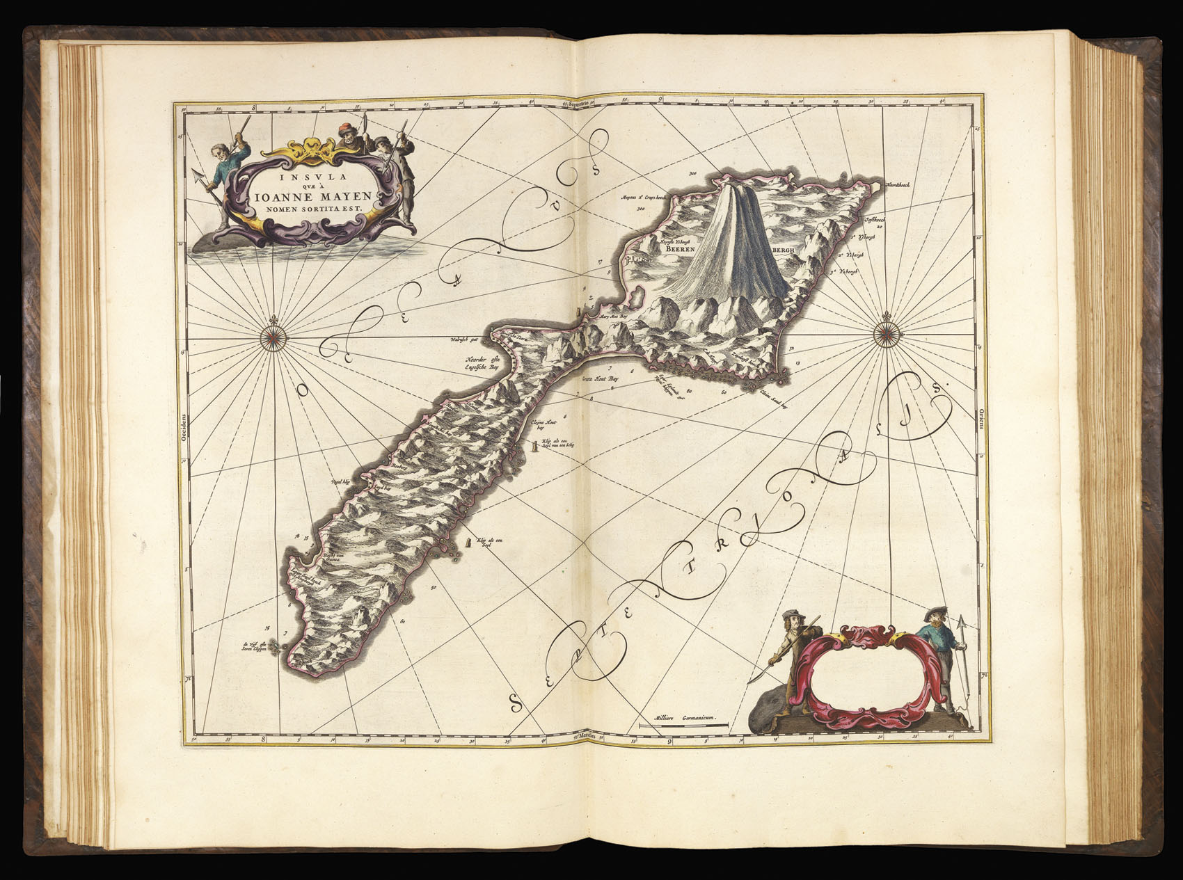
Insula Quae A Joanne Mayen Nomen Sortita Est.
- 作者: BLAEU, Johannes
- 出版地: Amsterdam
- 发布日期: 1665.
- 物理描述: Engraved map in contemporary hand-colour, heightened in gold.
- 方面: 440 by 550mm. (17.25 by 21.75 inches).
- 库存参考: 9688
笔记
Map of Jan Mayen island located in the Arctic Ocean. Part of the Kingdom of Norway.
The volcanic island of Jan Meyen (originally named Maurits Island) first appeared on Willem Jansz Blaeu’s 1620 map of Europe, originally published by Cornelis Doedz in 1606. The island was named “Jan Mayen” after captain Jan Jacobszoon May of the Amsterdam-financed Gouden Cath. Blaeu established its current name with the first detailed map of the island in his famous “Zeespiegel” atlas of 1623.
The map appeared in the ‘Atlas Major’, which, in its various editions, was the largest atlas ever published. It was justly famed for its production values, its high typographic standard, and the quality of its engraving, ornamentation, binding and colouring. The atlas frequently served as the official gift of the Dutch Republic to princes and other authorities. It is one of the most lavish and highly prized of all seventeenth-century illustrated books.
参考书目
- Van der Krogt
- Shirley, British Library.
- Brotton, 265-290
- S. Kramer, 'Ex bibliotheca Reisachiorum', Scriptorium 34 (1980), pp.91-95
相关项目


请注册以了解最新珍品、展览和活动信息
地址
纽约
PO Box 329, Larchmont, NY, USA
开放时间,伦敦画廊
周一至周五:10:00-18:00
周六请预约
公休日:所有银行假日以及 8月1日至31日
营业时间,纽约
仅限预约