 地图
地图  地图集
地图集  珍本
珍本  版画
版画  天文仪器
天文仪器 注册以了解我们最新的收购、展览和活动


地址
纽约
PO Box 329, Larchmont, NY, USA
开放时间,伦敦画廊
周一至周五:10:00-18:00
周六请预约
公休日:所有银行假日以及 8月1日至31日
营业时间,纽约
仅限预约

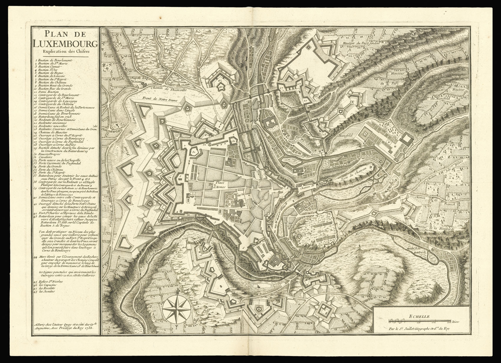
Plan de Luxembourg.
- 作者: JAILLOT, Hubert
- 出版地: Paris
- 出版商: chez l'Auteur Quay eta côte des Gr de Augustins
- 发布日期: 1735.
- 物理描述: Engraved map.
- 方面: 380 by 540mm. (15 by 21.25 inches).
- 库存参考: 2906
笔记
The plan shows the fortified city, the fields and hills on the outskirts, as well as the intricate flow of the river Alzette. The key on the left lists from 1 to 48 the forts, roads, gates, churches. A compass in the lower part of the map indicates North at the top.
When the duchy of Luxembourg was invaded by France between 1684 and 1697, the defences of its fortress were strengthened by the great siege engineer Sébastien Le Prestre de Vauban, who at the time also designed the fortresses of Strasbourg and Landau.
Alexis Hubert Jaillot trained in sculpture, and inherited a map and print publishing firm from his wife, the daughter of the crown colourist Nicholas Berey. Jaillot republished many of Nicholas Sanson’s maps after the premier French cartographer’s death, and enriched them with elaborate cartouches. He became Cartographer to the French King and died in 1712. His son Bernard Jean Hyacinthe and his grandson Bernard Antoine took over the firm.
Another known copy from 1735 is kept at the Bibliothèque Nationale, Paris.
相关项目


请注册以了解最新珍品、展览和活动信息
地址
纽约
PO Box 329, Larchmont, NY, USA
开放时间,伦敦画廊
周一至周五:10:00-18:00
周六请预约
公休日:所有银行假日以及 8月1日至31日
营业时间,纽约
仅限预约