 地图
地图  地图集
地图集  珍本
珍本  版画
版画  天文仪器
天文仪器 注册以了解我们最新的收购、展览和活动


地址
纽约
PO Box 329, Larchmont, NY, USA
开放时间,伦敦画廊
周一至周五:10:00-18:00
周六请预约
公休日:所有银行假日以及 8月1日至31日
营业时间,纽约
仅限预约

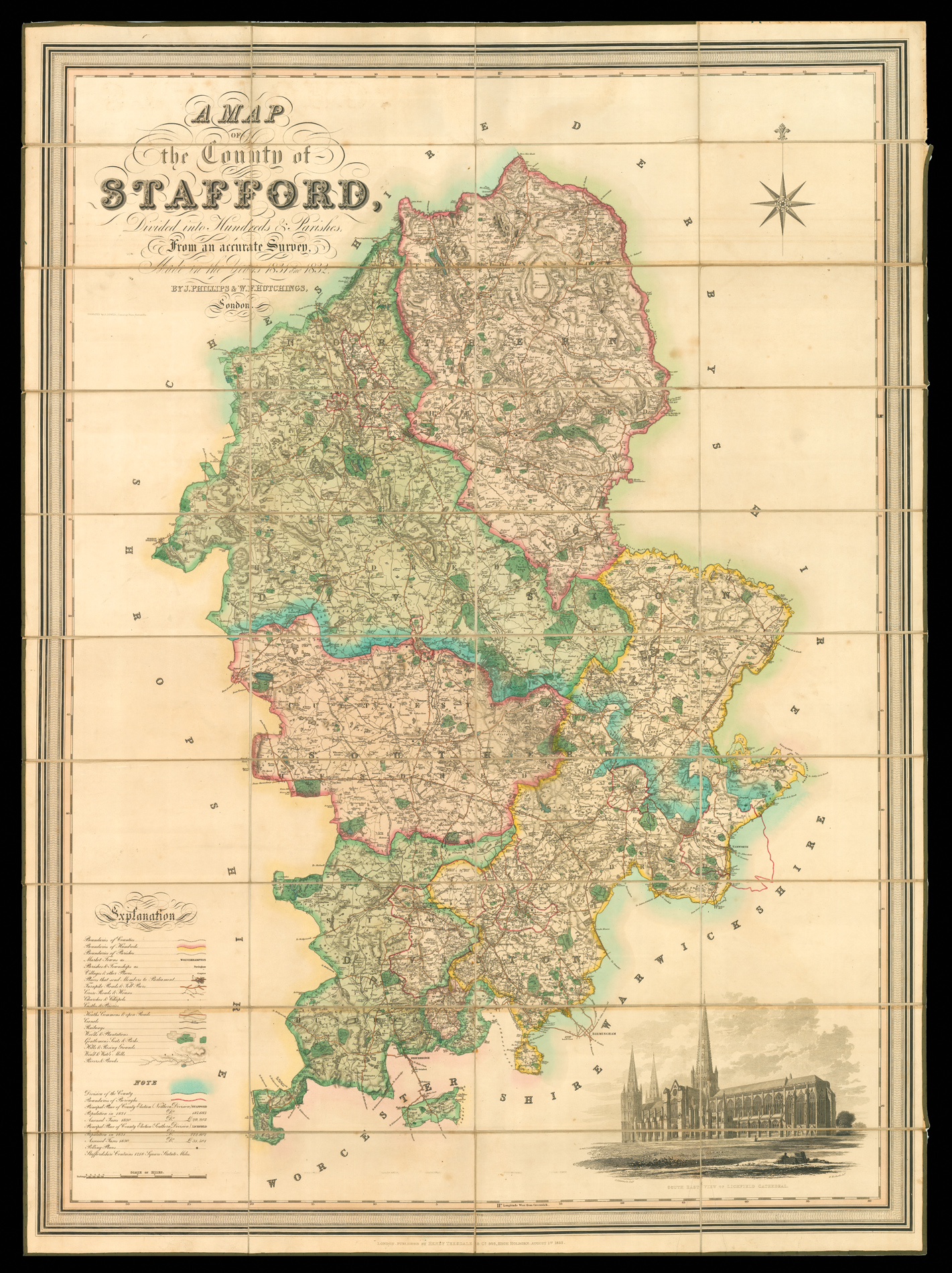
Staffordshire - Hutchings' large-scale map of Staffordshire
A Map of the County of Stafford Divided into Hundreds & Parishes, From an Accurate Survey, Made in the Years 1831 & 1832, By J. Phillips & W. J. Hutchings, London.
- 作者: PHILLIPS, J[ohn] & HUTCHINGS, W. F.
- 出版地: London
- 出版商: Published by Henry Teesdale & Co. 302, High Holborn
- 发布日期: August 1st, 1832.
- 物理描述: Large engraved map, dissected and mounted on linen, fine original full-wash colour, south east view of Lichfield cathedral, edged in green silk.
- 方面: 1370 by 990mm (54 by 39 inches).
- 库存参考: 11427
规模化:

笔记
Uncommon. A fine example in full original wash colour. There is a view of Lichfield Cathedral at the lower right. A table of explanation towards the bottom left outlines a wealth of topographical detail, including ichnographic representations of the principal towns, villages, churches, gentleman’s seats, commons, heaths and hills, parish and other boundaries, canals, wind and water-mills, roads, lanes, toll-bars and rivers.
相关项目


/
请注册以了解最新珍品、展览和活动信息
地址
纽约
PO Box 329, Larchmont, NY, USA
开放时间,伦敦画廊
周一至周五:10:00-18:00
周六请预约
公休日:所有银行假日以及 8月1日至31日
营业时间,纽约
仅限预约