 地图
地图  地图集
地图集  珍本
珍本  版画
版画  天文仪器
天文仪器 注册以了解我们最新的收购、展览和活动


地址
纽约
PO Box 329, Larchmont, NY, USA
开放时间,伦敦画廊
周一至周五:10:00-18:00
周六请预约
公休日:所有银行假日以及 8月1日至31日
营业时间,纽约
仅限预约

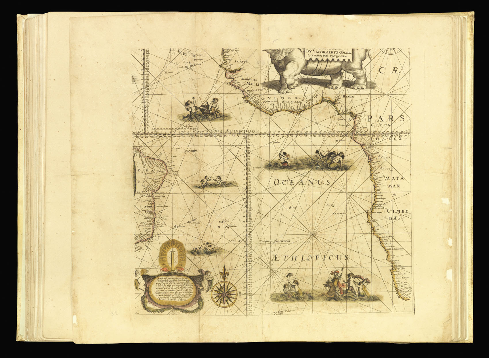
South Atlantic Ocean
[Chart of the South Atlantic]
- 作者: COLOM, Jacob Aertsz
- 出版地: Amsterdam
- 出版商: Printed By himselfe dwellinge on the Corne-market in the Fyrie-Colom, with Priviledge
- 发布日期: 1668
- 物理描述: Engraved map in fine original outline hand-colour
- 库存参考: 3920
笔记
A chart of the south Atlantic Ocean between the east coast of South America and the west coast of Africa, from Senegal to the Cape of Good Hope,with merpeople frolicking in the surf. The partially visible elephant cartouche shows that it was reduced from a larger map. It was originally published as the south eastern sheet of Colom’s separately issued wall map of c.1655, ‘Dese Vassende Grade-kaert’, which was based upon Willem Blaeu’s seminal ‘Paskaert’ of c.1630.
参考书目
- Not recorded in Koeman but c.f. Koeman J. Col 6A for a list of the charts.
相关项目


/
请注册以了解最新珍品、展览和活动信息
地址
纽约
PO Box 329, Larchmont, NY, USA
开放时间,伦敦画廊
周一至周五:10:00-18:00
周六请预约
公休日:所有银行假日以及 8月1日至31日
营业时间,纽约
仅限预约