 地图
地图  地图集
地图集  珍本
珍本  版画
版画  天文仪器
天文仪器 注册以了解我们最新的收购、展览和活动


地址
纽约
PO Box 329, Larchmont, NY, USA
开放时间,伦敦画廊
周一至周五:10:00-18:00
周六请预约
公休日:所有银行假日以及 8月1日至31日
营业时间,纽约
仅限预约

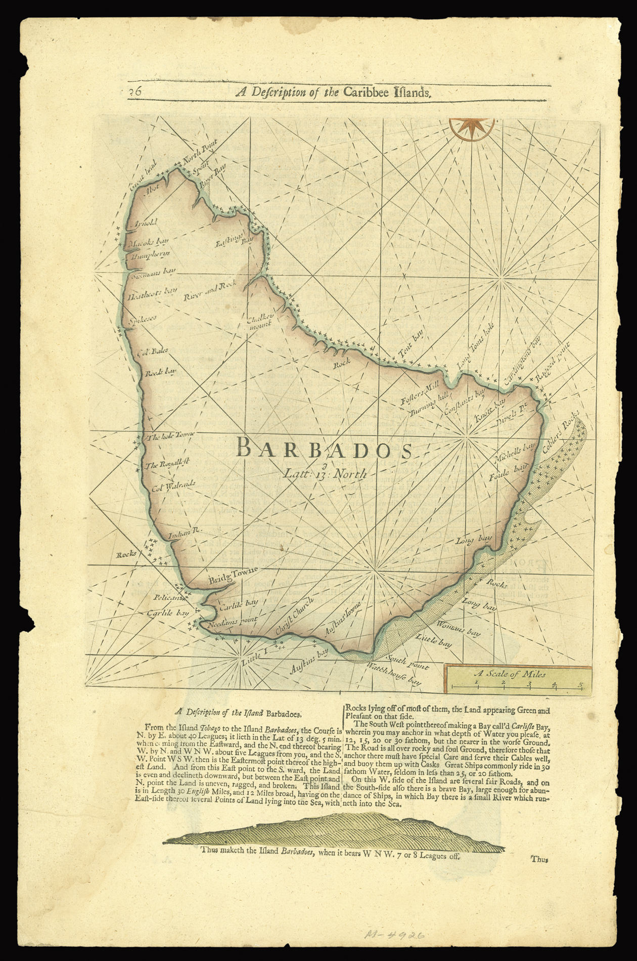
Seller's map of Barbados
Barbados.
- 作者: SELLER, John
- 出版地: [London
- 出版商: Mount and Page
- 发布日期: 1732].
- 物理描述: Hand-coloured engraved chart, text below with coastal profile, text to verso.
- 方面: 290 by 260mm. (11.5 by 10.25 inches).
- 库存参考: 2621
笔记
Rare sea chart of Barbados.
The chart shows rhumb lines, lines of latitude, coastal towns, anchorages, and coastal hazards.
The chart was first published by John Seller, in his English Pilot the Fourth Book, in 1682, the first English sea atlas to be devoted to the Americas.
相关项目


/
请注册以了解最新珍品、展览和活动信息
地址
纽约
PO Box 329, Larchmont, NY, USA
开放时间,伦敦画廊
周一至周五:10:00-18:00
周六请预约
公休日:所有银行假日以及 8月1日至31日
营业时间,纽约
仅限预约