 地图
地图  地图集
地图集  珍本
珍本  版画
版画  天文仪器
天文仪器 注册以了解我们最新的收购、展览和活动


地址
纽约
PO Box 329, Larchmont, NY, USA
开放时间,伦敦画廊
周一至周五:10:00-18:00
周六请预约
公休日:所有银行假日以及 8月1日至31日
营业时间,纽约
仅限预约

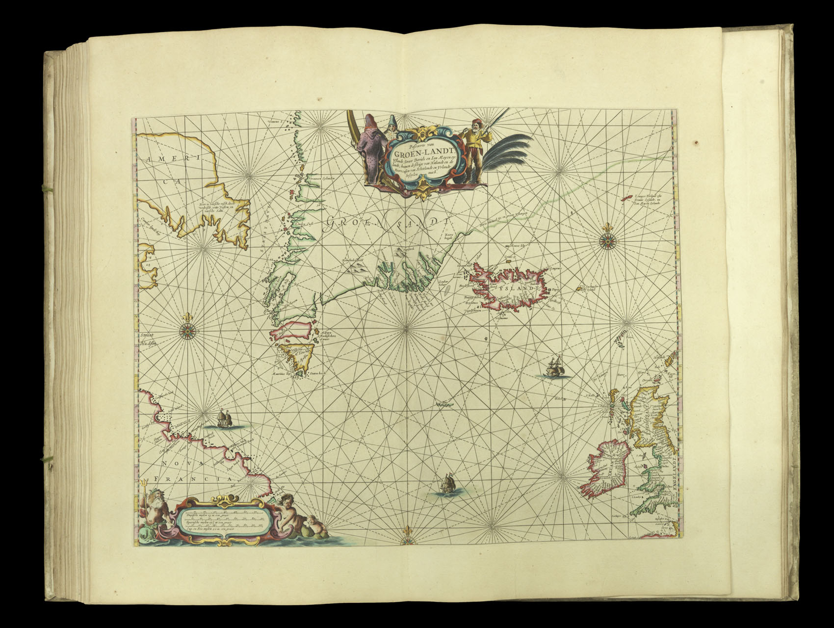
Pascaerte van Groen-Landt.
- 作者: GOOS, Pieter
- 出版地: Amsterdam
- 出版商: Pieter Goos
- 发布日期: 1666
- 物理描述: Engraved map in original outline hand-colour heightened in gold
- 库存参考: 3878
笔记
A chart of the northern Atlantic, from Canada (marked Nova Francia) to Great Britain and Ireland. This map would have been of particular interest to anyone concerned in cross-Atlantic trade. It details the approach to the Northwest Passage which connects the Atlantic and Pacific Oceans. Although the Northwest Passage would not be navigated by Europeans for almost three hundred years, it was hoped that the strait would provide an alternative route for European-Asian trade. The most important existing trades in the area covered by the chart, however, were the fur and whale markets. The cartouche is decorated with trappers wearing fur and a whaler brandishing a harpoon.
参考书目
- Burden 388
- Koeman Goos 1B
- NMM 3:92.
相关项目


请注册以了解最新珍品、展览和活动信息
地址
纽约
PO Box 329, Larchmont, NY, USA
开放时间,伦敦画廊
周一至周五:10:00-18:00
周六请预约
公休日:所有银行假日以及 8月1日至31日
营业时间,纽约
仅限预约