 地图
地图  地图集
地图集  珍本
珍本  版画
版画  天文仪器
天文仪器 注册以了解我们最新的收购、展览和活动


地址
纽约
PO Box 329, Larchmont, NY, USA
开放时间,伦敦画廊
周一至周五:10:00-18:00
周六请预约
公休日:所有银行假日以及 8月1日至31日
营业时间,纽约
仅限预约

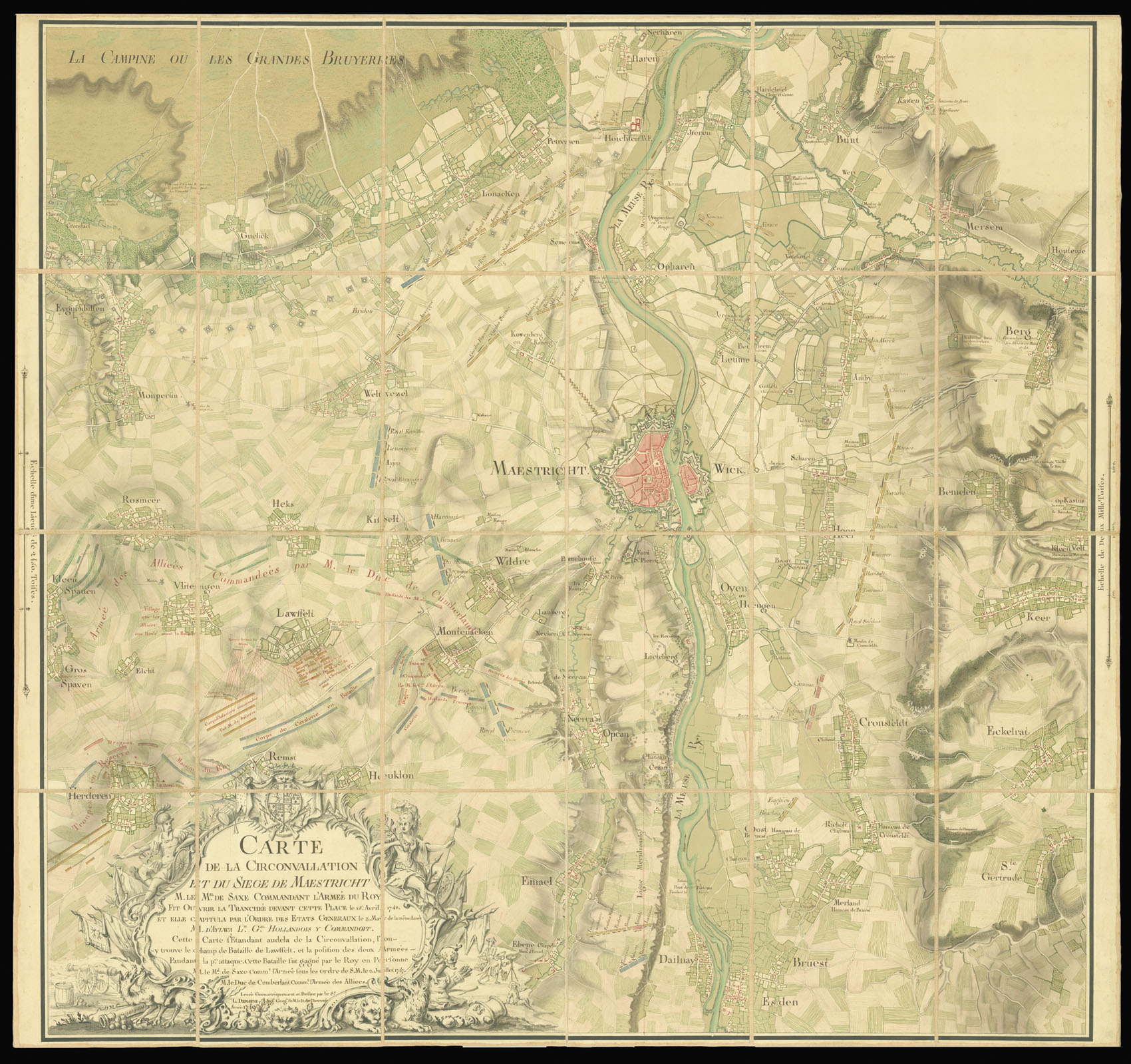
Carte de la Circonvallation et du Siege de Maestricht
- 作者: DEMARNE, L.
- 发布日期: 1749
- 物理描述: Large manuscript map, fine original hand-colour, elaborate title cartouche lower left, dissected and mounted on linen.
- 方面: 1210 by 1120mm (47.75 by 44 inches).
- 库存参考: 2401
笔记
Magnificent manuscript plan of the Battle of Lauffeld; and the Seige of Maastricht.
The battle took place on 2nd July 1747, during the French invasion of the Netherlands, as part of the War of Austrian Succession. The French victory would eventually lead to the fall of Maastricht in the following year, and leave the French as the major land power come the cessation of hostilities in April of 1748.
The map, drawn by the Duke de Luynes geographer L. Demarne, renders both events in great detail. In a small conceit Demarne has depicted himself just to the right of the cartouche, with a plane table and surrounded by two assistants.
出处
From the Library of the Duc de Luynes.
Charles Louis d’Albert de Luynes (1717-1771) was a French nobleman and member of the House of Albert. He was the fifth Duke of Luynes as well as Duke of Chevreuse. The Duke had a distinguished military career seeing action in both the Wars of Polish, and Austrian Succession.
相关项目


请注册以了解最新珍品、展览和活动信息
地址
纽约
PO Box 329, Larchmont, NY, USA
开放时间,伦敦画廊
周一至周五:10:00-18:00
周六请预约
公休日:所有银行假日以及 8月1日至31日
营业时间,纽约
仅限预约