 地图
地图  地图集
地图集  珍本
珍本  版画
版画  天文仪器
天文仪器 注册以了解我们最新的收购、展览和活动


地址
纽约
PO Box 329, Larchmont, NY, USA
开放时间,伦敦画廊
周一至周五:10:00-18:00
周六请预约
公休日:所有银行假日以及 8月1日至31日
营业时间,纽约
仅限预约

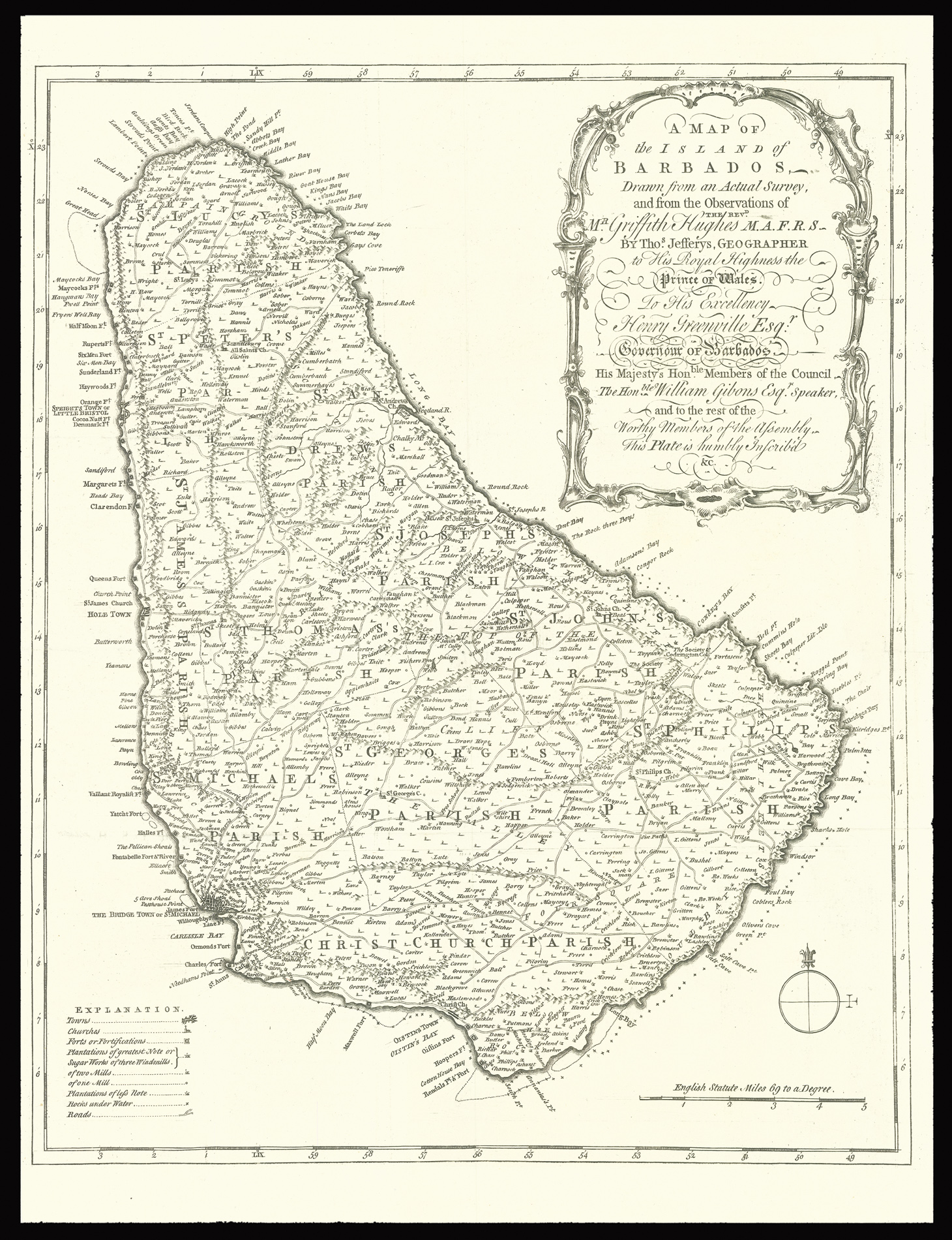
A Map of the Island of Barbados Drawn from an Actual Survey, and from the Observations of the revd. Mr. Griffith Hughes M.A.F.R.S. By Thos. Jefferys, Geographer to His Royal Highness the Prince of Wales.
- 作者: HUGHES, Griffith
- 出版地: London
- 出版商: Thomas Jefferys
- 发布日期: 1750
- 物理描述: Engraved map.
- 方面: 425 by 360mm (16.75 by 14.25 inches).
- 库存参考: 2673
笔记
A wonderful early map of the island of Barbados complied by the English parson Griffith Hughes. This map was issued as a fold-out plate in Hughes’ botanical volume entitled, The Natural History of Barbados published in 1750. The small folio work contained beautiful natural history plates many drawn by G.D. Ehret and was subscribed to by the leading naturalists of the day. The map itself is a very detailed copperplate engraving divided into parrishes and listing all towns, churchs, forts, plantations, “sugar works, roads and “rocks under water.”
Detailed map of Barbados depicting towns churches, fortifications, plantations, sugar works of three, two, and one mill, plantations of lesser note, rocks under water, coastal features, roads, and parishes.
参考书目
- MCC 31.
相关项目


请注册以了解最新珍品、展览和活动信息
地址
纽约
PO Box 329, Larchmont, NY, USA
开放时间,伦敦画廊
周一至周五:10:00-18:00
周六请预约
公休日:所有银行假日以及 8月1日至31日
营业时间,纽约
仅限预约