 地图
地图  地图集
地图集  珍本
珍本  版画
版画  天文仪器
天文仪器 注册以了解我们最新的收购、展览和活动


地址
纽约
PO Box 329, Larchmont, NY, USA
开放时间,伦敦画廊
周一至周五:10:00-18:00
周六请预约
公休日:所有银行假日以及 8月1日至31日
营业时间,纽约
仅限预约

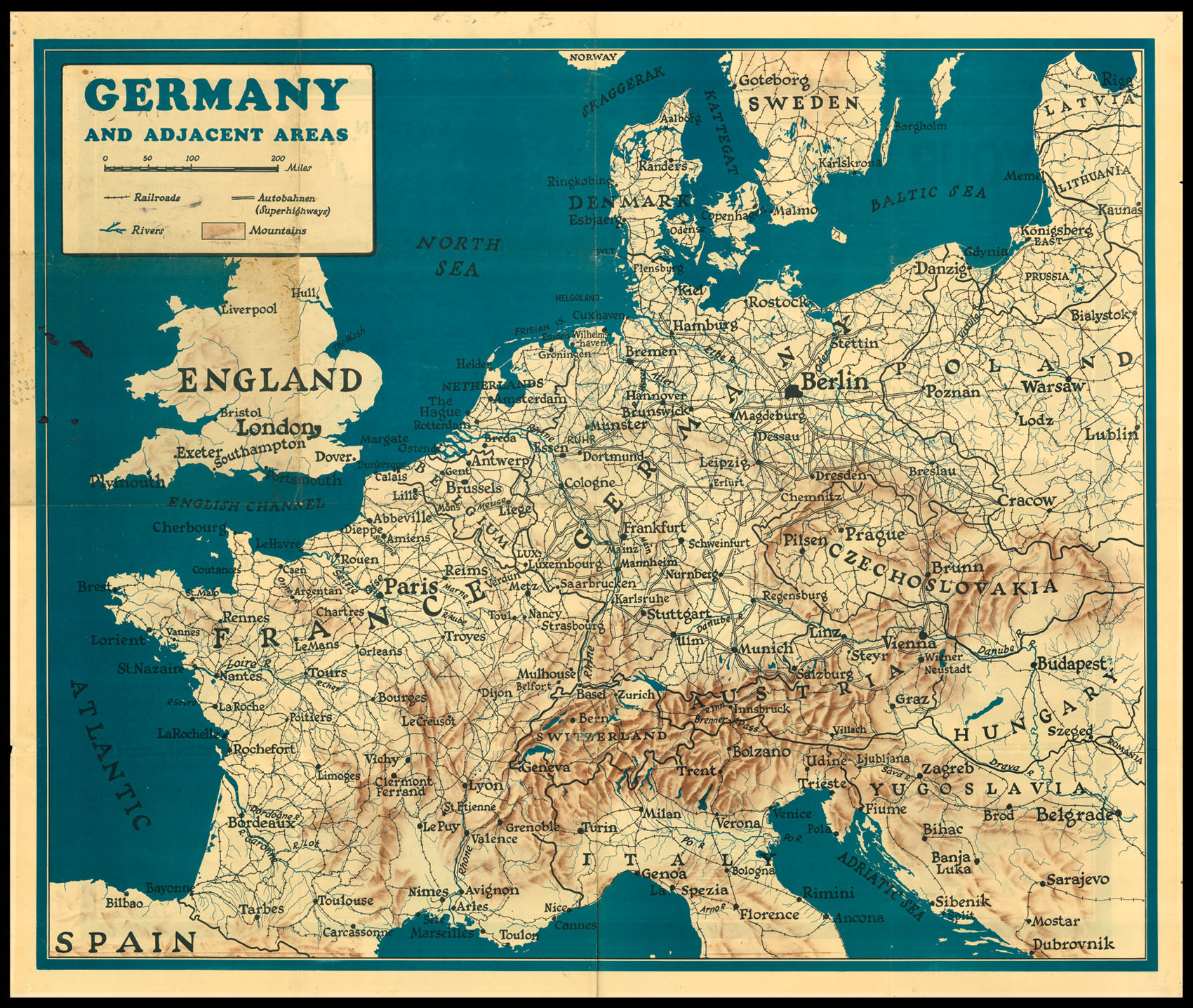

Germany and Adjacent Areas; Your War from D-Day On.
- 出版地: London
- 发布日期: 1944.
- 物理描述: Double sided chromolithographed map.
- 方面: 950 by 1140mm. (37.5 by 45 inches).
- 库存参考: 11481
笔记
A double sided map of western Europe. One side shows a normal map, with major cities, railways, rivers, mountains and motorways marked. The other side shows the same area, with differently coloured shaded areas representing various stages of the war. These include D-Day, the allied invasion of Normandy on 6 June 1944 via airborne and naval landings, helped by French Resistance; the Falaise Pocket, August 1944, where the German army was surrounded by the Allies and cut off, a key part of the Liberation of Paris; and the Battle of the Hedgerows, where Allied troops fought Germans as they retreated back into Normandy (Battle de Bocage). A small inscription at the lower edge encourages the owner to keep the map up to date by adding their own inscriptions showing the latest state of the war.
图片库
相关项目


请注册以了解最新珍品、展览和活动信息
地址
纽约
PO Box 329, Larchmont, NY, USA
开放时间,伦敦画廊
周一至周五:10:00-18:00
周六请预约
公休日:所有银行假日以及 8月1日至31日
营业时间,纽约
仅限预约