 地图
地图  地图集
地图集  珍本
珍本  版画
版画  天文仪器
天文仪器 注册以了解我们最新的收购、展览和活动


地址
纽约
PO Box 329, Larchmont, NY, USA
开放时间,伦敦画廊
周一至周五:10:00-18:00
周六请预约
公休日:所有银行假日以及 8月1日至31日
营业时间,纽约
仅限预约

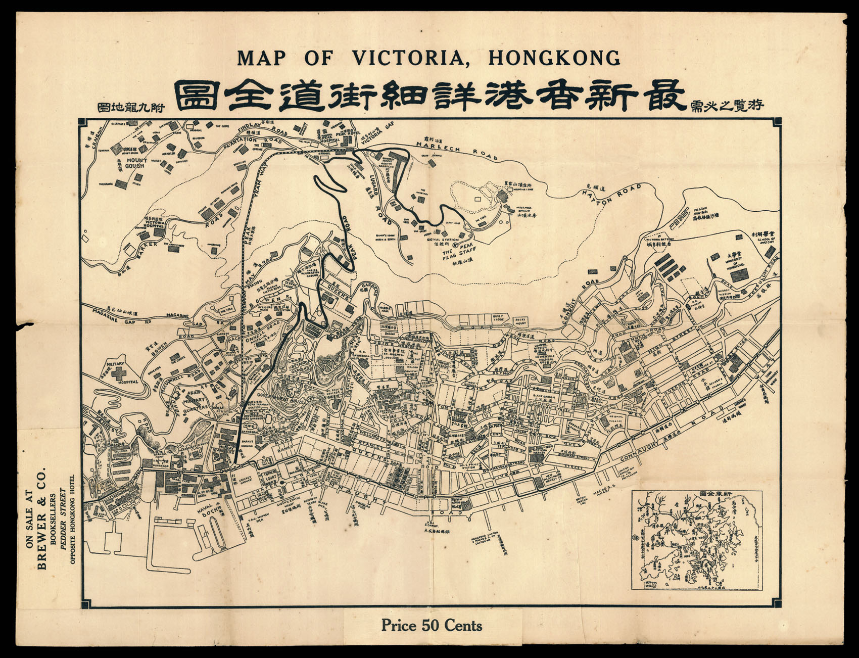
Map of Victoria, Hong Kong.
- 作者: ANONYMOUS
- 出版地: Hong Kong
- 出版商: On sale at Brewer & Co. Booksellers, Pedder Street, Opposite Hongkong Hotel
- 发布日期: c1933
- 物理描述: Lithographed map.
- 方面: 485 by 635mm (19 by 25 inches).
- 库存参考: 11974
笔记
Fine and detailed map of Victoria Hong Kong, with an inset map of Hong Kong at the bottom right corner.
The plan is orientated with south at the top. It depicts the northern coast of the Hong Kong Island, and stretches west to east from the Victoria, and the Wellington Barracks, to the China Merchant’s Wharf and the University of Hong Kong. The mapping of the urban areas are very detailed, labelling every street and shown the outline of all major buildings and facilities.
Several important public buildings are shown, including Government House, City Hall, and the Murray Barracks, as well as the great private mansions that graced the mid levels above the town. Victoria Peak is shown, schematically rising above the city. Immediately to the east of Victoria, beyond the Cricket Ground, is the Royal Navy Yard, the headquarters of the British Navy in East Asia.
相关项目


请注册以了解最新珍品、展览和活动信息
地址
纽约
PO Box 329, Larchmont, NY, USA
开放时间,伦敦画廊
周一至周五:10:00-18:00
周六请预约
公休日:所有银行假日以及 8月1日至31日
营业时间,纽约
仅限预约