 地图
地图  地图集
地图集  珍本
珍本  版画
版画  天文仪器
天文仪器 注册以了解我们最新的收购、展览和活动


地址
纽约
PO Box 329, Larchmont, NY, USA
开放时间,伦敦画廊
周一至周五:10:00-18:00
周六请预约
公休日:所有银行假日以及 8月1日至31日
营业时间,纽约
仅限预约


[Mediterranean chart on twelve sheets].
- 作者: ROUX, Joseph
- 出版地: [?Marseilles
- 出版商: ?Joseph Roux
- 发布日期: 1772].
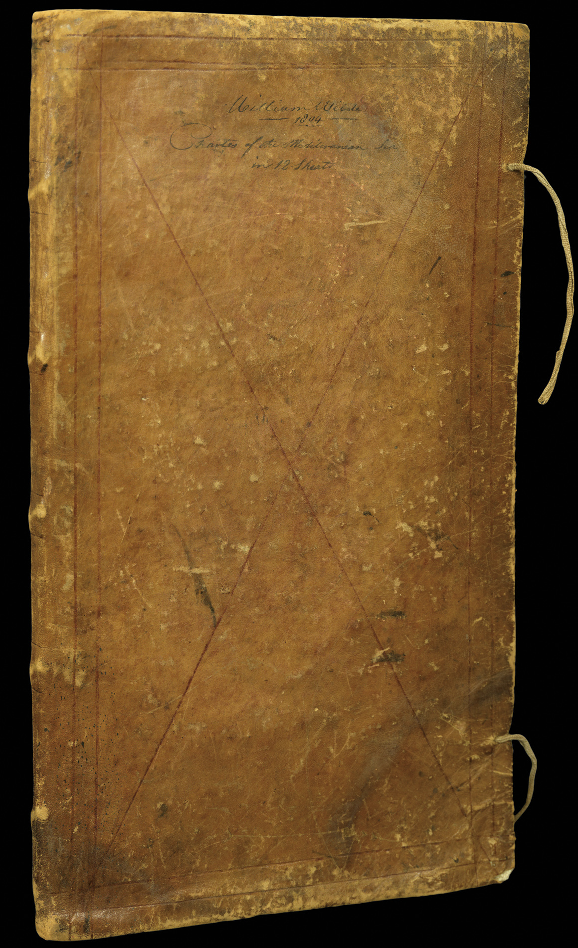
- 物理描述: Folio (650 by 400mm), 12 engraved folding charts, inscription 'Property of William Wilde - for the Brigg Albatross' to verso of first chart, contemporary limp calf, inscription 'William Wilde, 1804, Chart of the Mediterranean Sea in 12 Sheets' to lower cover, a few marks and stains to lower cover, rubbed.
- 库存参考: 1181
笔记
Roux’s large and detailed chart of the Mediterranean on twelve sheets.
Roux mentions them in the title of his atlas of Mediterranean ports as “ma Carte en douze Fleur”, and they were obviously meant to be companion pieces. Published in 1764, the charts were held in great esteem for many years. One of the more surprising admirers was Lord Nelson, who used an example aboard his flagship, HMS Victory, during his campaigns in the Mediterranean in 1803 and 1805 (see NMM 3:267).
The present example was once the property of William Wilde, a pilot abroad HMS Albatross – a sixteen gun brig-sloop which saw active service in the Mediterranean during the Napoleonic Wars.
参考书目
- Shirley, BL, M.Roux 2-a.
- NMM, 3: 267
图片库
相关项目


请注册以了解最新珍品、展览和活动信息
地址
纽约
PO Box 329, Larchmont, NY, USA
开放时间,伦敦画廊
周一至周五:10:00-18:00
周六请预约
公休日:所有银行假日以及 8月1日至31日
营业时间,纽约
仅限预约