 Rare Maps
  Rare Atlases
  Rare Books
  Rare Prints
  Globes and Planetaria
 Sign up to hear about our latest acquisitions, exhibitions and events


Find Us
New York
PO Box 329, Larchmont, NY, USA
Opening hours, London Gallery
Monday to Friday: 10:00 – 18:00
Saturday: by appointment
Closed: all bank holidays and 1-31 August
Opening hours, New York
By appointment only
Opening hours

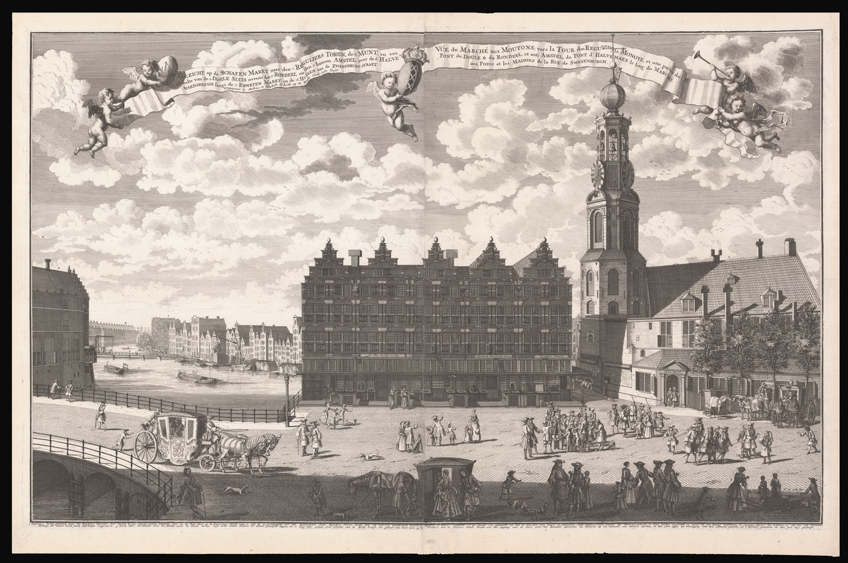
Gezicht op de Schapen Markt naer den Reguliers Toren, de Munt, en een ge deelte van de Doele Sluis nevens het Rondeel en den binnen Amstel over de Halve Maensbrugh langs de Erweten Markt en de Huizen van de Zwanenburg Straet.
- Author: DE LETH, Andries; DE LETH, Hendrik
- Publication place: Amsterdam
- Publisher: Andries De Leth, Hendrik De Leth
- Publication date: c1720
- Physical description: Etching with engraving, on two sheets joined.
- Dimensions: 570 by 910mm. (22.5 by 35.75 inches).
- Inventory reference: 14399
Notes
A view of the Schapenplien (Muntplien) with the Munttoren (The Mint Tower), the Englese Huizen (English Houses), and the Doelensluis.
The Muntplein is named after the Munttoren (or simply Munt) tower which stands on this square. This tower was once part of the three main medieval city gates. In the seventeenth century, it temporarily served as a mint, hence the name. The square was originally named Schapenplein and in the seventeenth century was enclosed by the Englese Huizen, shown in the centre. The buildings were constructed in 1624, and would be demolished in the late nineteenth century for the widening of the bridge over the Singel, as a result of which the enclosed Schapenplein disappeared. The new square was given the name Sophiaplein, after the deceased first wife of King William III, but was soon called the Muntplein or in short, the Munt.
Andries de Leth (1662-1731) and Hendrik de Leth (1692-1759) were engravers, publishers, and mapmakers working in Amsterdam during the first half of the eighteenth century.
Bibliography
- R.W.P. de Vries, auction, 1925: 277.
Related items


Sign up to hear about our latest acquisitions, exhibitions and events
Find Us
New York
PO Box 329, Larchmont, NY, USA
Opening hours, London Gallery
Monday to Friday: 10:00 – 18:00
Saturday: by appointment
Closed: all bank holidays and 1-31 August
Opening hours, New York
By appointment only