 Rare Maps
  Rare Atlases
  Rare Books
  Rare Prints
  Globes and Planetaria
 Sign up to hear about our latest acquisitions, exhibitions and events


Find Us
New York
PO Box 329, Larchmont, NY, USA
Opening hours, London Gallery
Monday to Friday: 10:00 – 18:00
Saturday: by appointment
Closed: all bank holidays and 1-31 August
Opening hours, New York
By appointment only
Opening hours

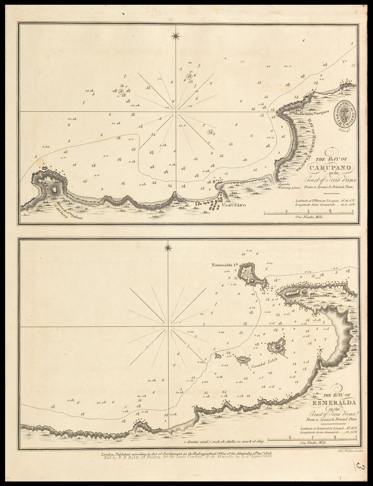
The Bay of Carupano on the Coast of Terra Firma; The Bay of Esmerelda on the Coast of Terra Firma
- Author: WALKER, John & Charles
- Publication place: London
- Publisher: Hydrographical Office of the Admiralty
- Publication date: 12th Dec 1826.
- Physical description: Two engraved charts on one mapsheet.
- Dimensions: 142 by 238mm. (5.5 by 9.25 inches).
- Inventory reference: 11600
Notes
Rare admiralty chart of the the Bays of Carupano and Esmeralda from the Venezuelan coast.
The title states that the chart was copied from a ‘Spanish printed Plan’, this refers to the ‘Portulano de la America Setentrional’ a work published by the Spanish Admiralty in 1809, and containing 111 charts of the Caribbean and Gulf of Mexico. A second edition of the pilot was published in 1818 with 121 charts.
John and Charles Walker, founding members of the Royal Geographic Society, were leading mapmakers and engravers working in London in the first half of the nineteenth century. They are known to have produced numerous charts for James Horsburgh and the Admiralty.
Related items


Sign up to hear about our latest acquisitions, exhibitions and events
Find Us
New York
PO Box 329, Larchmont, NY, USA
Opening hours, London Gallery
Monday to Friday: 10:00 – 18:00
Saturday: by appointment
Closed: all bank holidays and 1-31 August
Opening hours, New York
By appointment only