 Rare Maps
  Rare Atlases
  Rare Books
  Rare Prints
  Globes and Planetaria
 Sign up to hear about our latest acquisitions, exhibitions and events


Find Us
New York
PO Box 329, Larchmont, NY, USA
Opening hours, London Gallery
Monday to Friday: 10:00 – 18:00
Saturday: by appointment
Closed: all bank holidays and 1-31 August
Opening hours, New York
By appointment only
Opening hours

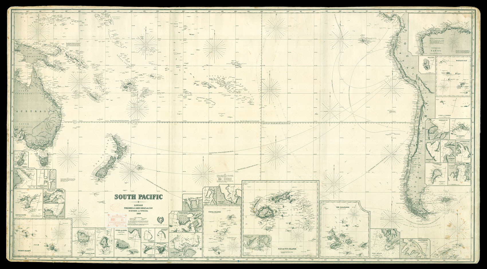
South Pacific Ocean
- Author: IMRAY, James
- Publication place: London
- Publisher: James Imray & Son, Hydrographers
- Publication date: 1869.
- Physical description: Engraved chart on three joined sheets, backed on blue paper, 36 inset charts.
- Dimensions: 1020 by 1870mm. (40.25 by 73.5 inches).
- Inventory reference: 11977
Notes
Large general chart of the South Pacific.
The map stretches from Papua New Guinea and Eastern Australia to Western South America. The inset maps show the most important ports and islands, and throughout the chart there are notes clarifying certain names and details. There are four routes marked in pencil starting from the Northern part of the ocean and going towards South America, where they make a turn around its tip. The pencil markings indicate that the chart was used at sea.
James Imray (1803-1870), worked originally in the stationery and account book publishing business. In 1836 Imray joined with Michael Blachford. The partnership flourished and soon began to compete with the larger firm of Norie and Wilson. In 1846 Imray bought out Blachford, and the company survived, led by his descendants, into the twentieth century, when it merged with Norie and Wilson.
Related items


Sign up to hear about our latest acquisitions, exhibitions and events
Find Us
New York
PO Box 329, Larchmont, NY, USA
Opening hours, London Gallery
Monday to Friday: 10:00 – 18:00
Saturday: by appointment
Closed: all bank holidays and 1-31 August
Opening hours, New York
By appointment only