 Rare Maps
  Rare Atlases
  Rare Books
  Rare Prints
  Globes and Planetaria
 Sign up to hear about our latest acquisitions, exhibitions and events


Find Us
New York
PO Box 329, Larchmont, NY, USA
Opening hours, London Gallery
Monday to Friday: 10:00 – 18:00
Saturday: by appointment
Closed: all bank holidays and 1-31 August
Opening hours, New York
By appointment only
Opening hours

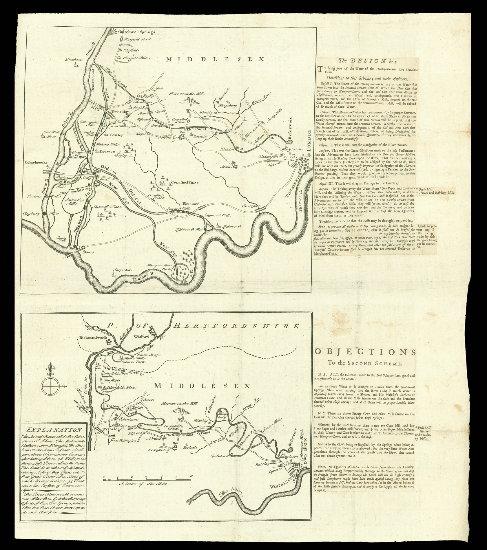
[Two untitled maps of proposed canals to Marylebone] 1. [Untitled map of ‘The [Proposed] Canal’ from the River Colne to a ‘Reservoir’ north of ‘Mary le bone’]2. [Untitled map of a Proposed Canal from ‘Gultchwell Springs’ to a ‘Reservoir’ north of ‘Mary le bone’]
- Author: BLACKMORE
- Publication place: London
- Publisher: Blackmore
- Publication date: ca.1720.
- Physical description: Two engraved maps, printed on one sheet with extracts from a printed document pasted beside each.
- Dimensions: 450 by 400mm. (17.75 by 15.75 inches).
- Inventory reference: 11335
Notes
The upper diagram (240 mm x 265 mm) shows the canal proposed by one ‘Mr. Blackmore’; it reflects a revised version of his original proposals, involving some complicated additional engineering projects to bring water to the King’s palace at Hampton Court, the ‘New Cut’, while expanding the Colne River, Heatham Stream and Stanwell Stream so as not to harm the water-flow to the mills downstream of the canal nor, indeed, the Thames itself, which early objectors to the scheme had all complained about.
The letterpress text explains the benefits of this scheme, lists the objections raised and, in a partisan fashion, rebuts the objections.
The second map (190 mm x 265 mm), copied from Thomas Acherley’s (the previous item), is accompanied by the extract of the document that criticizes (again in a highly partisan fashion) his proposals, concluding that his scheme was unworkable.
In fact, it was the Blackmore scheme that was judged unviable, in that there was insufficient “drop” to create a flow from the Colne to the reservoir in London, while Acherley’s scheme, though possible, never garnered the support necessary to proceed.
Bibliography
- Neither the maps nor the original document have been traced.
Related items


Sign up to hear about our latest acquisitions, exhibitions and events
Find Us
New York
PO Box 329, Larchmont, NY, USA
Opening hours, London Gallery
Monday to Friday: 10:00 – 18:00
Saturday: by appointment
Closed: all bank holidays and 1-31 August
Opening hours, New York
By appointment only