 Rare Maps
  Rare Atlases
  Rare Books
  Rare Prints
  Globes and Planetaria
 Sign up to hear about our latest acquisitions, exhibitions and events


Find Us
New York
PO Box 329, Larchmont, NY, USA
Opening hours, London Gallery
Monday to Friday: 10:00 – 18:00
Saturday: by appointment
Closed: all bank holidays and 1-31 August
Opening hours, New York
By appointment only
Opening hours

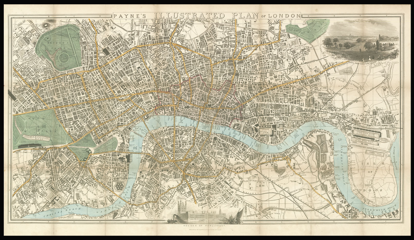
Payne's Illustrated Plan of London.
- Author: PAYNE, Albert Henry
- Publication place: Dresden and Lerpzig
- Publisher: Published for the Proprietors by A.H. Payne
- Publication date: c.1851
- Physical description: Hand-coloured lithograph plan, extending west to east from Hyde Park to West India Docks and from north to south from Regents Park to The Oval, vignette view of London from Hampstead Heath upper right, and of the Houses of Parliament below, 6pp. guide pasted to upper pastedown, folding into red cloth covers, publisher's label pasted to upper board.
- Dimensions: 450 by 790mm. (17.75 by 31 inches).
- Inventory reference: 2477
Notes
An attractive map and guide to London produced for visitors during the Great Exhibition.
The plan shows the Crystal Palace, which occupies a large part of the southern portion of Hyde Park. Railways and are clearly marked in black with main roads coloured yellow, open spaces in green, and the City of London outlined in red. Below the plan is a view of the newly reconstructed Palace of Westminster. The guide lists the sights and amusements to be seen in London and its vicinity. These include Chelsea Hospital and Gardens; Buckingham Palace; Royal Botanic Gardens at Kew; and the Tower of London.
Related items


Sign up to hear about our latest acquisitions, exhibitions and events
Find Us
New York
PO Box 329, Larchmont, NY, USA
Opening hours, London Gallery
Monday to Friday: 10:00 – 18:00
Saturday: by appointment
Closed: all bank holidays and 1-31 August
Opening hours, New York
By appointment only