 Rare Maps
  Rare Atlases
  Rare Books
  Rare Prints
  Globes and Planetaria
 Sign up to hear about our latest acquisitions, exhibitions and events


Find Us
New York
PO Box 329, Larchmont, NY, USA
Opening hours, London Gallery
Monday to Friday: 10:00 – 18:00
Saturday: by appointment
Closed: all bank holidays and 1-31 August
Opening hours, New York
By appointment only
Opening hours

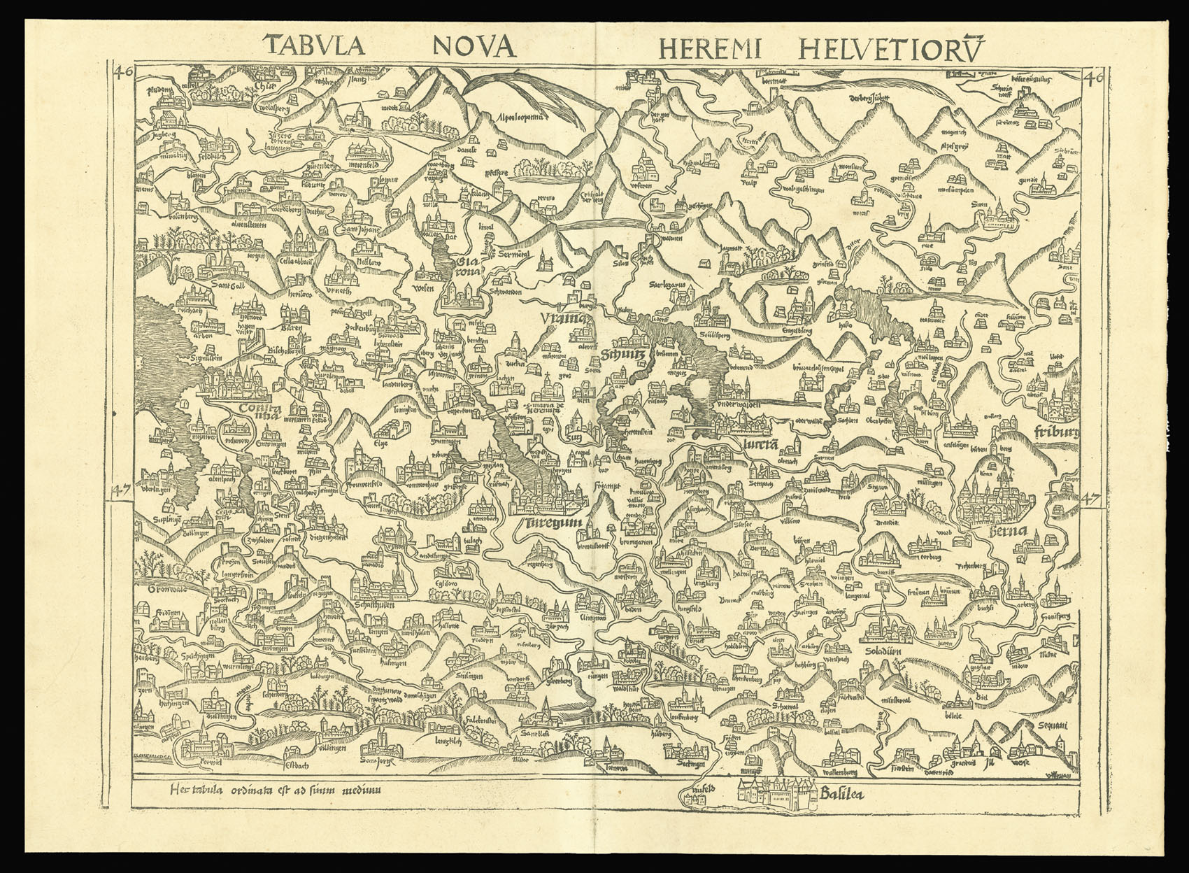
Tabvla Nova Heremi Helvetiorv.
- Author: WALDSEEMULLER, Martin
- Publication place: [Strasburg
- Publication date: 1513].
- Physical description: Double-page woodcut map.
- Dimensions: 620 by 450mm. (24.5 by 17.75 inches).
- Inventory reference: 2634
Notes
Waldseemuller’s ‘modern’ map of Switzerland published in the seminal atlas of 1513.
Along with the twenty-seven Ptolemaic maps, Waldseemüller also added a second section of twenty modern maps, which was the first major attempt to break away from the Ptolemaic tradition. The present map of Switzeraland, is the first modern – i.e. non-Ptolemaic – map of the county. It differs stylistically from the other modern maps and was probably adapted from a manuscript map by Konrad Türst of circa 1495.
Related items


Sign up to hear about our latest acquisitions, exhibitions and events
Find Us
New York
PO Box 329, Larchmont, NY, USA
Opening hours, London Gallery
Monday to Friday: 10:00 – 18:00
Saturday: by appointment
Closed: all bank holidays and 1-31 August
Opening hours, New York
By appointment only