 Rare Maps
  Rare Atlases
  Rare Books
  Rare Prints
  Globes and Planetaria
 Sign up to hear about our latest acquisitions, exhibitions and events


Find Us
New York
PO Box 329, Larchmont, NY, USA
Opening hours, London Gallery
Monday to Friday: 10:00 – 18:00
Saturday: by appointment
Closed: all bank holidays and 1-31 August
Opening hours, New York
By appointment only
Opening hours

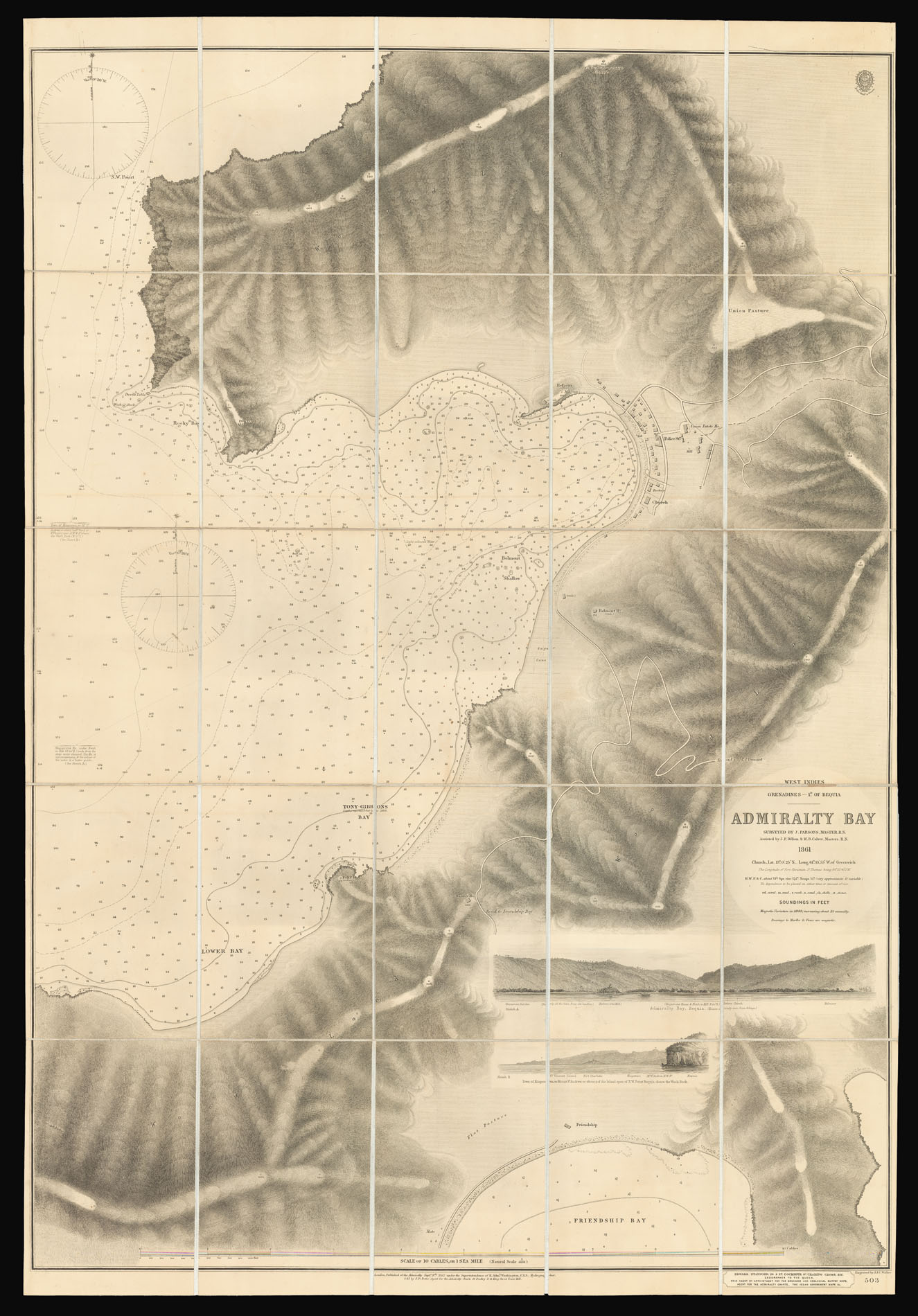
Grenadines - 1d. of Bequia. Admiralty Bay surveyed by J. Parsons Master R.N. Assisted by J.P. Dillon & W.B. Calver Master R.N.
- Author: WALKER, John & Charles
- Publication place: London
- Publisher: Published at the Hydrographical Office of the Admiralty, Sold by J.D. Potter and E. Stanford.
- Publication date: 1863.
- Physical description: Engraved chart dissected and mounted on linen, two coastal profiles, numerous soundings and signs of the sea, engraved coat of arms of the Hydrographic Office, Stanford publisher's label pasted to lower margin, brown slipcase with Stanford's label.
- Dimensions: 1010 by 690mm. (39.75 by 27.25 inches).
- Inventory reference: 12868
Notes
Rare Admiralty chart of Admiralty Bay on Bequia.
This detailed Admiralty chart depicts Admiralty Bay and the island’s capital Port Elizabeth. The town is shown in it’s infancy with a church, rectory, police station, and a few other houses scattered along two main roads. Elevation is shown by hatchures, with summits marked in fleet. To the see are soundings, achorages and other signs of the sea; bays are named including Tony Gibbons Bay, which would in the twentieth century be named after Prince Margaret who was a frequent visitor to the island. Below the title are two coastal profiles of Admiral Bay, and the town of Kingstown.
The British Hydrographic Office was founded in 1795 by George III, who appointed Alexander Dalrymple as the first Hydrographer to the Admiralty. The first charts were produced in 1800. Unlike the U. S. Coast Survey the Hydrographic Office was given permission to sell charts to the public and they produced a great number of sea charts covering every corner of the globe. Most of the Admiralty charts produced by the Hydrographic Office delineated coastline as well as high and low water marks and record depth of water as established by soundings. In addition these charts included information on shoals, reefs, and other navigational hazards that plagued mariners across the world. Thanks to the innovations of Sir Francis Beaufort, who developed the Beaufort Scale of wind strength, the British Hydrographic Office became one of the leading producers of sea charts.
Rare not traced at the National Maritime Museum.
Related items


Sign up to hear about our latest acquisitions, exhibitions and events
Find Us
New York
PO Box 329, Larchmont, NY, USA
Opening hours, London Gallery
Monday to Friday: 10:00 – 18:00
Saturday: by appointment
Closed: all bank holidays and 1-31 August
Opening hours, New York
By appointment only