 Rare Maps
  Rare Atlases
  Rare Books
  Rare Prints
  Globes and Planetaria
 Sign up to hear about our latest acquisitions, exhibitions and events


Find Us
New York
PO Box 329, Larchmont, NY, USA
Opening hours, London Gallery
Monday to Friday: 10:00 – 18:00
Saturday: by appointment
Closed: all bank holidays and 1-31 August
Opening hours, New York
By appointment only
Opening hours

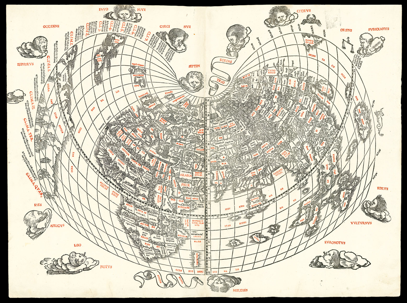
[Cordiform world map].
- Author: PTOLEMAEUS, Claudius; Bernardus SYLVANUS
- Publication place: [Venice
- Publisher: Jacobus Pentius de Lencho
- Publication date: 1511].
- Physical description: Double-page woodcut map, printed in red and black.
- Dimensions: 430 by 575mm. (17 by 22.75 inches).
- Inventory reference: 2289
Notes
This large cordiform modern world map, published in the first Venetian edition of Ptolemy, is only the second map in a Ptolemaic atlas to show America, and the first western printed map to indicate Japan. “The capital letters are printed in red by means of type set into the woodblocks which, together with the decorative windheads, zodiacal signs, and distinctive heart-shaped projection, make this a most striking representation. … Sylvanus’ map was not reprinted and hence remains relatively scarce. His new heart-shaped projection was, however, adapted by several later cartographers and used for a number of important maps throughout the sixteenth century” (Shirley).
Bibliography
- Shirley, Mapping of the World, 32.
Related items


Sign up to hear about our latest acquisitions, exhibitions and events
Find Us
New York
PO Box 329, Larchmont, NY, USA
Opening hours, London Gallery
Monday to Friday: 10:00 – 18:00
Saturday: by appointment
Closed: all bank holidays and 1-31 August
Opening hours, New York
By appointment only