 Rare Maps
  Rare Atlases
  Rare Books
  Rare Prints
  Globes and Planetaria
 Sign up to hear about our latest acquisitions, exhibitions and events


Find Us
New York
PO Box 329, Larchmont, NY, USA
Opening hours, London Gallery
Monday to Friday: 10:00 – 18:00
Saturday: by appointment
Closed: all bank holidays and 1-31 August
Opening hours, New York
By appointment only
Opening hours

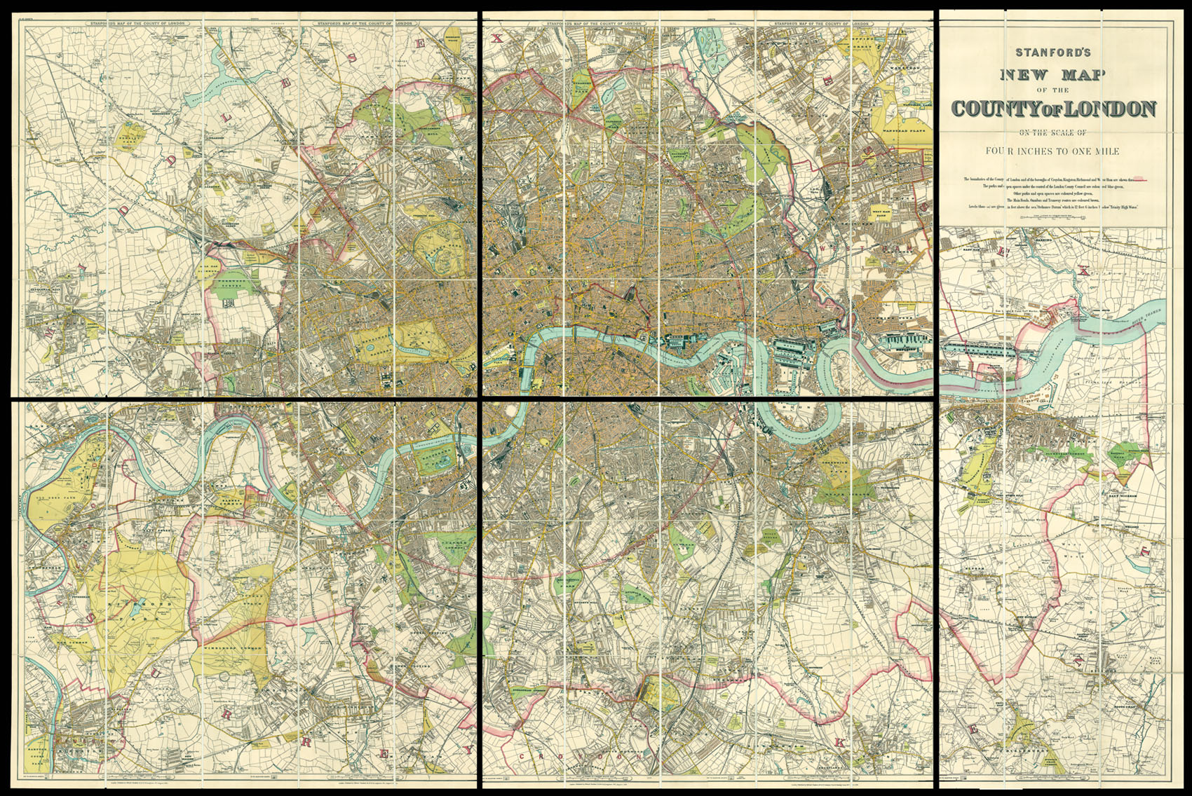
Stanford's Map of the County of London
- Author: STANFORD, Edward
- Publication place: London
- Publisher: Edward Stanford
- Publication date: 1894.
- Physical description: Map in five sheets, each backed on linen with marbled cover papers, four sheets 640 x 785 mm, one sheet 1300 x 385 mm
- Dimensions: 1410 by 2100mm. (55.5 by 82.75 inches).
- Inventory reference: 11467
Notes
A fine example of Stanford’s map of London, mounted here as five sheets instead of twenty as sold.
Edward Stanford (1827-1904) was a highly successful publisher, known for his accurate maps of London. He began his career working for Trelawny Saunders, an enterprising mapmaker who supplied a daily weather chart for the Great Exhibition. Stanford started his own business in 1853, was elected a fellow of the Royal Geographical Society the following year and set about expanding the cartographical aspect of the firm.
Bibliography
- Hyde 266 (1)
- BL 144.d.20.
Related items


Sign up to hear about our latest acquisitions, exhibitions and events
Find Us
New York
PO Box 329, Larchmont, NY, USA
Opening hours, London Gallery
Monday to Friday: 10:00 – 18:00
Saturday: by appointment
Closed: all bank holidays and 1-31 August
Opening hours, New York
By appointment only