 Rare Maps
  Rare Atlases
  Rare Books
  Rare Prints
  Globes and Planetaria
 Sign up to hear about our latest acquisitions, exhibitions and events


Find Us
New York
PO Box 329, Larchmont, NY, USA
Opening hours, London Gallery
Monday to Friday: 10:00 – 18:00
Saturday: by appointment
Closed: all bank holidays and 1-31 August
Opening hours, New York
By appointment only
Opening hours

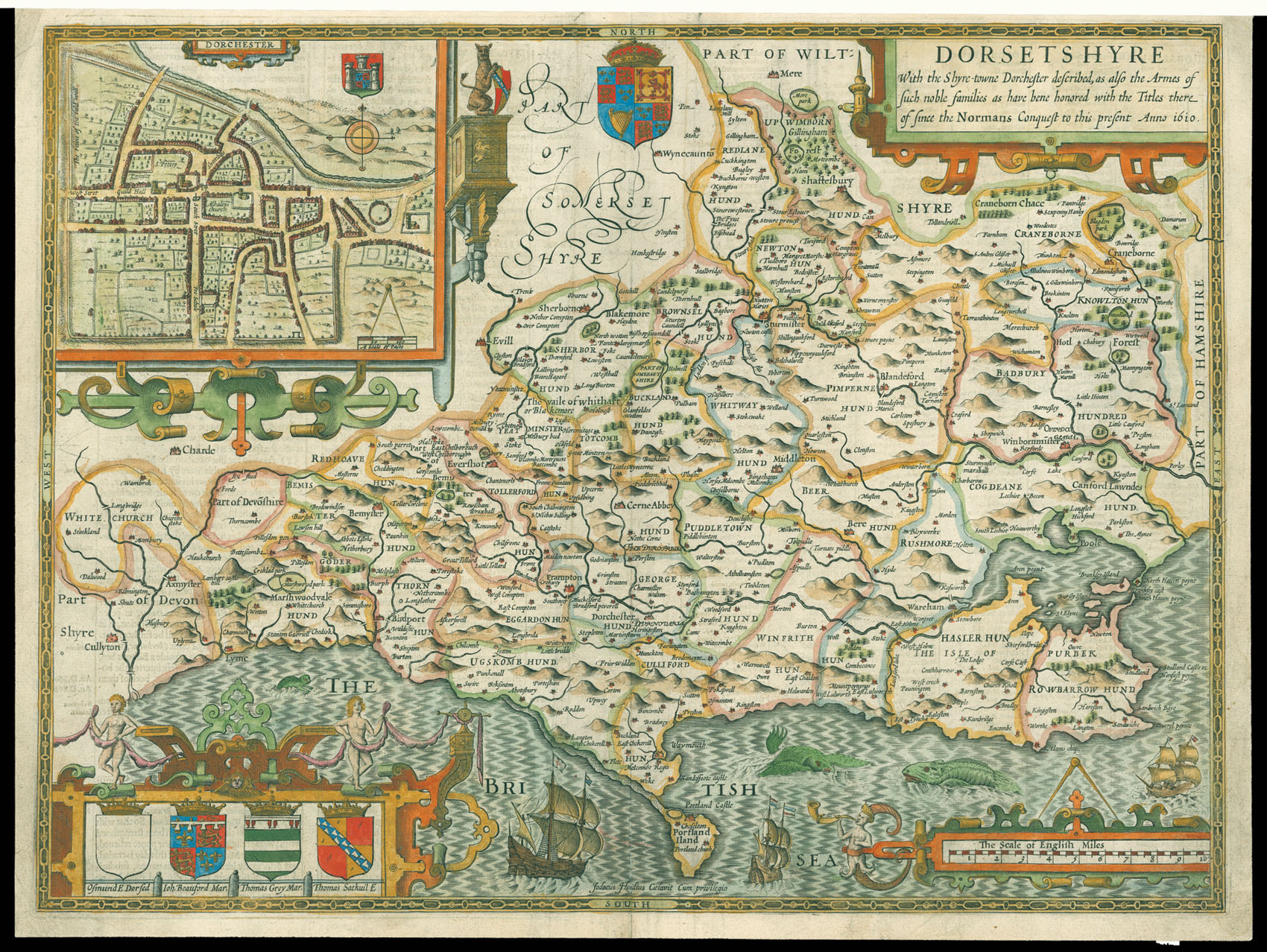
Dorsetshyre With the Shyre-towne Dorchester described, as also the Armes of such noble families as have bene honored with the Titles there of since the Normans Conquest to this present Anno 1610.
- Author: SPEED, John
- Publication place: London
- Publication date: 1627
- Physical description: Engraved map with hand colouring.
- Dimensions: 380 by 510mm. (15 by 20 inches).
- Inventory reference: 11798
Notes
A map of Dorset, with an inset map of Dorchester.
John Speed (1552-1629) was the outstanding cartographer of his age. His ‘Theatre of Great Britain’ was the first atlas of the British Isles: Speed prepared the maps himself about two years before they were published. His maps and books dominated the seventeenth-century English market. The present map is taken from the 1627 English edition published by George Humble.
Bibliography
- Chubb XXV.
Related items


Sign up to hear about our latest acquisitions, exhibitions and events
Find Us
New York
PO Box 329, Larchmont, NY, USA
Opening hours, London Gallery
Monday to Friday: 10:00 – 18:00
Saturday: by appointment
Closed: all bank holidays and 1-31 August
Opening hours, New York
By appointment only