 Rare Maps
  Rare Atlases
  Rare Books
  Rare Prints
  Globes and Planetaria
 Sign up to hear about our latest acquisitions, exhibitions and events


Find Us
New York
PO Box 329, Larchmont, NY, USA
Opening hours, London Gallery
Monday to Friday: 10:00 – 18:00
Saturday: by appointment
Closed: all bank holidays and 1-31 August
Opening hours, New York
By appointment only
Opening hours

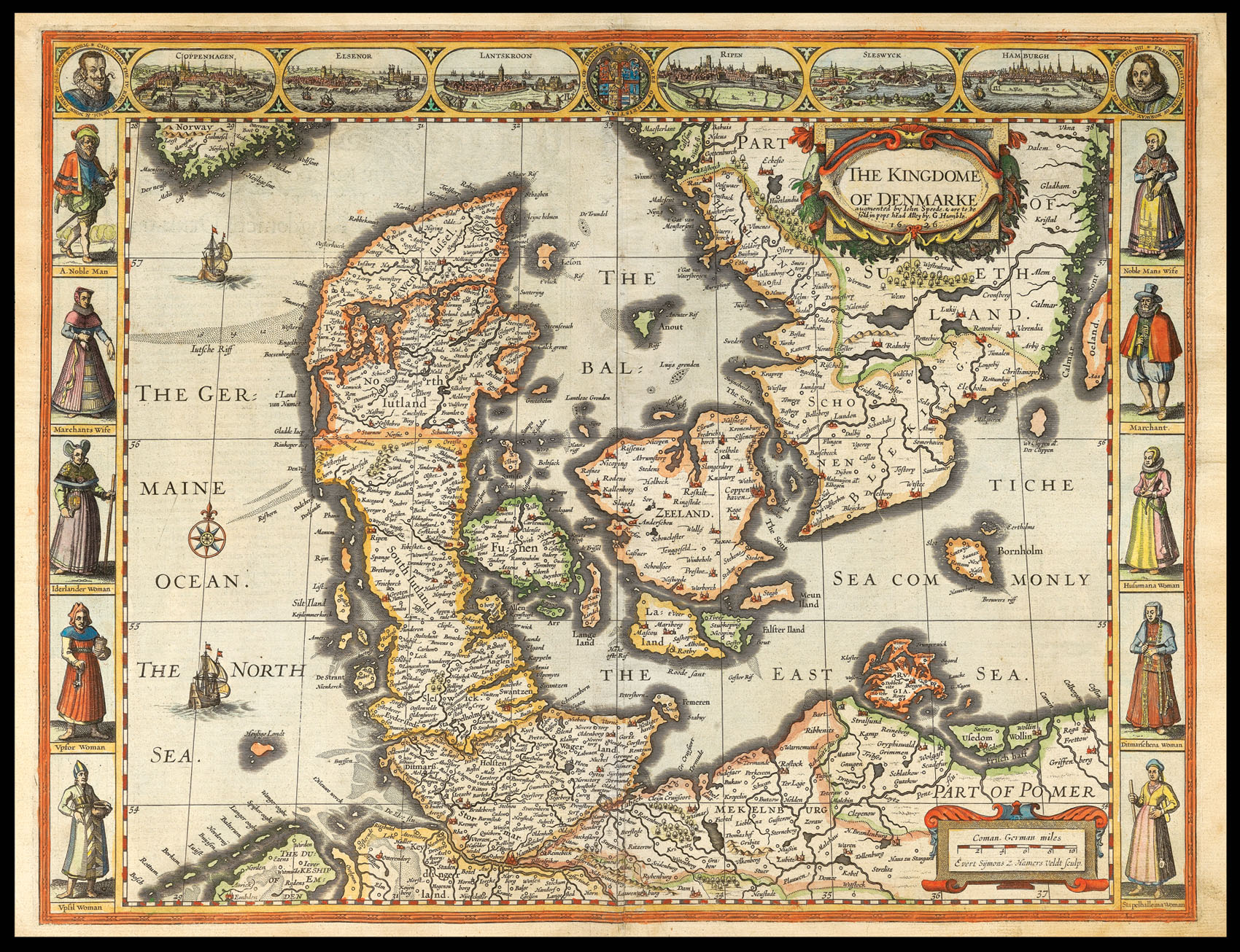
Denmarke
- Author: SPEED, John
- Publication place: London
- Publisher: Are to be sold in popes-head alley by G. Humble
- Publication date: 1631
- Physical description: Engraved map with hand colouring.
- Dimensions: 408 by 509mm. (16 by 20 inches).
- Inventory reference: 11417
Notes
A map of Denmark, parts of Poland and Norway. The upper border contains views of Copenhagen, Helsingør, Ribe, Schleswig and Hamburg. There are two portrait medallions of Christian IV of Denmark and Norway and his son the Prince-Elect Christian, although Speed appears to have amalgamated the Prince-Elect with his younger brother Frederik. The German city of Hamburg is included because of its proximity (and thus its position in trade) to Denmark. The side borders contain local figures wearing native dress.
John Speed (1552-1629) was the outstanding cartographer of his age. His ‘Theatre of Great Britain’, first published in 1611 or 1612, was the first atlas of Great Britain: Speed prepared the maps himself about two years before they were published. This map is from the ‘Prospect of the Most Famous Parts of the World’, produced in collaboration with Speed to accompany the ‘Theatre’ and published in a joint edition by George Humble in 1631. Many of the maps were anglicized versions of works by Dutch makers, who introduced the carte-à-figure style, with borders of figures in local costume and city views.
Bibliography
- Chubb XXV.
Related items


Sign up to hear about our latest acquisitions, exhibitions and events
Find Us
New York
PO Box 329, Larchmont, NY, USA
Opening hours, London Gallery
Monday to Friday: 10:00 – 18:00
Saturday: by appointment
Closed: all bank holidays and 1-31 August
Opening hours, New York
By appointment only