 Rare Maps
  Rare Atlases
  Rare Books
  Rare Prints
  Globes and Planetaria
 Sign up to hear about our latest acquisitions, exhibitions and events


Find Us
New York
PO Box 329, Larchmont, NY, USA
Opening hours, London Gallery
Monday to Friday: 10:00 – 18:00
Saturday: by appointment
Closed: all bank holidays and 1-31 August
Opening hours, New York
By appointment only
Opening hours

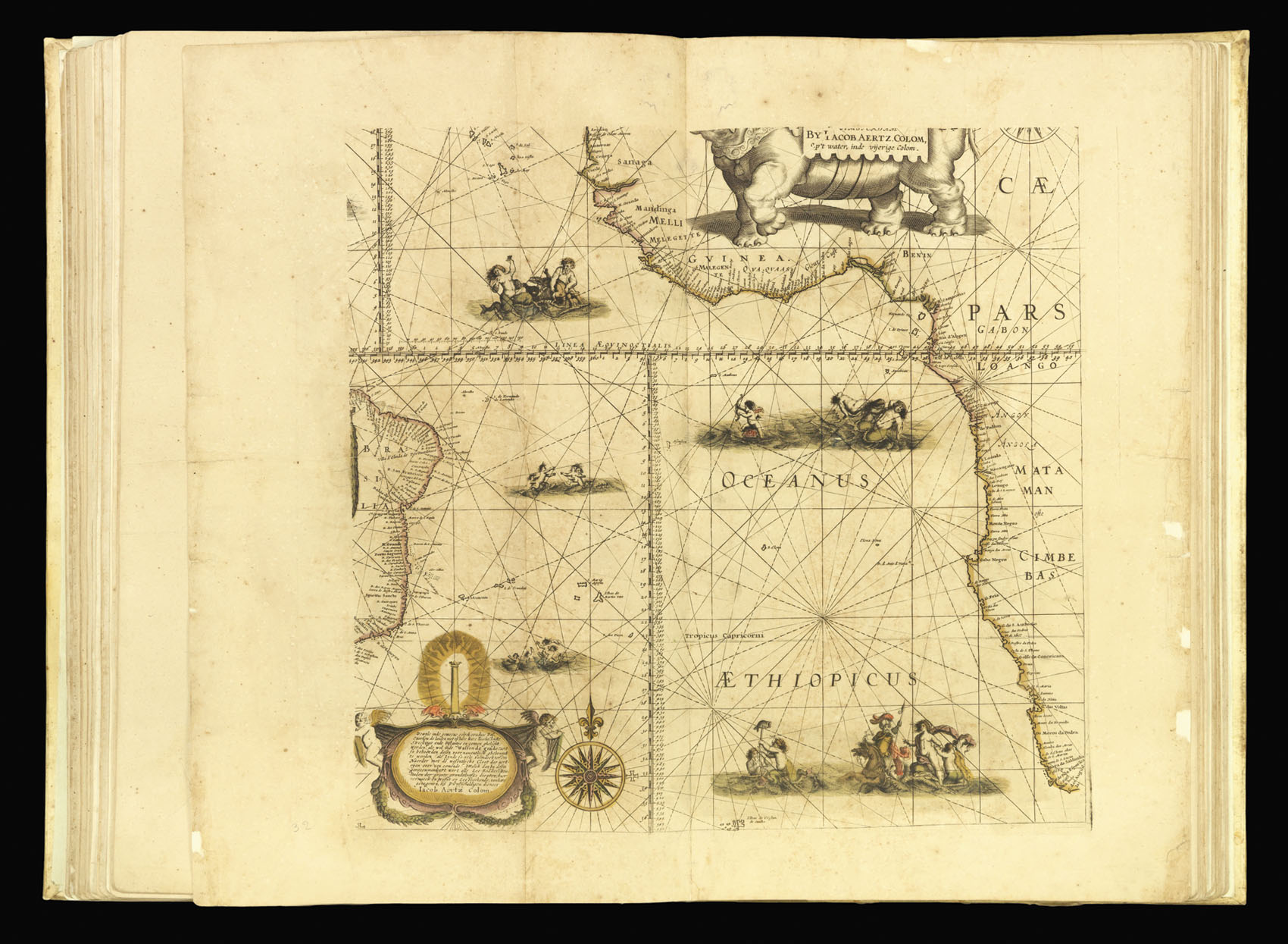
[Chart of the South Atlantic]
- Author: COLOM, Jacob Aertsz
- Publication place: Amsterdam
- Publisher: Printed By himselfe dwellinge on the Corne-market in the Fyrie-Colom, with Priviledge
- Publication date: 1668
- Physical description: Engraved map in fine original outline hand-colour
- Inventory reference: 3920
Notes
A chart of the south Atlantic Ocean between the east coast of South America and the west coast of Africa, from Senegal to the Cape of Good Hope,with merpeople frolicking in the surf. The partially visible elephant cartouche shows that it was reduced from a larger map. It was originally published as the south eastern sheet of Colom’s separately issued wall map of c.1655, ‘Dese Vassende Grade-kaert’, which was based upon Willem Blaeu’s seminal ‘Paskaert’ of c.1630.
Bibliography
- Not recorded in Koeman but c.f. Koeman J. Col 6A for a list of the charts.
Related items


Sign up to hear about our latest acquisitions, exhibitions and events
Find Us
New York
PO Box 329, Larchmont, NY, USA
Opening hours, London Gallery
Monday to Friday: 10:00 – 18:00
Saturday: by appointment
Closed: all bank holidays and 1-31 August
Opening hours, New York
By appointment only