 Rare Maps
  Rare Atlases
  Rare Books
  Rare Prints
  Globes and Planetaria
 Sign up to hear about our latest acquisitions, exhibitions and events


Find Us
New York
PO Box 329, Larchmont, NY, USA
Opening hours, London Gallery
Monday to Friday: 10:00 – 18:00
Saturday: by appointment
Closed: all bank holidays and 1-31 August
Opening hours, New York
By appointment only
Opening hours

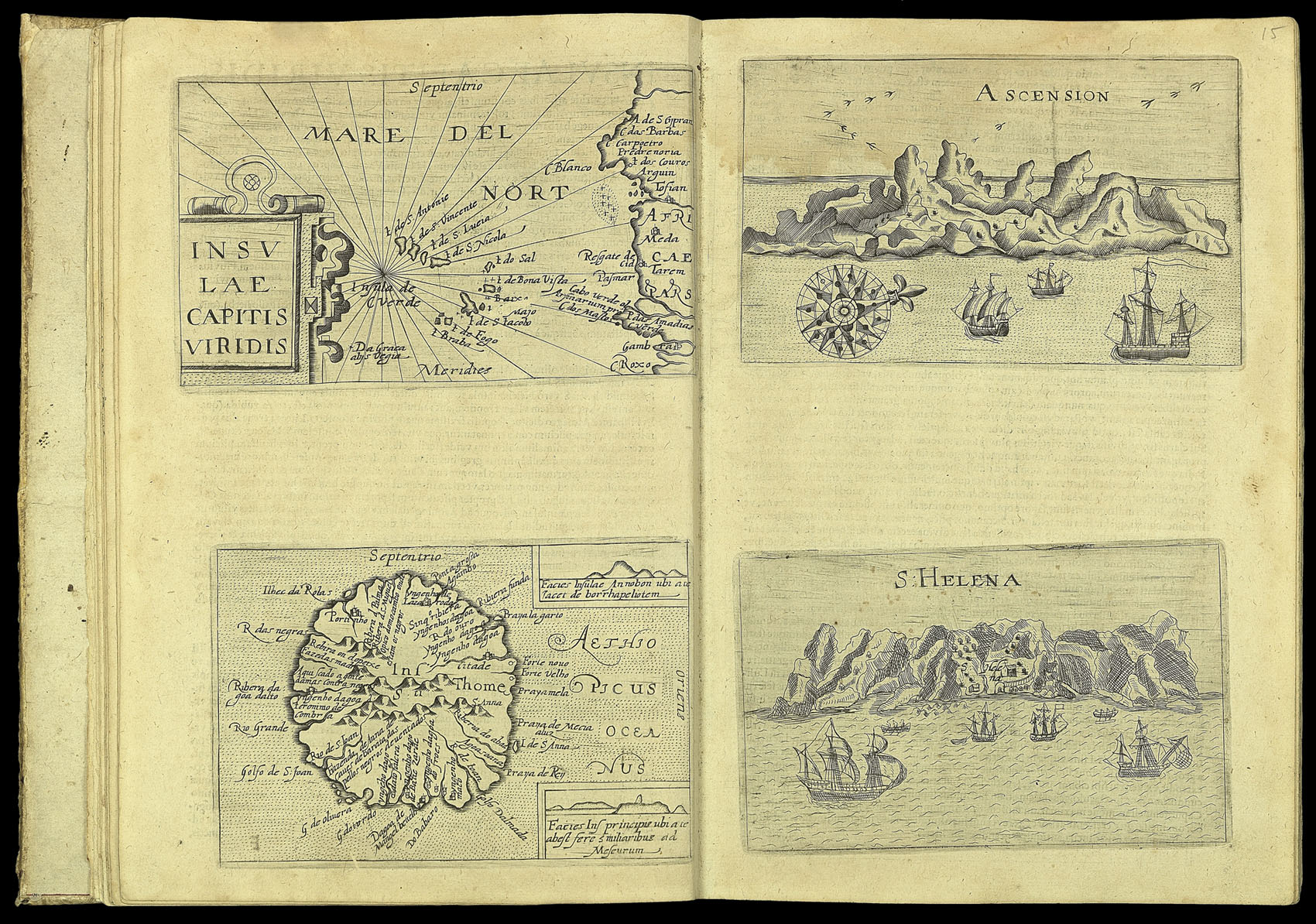
Insulae Capitis Viridis / Ascension / Ins. S. Thome / S. Helena
- Author: METELLUS, Johannes
- Publication place: Coloniæ Agrippinaæ
- Publisher: excudebat Ioann. Christophori
- Publication date: 1601
- Physical description: Engraved map
- Inventory reference: 3379
Notes
Four maps showing Portuguese-controlled islands (clockwise): the Cape Verde Islands, Ascension Island, Saint Helena, Sao Tome. St Helena and Ascension Island are shown as views of the entrance into their main ports: neither of the islands were permanently inhabited at the time, although they had been claimed by the Portuguese in the fifteenth century, and therefore had no infrastructure worth showing on a map. They simply acted as convenient stopping points on the transatlantic voyage; ill sailors were often left there to recover before being picked up by the next passing vessel.
These maps appear in the ‘Insularum orbis aliquot insularum’ by Johannes Metellus. It stands out as a northern European contribution to the tradition of ‘isolari’, or ‘island books’, that has its origins in the manuscript Mediterranean chart books of the fifteenth century, and in the printed works of Sonetti, Bordone, and Porcacchi.
Johannes Metellus (Jean Matal) (1520–1597) was a Burgundian scholar in law and geography. He originally worked in Bologna, where he assisted with the publication of Lelio Torelli’s encyclopaedia, before travelling over Europe, meeting the cartographer Abraham Ortelius in the process, and settling in Cologne by 1563. Through his connection with Ortelius and the publisher Christophe Plantijn, Metellus contributed to some of the most important cartographic works of the period. He provided material for a new edition of Ortelius’ best-selling atlas ‘Theatrum Orbis Terrarum;, passed Gerard Mercator information in 1577 about an expedition to Mexico, and is thanked in the introduction to Michael Eitzinger’s famous ‘Leo Belgicus’. He also wrote the description of Lyon in the first volume of Braun and Hogenburg’s ‘Civitatis Orbis Terrarum’, and a preface to volume two of the same work.
By the time his isolario was published in 1601, the genre had developed into a complex mixture of atlas, travel narrative and tourist guide. Despite the publication of more comprehensive cartographical works like Ortelius’ atlas, they remained resolutely popular, although the extension of the range of Metellus’ work beyond the traditional Mediterranean limits suggests an attempt to follow contemporary interest. His own work borrowed heavily from the Italian cartographic tradition of the so-called ‘Laferi School’. This is particularly evident in the present work – his final atlas, where at least half of the maps are not very well disguised copies of those of Giuseppe Rosaccio.
Bibliography
- Zacharakis 2171–2184.
- Meurer, Peter, 'Atlantes Coloniensis: Die Kölner Schule der Atlaskartographie 1570–1620', Cologne, 1988, pp. 162–167 and 190–192, Met 10. c.f. Cervoni 21
Related items


Sign up to hear about our latest acquisitions, exhibitions and events
Find Us
New York
PO Box 329, Larchmont, NY, USA
Opening hours, London Gallery
Monday to Friday: 10:00 – 18:00
Saturday: by appointment
Closed: all bank holidays and 1-31 August
Opening hours, New York
By appointment only