 Rare Maps
  Rare Atlases
  Rare Books
  Rare Prints
  Globes and Planetaria
 Sign up to hear about our latest acquisitions, exhibitions and events


Find Us
New York
PO Box 329, Larchmont, NY, USA
Opening hours, London Gallery
Monday to Friday: 10:00 – 18:00
Saturday: by appointment
Closed: all bank holidays and 1-31 August
Opening hours, New York
By appointment only
Opening hours

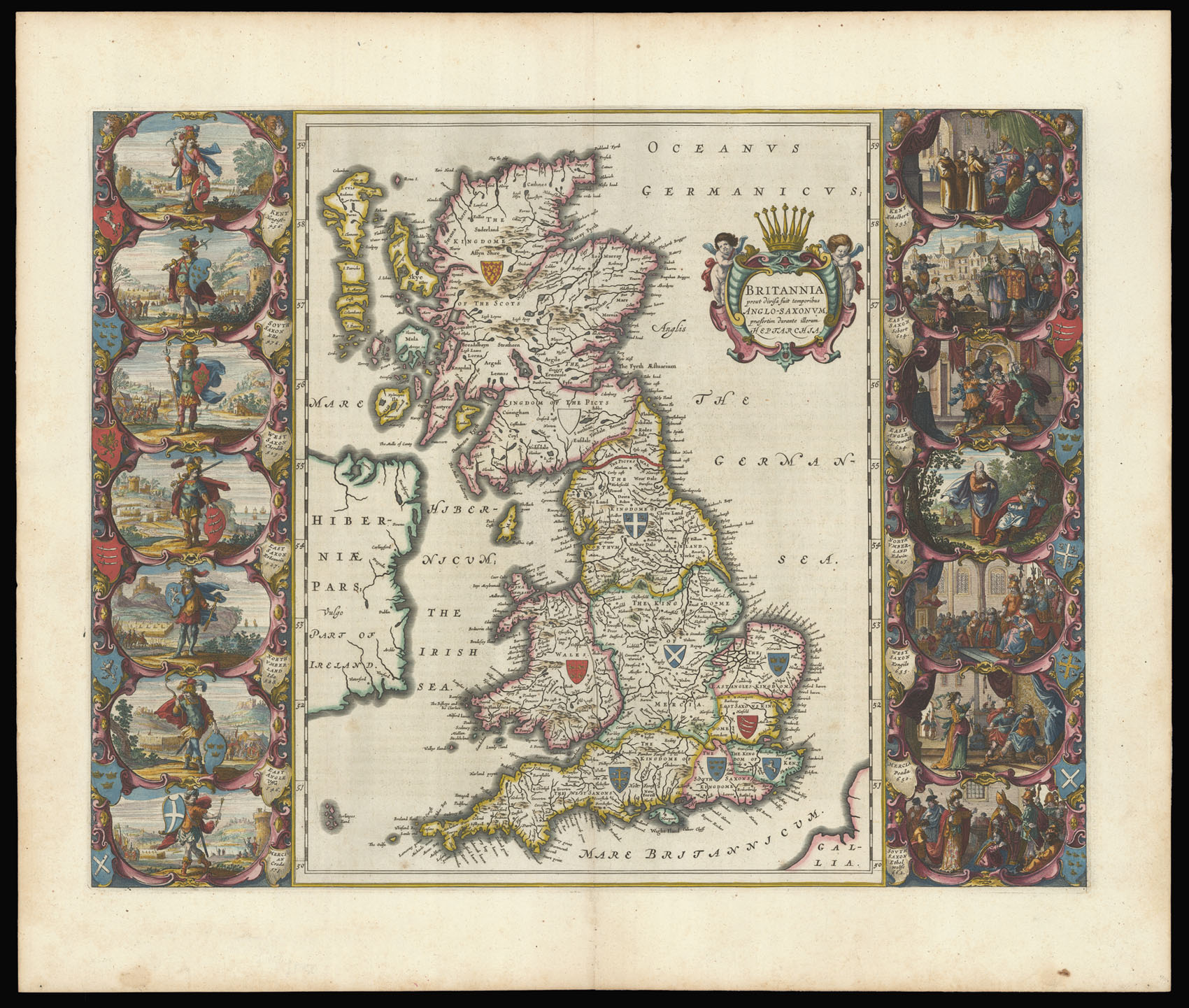
Britannia prout divisa fuit temporibus Anglo-Saxonum praefertin durante illorum Heptarchia.
- Author: BLAEU, Joan
- Publication place: Amsterdam
- Publication date: 1645.
- Physical description: Engraved map in fine original hand colour.
- Inventory reference: 12256
Notes
Blaeu’s famous “Heptarchy” map showing England, Scotland, and Wales divided into the seven Anglo-Saxon Kingdoms.
This stunning map is a superb example of Dutch cartographic design and is one of the most decorative maps of the British Isles ever produced. The dramatic vignettes to each side of the map depict the founders of each of the seven Kingdoms, whilst the scenes on the right show the conversion of the various Kingdoms to Christianity. Closely modelled on Speed’s ‘Heptarchy’ of 1611, the vignettes surrounding Blaeu’s version have been completely redone in the grand style of Dutch contemporary paintings.
Related items


Sign up to hear about our latest acquisitions, exhibitions and events
Find Us
New York
PO Box 329, Larchmont, NY, USA
Opening hours, London Gallery
Monday to Friday: 10:00 – 18:00
Saturday: by appointment
Closed: all bank holidays and 1-31 August
Opening hours, New York
By appointment only