 Rare Maps
  Rare Atlases
  Rare Books
  Rare Prints
  Globes and Planetaria
 Sign up to hear about our latest acquisitions, exhibitions and events


Find Us
New York
PO Box 329, Larchmont, NY, USA
Opening hours, London Gallery
Monday to Friday: 10:00 – 18:00
Saturday: by appointment
Closed: all bank holidays and 1-31 August
Opening hours, New York
By appointment only
Opening hours

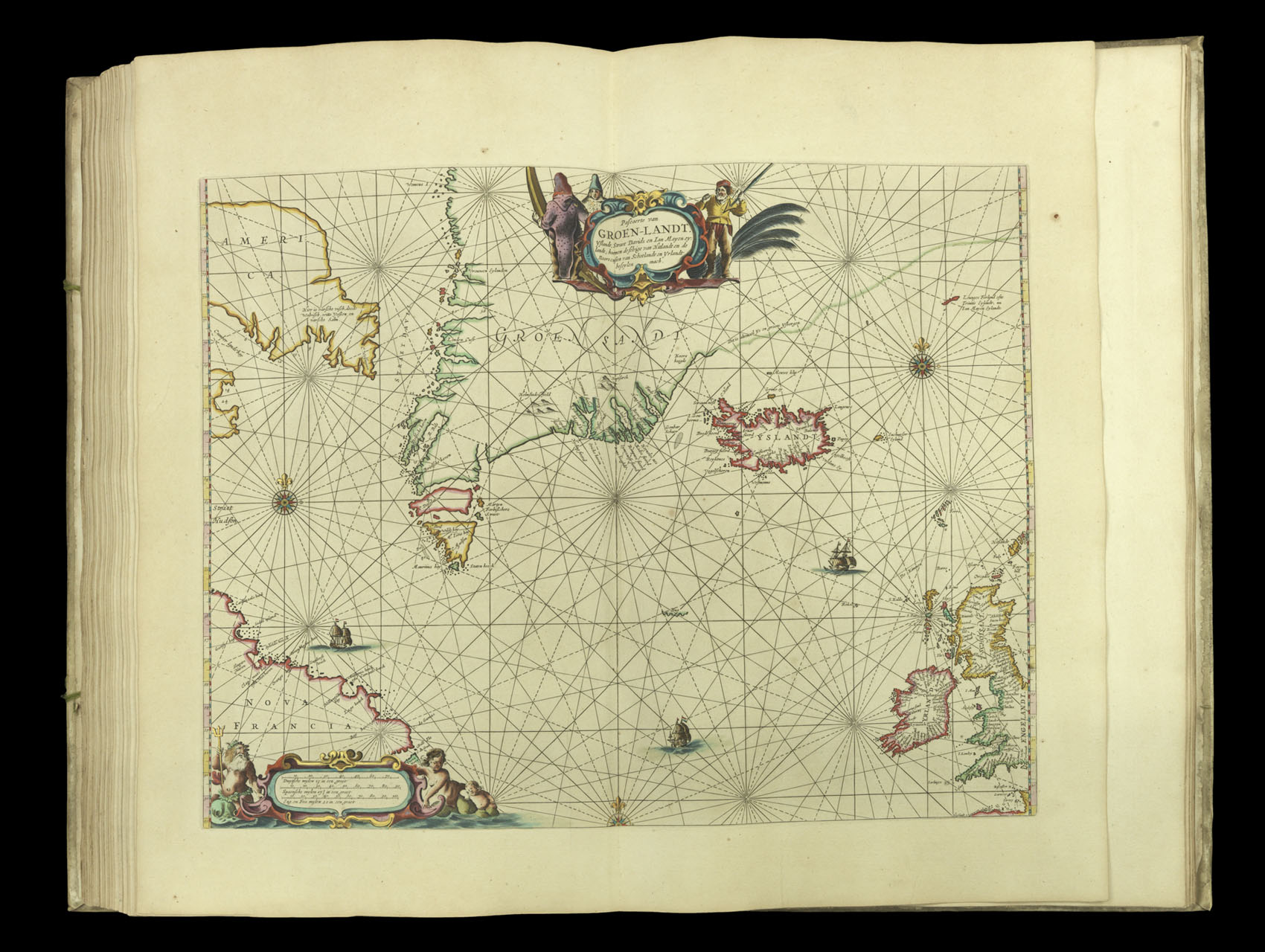
Pascaerte van Groen-Landt.
- Author: GOOS, Pieter
- Publication place: Amsterdam
- Publisher: Pieter Goos
- Publication date: 1666
- Physical description: Engraved map in original outline hand-colour heightened in gold
- Inventory reference: 3878
Notes
A chart of the northern Atlantic, from Canada (marked Nova Francia) to Great Britain and Ireland. This map would have been of particular interest to anyone concerned in cross-Atlantic trade. It details the approach to the Northwest Passage which connects the Atlantic and Pacific Oceans. Although the Northwest Passage would not be navigated by Europeans for almost three hundred years, it was hoped that the strait would provide an alternative route for European-Asian trade. The most important existing trades in the area covered by the chart, however, were the fur and whale markets. The cartouche is decorated with trappers wearing fur and a whaler brandishing a harpoon.
Bibliography
- Burden 388
- Koeman Goos 1B
- NMM 3:92.
Related items


Sign up to hear about our latest acquisitions, exhibitions and events
Find Us
New York
PO Box 329, Larchmont, NY, USA
Opening hours, London Gallery
Monday to Friday: 10:00 – 18:00
Saturday: by appointment
Closed: all bank holidays and 1-31 August
Opening hours, New York
By appointment only