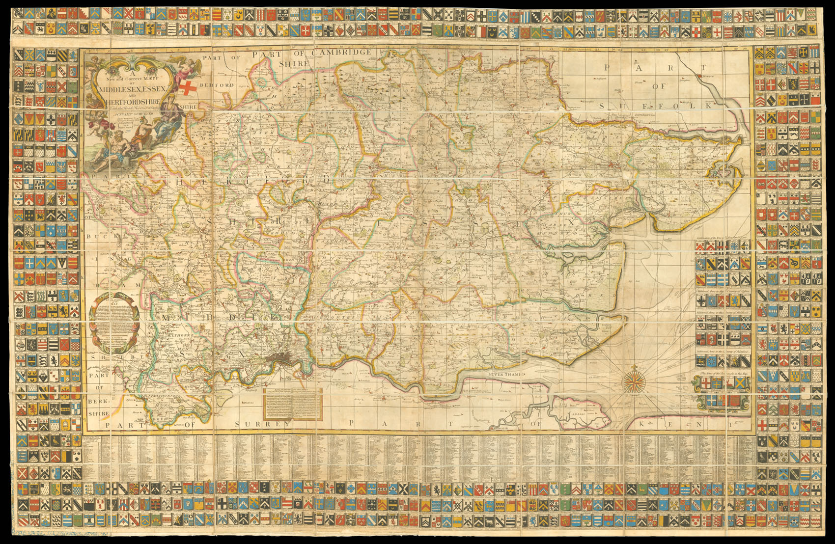
A New and Correct Mapp of Middlesex, Essex, and Hertfordshire With the Roads, Rivers, Sea Coasts &c. Actually Surveyed.
- Author: WARBURTON, John, Joseph BLAND, and Paylor SMYTHE
- Publication place: London
- Publication date: 1724.
- Physical description: Large hand-coloured engraved map on seven sheets, dissected and mounted on linen, subscriber's coats-of-arms to borders, folding into red cloth slipcase, with publisher's label of James Wyld, rubbed.
- Dimensions: 1190 by 1840mm (46.75 by 72.5 inches).
- Inventory reference: 1997
Notes
Following the commercial success of his maps of Northumberland (c1716) and Yorkshire (c1720), Warburton announced his intention to publish maps of all the counties in England and Wales, though in many cases combining several counties on one map. The marketing for his next map, (that of Middlesex, Essex and Hertfordshire) followed familiar lines and on 25th October 1720, Warburton announced that “Proposals are given out and Subscriptions taken in for Surveying and Publishing the Counties of Middlesex (cum London) Essex and Hertfordshire…which it is hoped will be as agreeable to the Nobility and Gentry that have Seats of Inheritance therein, as to those in the Counties already Survey’d, and that their Approbation of the Undertaking will be shown by a ready Compliance in sending their Coats of Arms and Subscription monies viz 16s 6p…” By February 1723 Warburton was able to announce the progress of the surveys and the acceptance of over 300 subscribers for their coats-of-arms to be inserted on the map. A further announcement on 2nd November 1723 stated that the surveyor Paylor Smyth had completed his survey,though it was over a year before Warburton was able to announce the publication of the map which now included “in the margin 724 Coats of Arms, belonging to the Families that have Seats and Estates in the said Counties…The Price is Ten Shillings in Sheets, or Twelve Shillings and Sixpence if pasted on Cloth, and coloured.”
The announcement of the 724 coats of arms (the final production did in fact display 736), caused the immediate displeasure of the College of Heralds who attacked Warburton for the inaccuracy, even non-existence of some of the arms on the Northumberland and Yorkshire maps and even queried Warburton’s right to publish arms without a proper authority “not having resided within the Herald’s Office for about two Years last past”. Despite the stated intention to map the whole country, Warburton carried out no further surveys, though he did announce in 1749 separate maps of Middlesex and Hertfordshire taken from the large survey, which were advertised to include borders of coats-of-arms but which never materialised in this state.
The map itself is finely detailed and includes the divisions of the three counties and their hundreds and main roads, whilst the distances between the latter are indicated in miles and furlongs. Further detail includes woods, rivers, wind and water mills, battlefields, marshes and sandbanks. The most impressive feature, however, is the border of armorials of the subscribers, each one keyed to refer to his respective residence on the map. This feature had already appeared on earlier large-scale county surveys, for example Senex’s map of Surrey, and had undoubtedly contributed to the success of Warburton’s maps of Northumberland and Yorkshire. Whilst Warburton took by far the major part in the publication of the 3 counties map with Paylor Smyth doing the survey, Joseph Bland’s part in the enterprise would appear to be limited to collecting subscriptions and the distribution of the published map. With over 700 subscribers it should have been a considerable commercial success. Aesthetically it was very pleasing due partly to the clarity of Samuel Parker’s engraving (he was also responsible for the Yorkshire map) but mainly to its impressive size and multitude of armorials, all with references on the map. Each of the six topographical sheets, except sheet 2, contains coats-of-arms, the seventh sheet comprising three rows of armorials for pasting along the top of the map should it be displayed, as was intended, as a wall map. When shown in this way it is undoubtedly one of the most spectacular examples of eighteenth century English cartography ever produced. There were further editions by Thomas Bowles c1753, and Bowles and Carver c1795 and possibly by Robert Wilkinson early in the nineteenth century.
Although the unusually large number of subscribers, if in fact they all existed, suggests a production well in excess of the usual large-scale printing, the temptation to display it as a wall map would have contributed to an even higher mortality rate than usual – certainly few examples have survived.
 Rare Maps
  Rare Atlases
  Rare Books
  Rare Prints
  Globes and Planetaria


