 Rare Maps
  Rare Atlases
  Rare Books
  Rare Prints
  Globes and Planetaria
 Sign up to hear about our latest acquisitions, exhibitions and events


Find Us
New York
PO Box 329, Larchmont, NY, USA
Opening hours, London Gallery
Monday to Friday: 10:00 – 18:00
Saturday: by appointment
Closed: all bank holidays and 1-31 August
Opening hours, New York
By appointment only
Opening hours

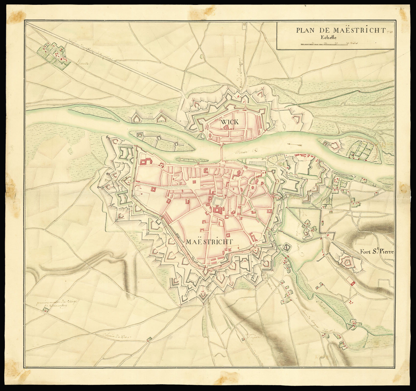
Plan de Maëstricht
- Publication date: 1748
- Physical description: Manuscript plan with original hand colouring.
- Dimensions: 461 by 496mm. (18.25 by 19.5 inches).
- Inventory reference: 2901
Notes
The plan depicts the fortified Maastricht and Wick during the siege of 1748. The main roads around the city are named.
The siege took place between April and May 1748. Under the command of Maurice de Saxe, the French besieged and captured the Dutch barrier fortress of Maastricht in the final months of the campaign in the Low Countries. After a relatively long siege the garrison of Maastricht capitulated and marched out with the honours of war.
Related items


Sign up to hear about our latest acquisitions, exhibitions and events
Find Us
New York
PO Box 329, Larchmont, NY, USA
Opening hours, London Gallery
Monday to Friday: 10:00 – 18:00
Saturday: by appointment
Closed: all bank holidays and 1-31 August
Opening hours, New York
By appointment only