 Rare Maps
  Rare Atlases
  Rare Books
  Rare Prints
  Globes and Planetaria
 Sign up to hear about our latest acquisitions, exhibitions and events


Find Us
New York
PO Box 329, Larchmont, NY, USA
Opening hours, London Gallery
Monday to Friday: 10:00 – 18:00
Saturday: by appointment
Closed: all bank holidays and 1-31 August
Opening hours, New York
By appointment only
Opening hours

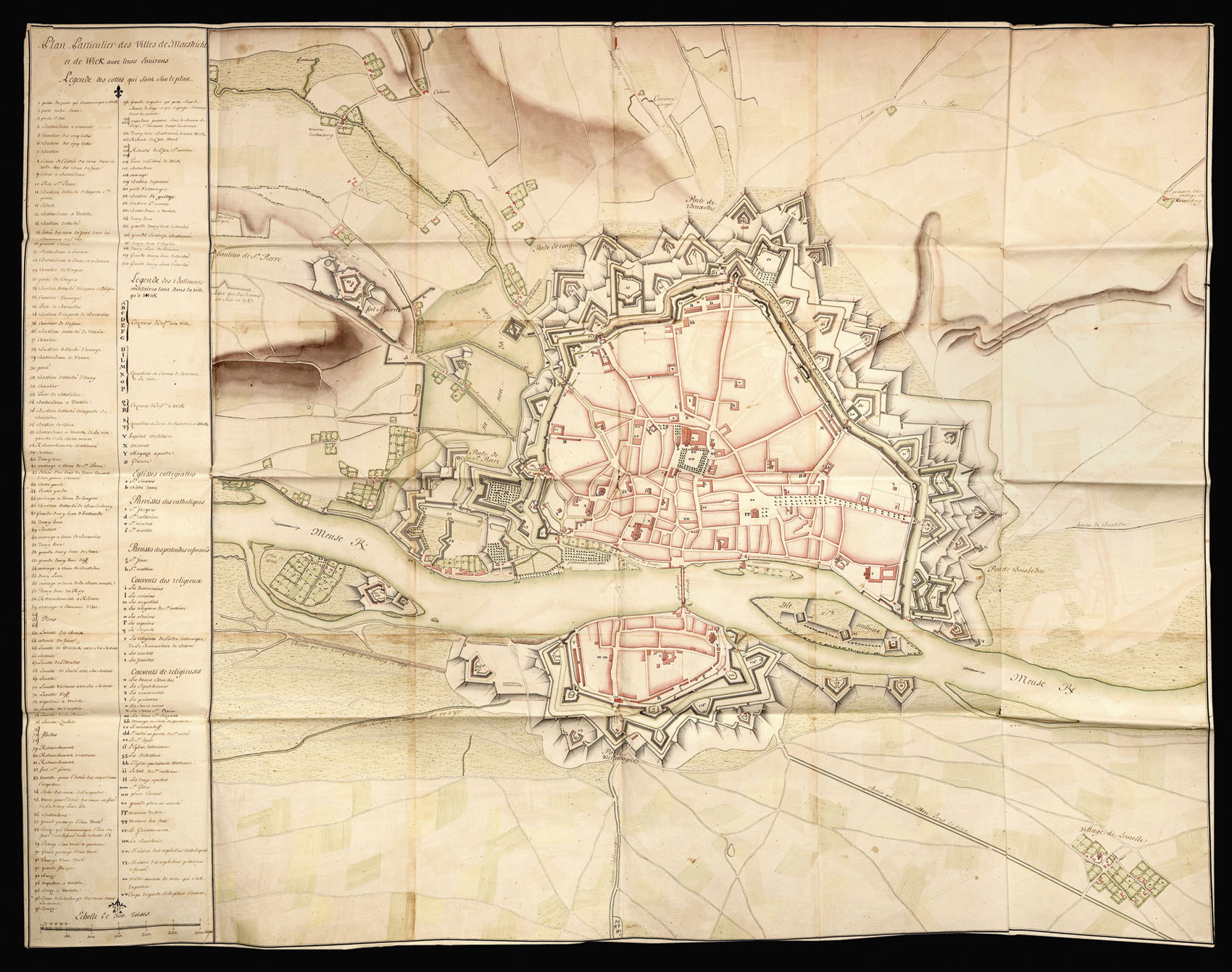
Plan Particulier des Villes de Maestricht et de Wick avec leurs Environs
- Author: French school
- Publication date: c1748
- Physical description: Manuscript plan with fine original hand-colour.
- Dimensions: 1200 by 1500mm. (47.25 by 59 inches).
- Inventory reference: 2898
Notes
Large and detailed plan of Maastricht, Wick and their environs; title and key on the left side of the map. The plan is oriented with West at the top.
The key lists the main buildings and places of interest, including churches, fortresses, cofferdams, water locks. The living quarters and houses are drawn in red, fields in green and fortifications in brown. Alphabetically listed are the fortresses and other military buildings including the hospital and the areas where the soldiers lived. Following are the College Churches, the Catholics neighbourhoods, the convents.
Related items


Sign up to hear about our latest acquisitions, exhibitions and events
Find Us
New York
PO Box 329, Larchmont, NY, USA
Opening hours, London Gallery
Monday to Friday: 10:00 – 18:00
Saturday: by appointment
Closed: all bank holidays and 1-31 August
Opening hours, New York
By appointment only