 Rare Maps
  Rare Atlases
  Rare Books
  Rare Prints
  Globes and Planetaria
 Sign up to hear about our latest acquisitions, exhibitions and events


Find Us
New York
PO Box 329, Larchmont, NY, USA
Opening hours, London Gallery
Monday to Friday: 10:00 – 18:00
Saturday: by appointment
Closed: all bank holidays and 1-31 August
Opening hours, New York
By appointment only
Opening hours

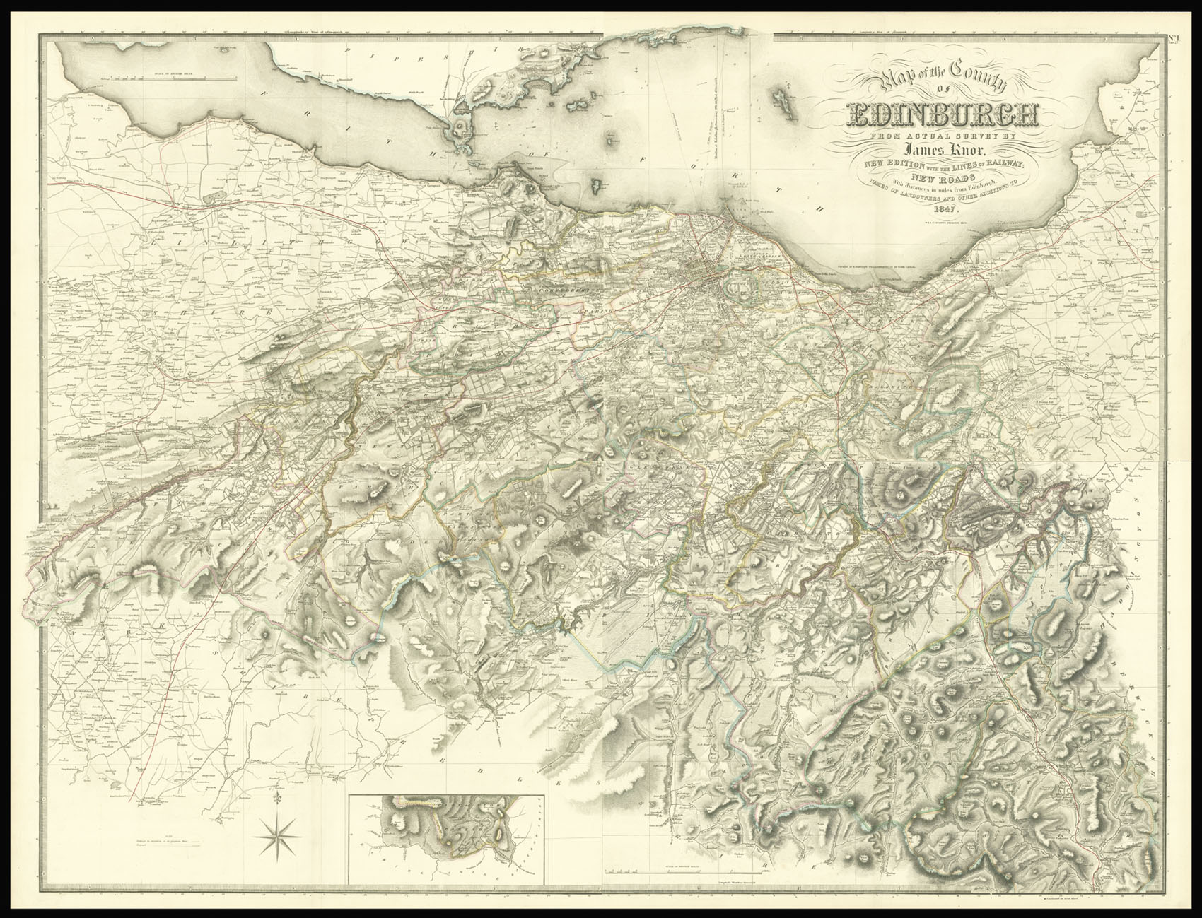
Map of the County of Edinburgh from actual survey by James Knox, New Edition with the lines of railway; New Roads With distances in miles from Edinburgh. Names of Landowners and other additions to 1847.
- Author: KNOX, James
- Publication place: Edinburgh
- Publisher: [Blackwood & Sons
- Publication date: 1855].
- Physical description: Large scale engraved map on four sheets, fine original outline hand-colour.
- Dimensions: 1020 by 1340mm (40.25 by 52.75 inches).
- Inventory reference: 2368
Notes
Large-scale map of the Midlothian.
John Knox (fl. 1800-1856), published his first survey of Midlothian in 1816. The map was so we received that it became the standard work for the county and an updated version was included in John Thompson’s ‘Atlas of Scotland’ – published in 1832 – the first large-scale county atlas of Scotland. In 1838 the plates were purchased by W. & A. K. Johnston, and re-engraved, updating the topography and adding new railways. The map – the present example – was subsequently published in Blackwood’s ‘Atlas of Scotland’ in 1855.
The map is superbly detailed giving information upon elevation by hachures, parish boundaries, field boundaries, parks, squares, rivers, roads, railways, cities, towns, villages, churches, gentleman’s seats, soundings, sea hazards, and anchorages.
Scale: 1.5 inches to the statute mile.
Related items


Sign up to hear about our latest acquisitions, exhibitions and events
Find Us
New York
PO Box 329, Larchmont, NY, USA
Opening hours, London Gallery
Monday to Friday: 10:00 – 18:00
Saturday: by appointment
Closed: all bank holidays and 1-31 August
Opening hours, New York
By appointment only