 Rare Maps
  Rare Atlases
  Rare Books
  Rare Prints
  Globes and Planetaria
 Sign up to hear about our latest acquisitions, exhibitions and events


Find Us
New York
PO Box 329, Larchmont, NY, USA
Opening hours, London Gallery
Monday to Friday: 10:00 – 18:00
Saturday: by appointment
Closed: all bank holidays and 1-31 August
Opening hours, New York
By appointment only
Opening hours

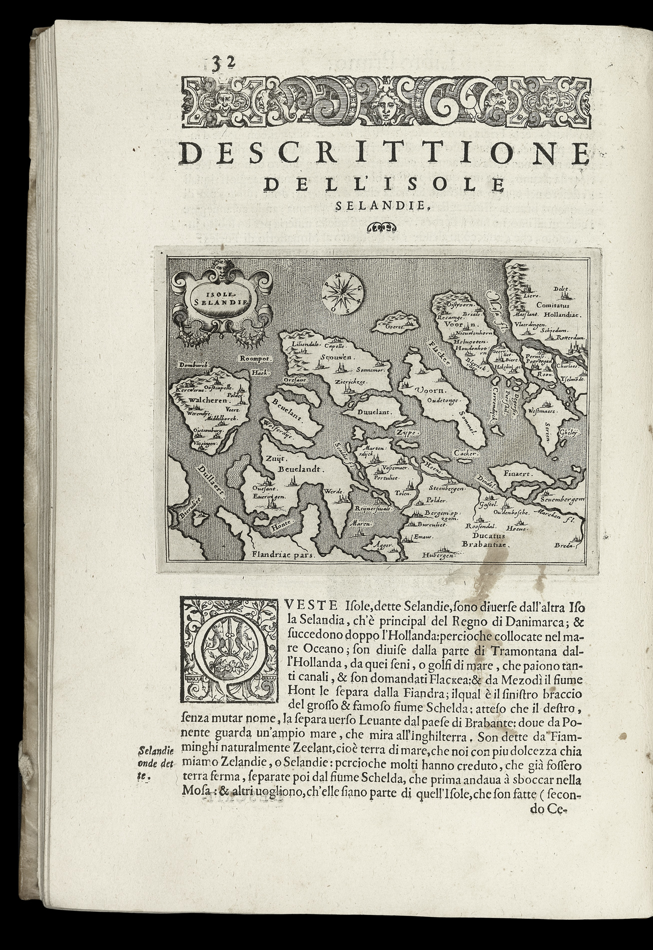
Isole Selandie
- Author: PORCACCHI, Thomaso
- Publication place: In Venetia
- Publisher: Appresso gli heredi di Simon Galignani
- Publication date: 1590
- Physical description: Woodcut map
- Dimensions: 110 by 150 mm (4.25 x 6 inches)
- Inventory reference: 3371
Notes
A detailed map of the islands of Zeeland on the west coast of the Netherlands.
This map appears in ‘L’isole piu famose’ by Tommaso Porcacchi, a beautiful and important isolario first published in 1572. The isolario, or island book, was a genre developed in the Mediterranean over the sixteenth century as a unique blend of literature, geography and art. It combined up-to-date cartography with contemporary accounts of and information about the places it portrayed. Porcacchi’s work represents the culmination of a movement in the genre towards cartographical accuracy; ‘L’isole’ was aimed specifically at readers who ‘dello studio della geografia si dilettano’ (delight in geographical studies). ‘L’isole’ was the first isolario with maps engraved on copper.
This is the third edition of ‘L’isole piu famose’, enlarged from the original and, according to Phillips, containing 17 maps which do not appear in the 1572 original including two of the New World: Jamaica and Puerto Rico. The addition of the New World islands from the second edition onwards reflects contemporary interest in the geography of the Americas. The detailed, beautifully engraved island maps are set in context by the two splendid world maps in the closing sections entitled ‘Descrizione del Mappamondo’ and ‘Discorso intorno alla carta da navigate,’ pages 193 to 20.
Bibliography
- Philips 3328
- Sabin 64105
- Shirley 127–28
- c.f. 'The World Encompassed' 86.
Related items


Sign up to hear about our latest acquisitions, exhibitions and events
Find Us
New York
PO Box 329, Larchmont, NY, USA
Opening hours, London Gallery
Monday to Friday: 10:00 – 18:00
Saturday: by appointment
Closed: all bank holidays and 1-31 August
Opening hours, New York
By appointment only