 Rare Maps
  Rare Atlases
  Rare Books
  Rare Prints
  Globes and Planetaria
 Sign up to hear about our latest acquisitions, exhibitions and events


Find Us
New York
PO Box 329, Larchmont, NY, USA
Opening hours, London Gallery
Monday to Friday: 10:00 – 18:00
Saturday: by appointment
Closed: all bank holidays and 1-31 August
Opening hours, New York
By appointment only
Opening hours

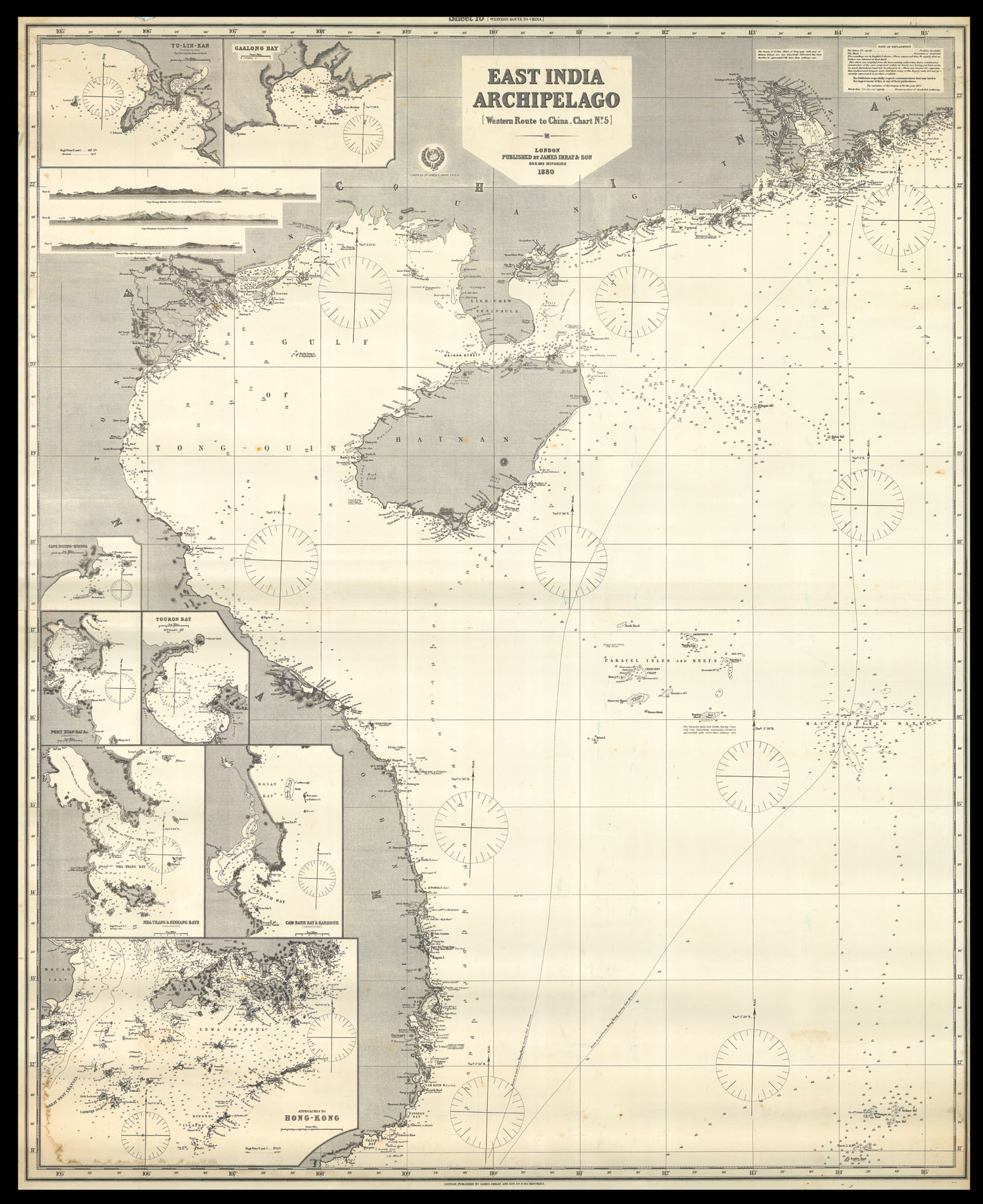
East India Archipelago Western Route to China. Chart No.5.
- Author: IMRAY, James
- Publication place: London
- Publisher: James Imray & Son
- Publication date: 1880.
- Physical description: Engraved chart, backed on blue paper.
- Dimensions: 1245 by 1015mm. (49 by 40 inches).
- Inventory reference: 11960
Notes
A large blue-backed chart of Vietnam, Hainan Island and southwest China, showing two potential routes to Hong Kong during the monsoon. There are inset maps of ports along the South China Sea coasts, including Hong Kong, Touron Bay (now known as Da Nang) and Ganlong Bay (now known as Ha Long Bay), and some coastal views to the upper left. This is the fifth in a set of six maps which illustrate the route to China via the Pacific.
James Imray (1803-1870), worked originally in the stationery and account book publishing business. In 1836 Imray joined with Michael Blachford. The partnership flourished and soon began to compete with the larger firm of Norie and Wilson. In 1846 Imray bought out Blachford, and the company survived, led by his descendants, into the twentieth century, when it merged with Norie and Wilson.
Related items


Sign up to hear about our latest acquisitions, exhibitions and events
Find Us
New York
PO Box 329, Larchmont, NY, USA
Opening hours, London Gallery
Monday to Friday: 10:00 – 18:00
Saturday: by appointment
Closed: all bank holidays and 1-31 August
Opening hours, New York
By appointment only