 Rare Maps
  Rare Atlases
  Rare Books
  Rare Prints
  Globes and Planetaria
 Sign up to hear about our latest acquisitions, exhibitions and events


Find Us
New York
PO Box 329, Larchmont, NY, USA
Opening hours, London Gallery
Monday to Friday: 10:00 – 18:00
Saturday: by appointment
Closed: all bank holidays and 1-31 August
Opening hours, New York
By appointment only
Opening hours

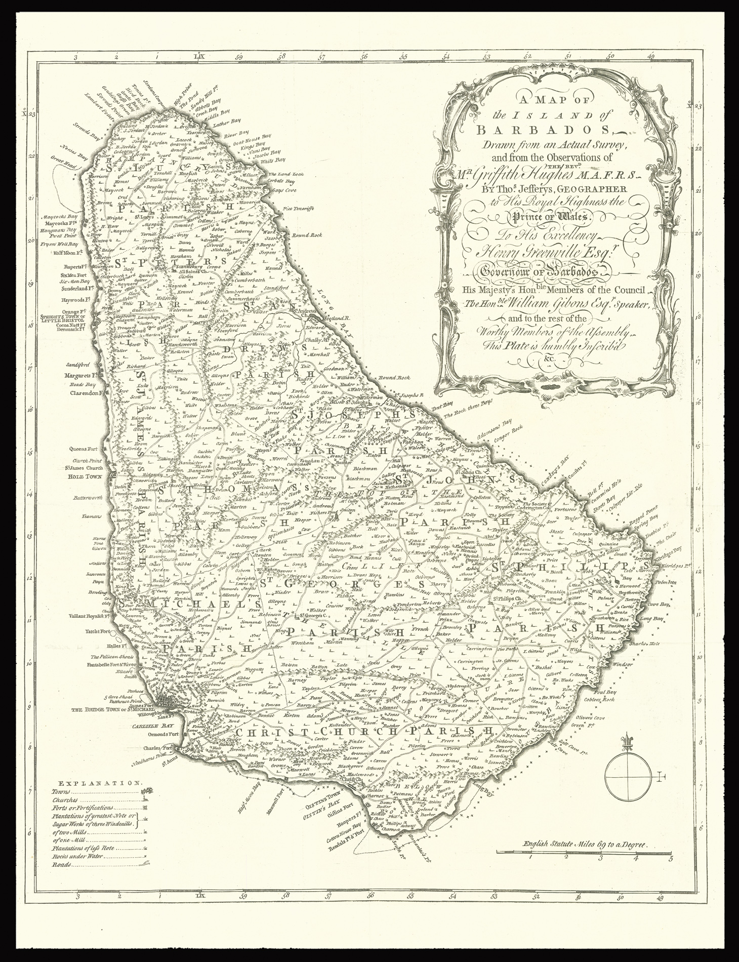
A Map of the Island of Barbados Drawn from an Actual Survey, and from the Observations of the revd. Mr. Griffith Hughes M.A.F.R.S. By Thos. Jefferys, Geographer to His Royal Highness the Prince of Wales.
- Author: HUGHES, Griffith
- Publication place: London
- Publisher: Thomas Jefferys
- Publication date: 1750
- Physical description: Engraved map.
- Dimensions: 425 by 360mm (16.75 by 14.25 inches).
- Inventory reference: 2673
Notes
A wonderful early map of the island of Barbados complied by the English parson Griffith Hughes. This map was issued as a fold-out plate in Hughes’ botanical volume entitled, The Natural History of Barbados published in 1750. The small folio work contained beautiful natural history plates many drawn by G.D. Ehret and was subscribed to by the leading naturalists of the day. The map itself is a very detailed copperplate engraving divided into parrishes and listing all towns, churchs, forts, plantations, “sugar works, roads and “rocks under water.”
Detailed map of Barbados depicting towns churches, fortifications, plantations, sugar works of three, two, and one mill, plantations of lesser note, rocks under water, coastal features, roads, and parishes.
Bibliography
- MCC 31.
Related items


Sign up to hear about our latest acquisitions, exhibitions and events
Find Us
New York
PO Box 329, Larchmont, NY, USA
Opening hours, London Gallery
Monday to Friday: 10:00 – 18:00
Saturday: by appointment
Closed: all bank holidays and 1-31 August
Opening hours, New York
By appointment only