 Rare Maps
  Rare Atlases
  Rare Books
  Rare Prints
  Globes and Planetaria
 Sign up to hear about our latest acquisitions, exhibitions and events


Find Us
New York
PO Box 329, Larchmont, NY, USA
Opening hours, London Gallery
Monday to Friday: 10:00 – 18:00
Saturday: by appointment
Closed: all bank holidays and 1-31 August
Opening hours, New York
By appointment only
Opening hours

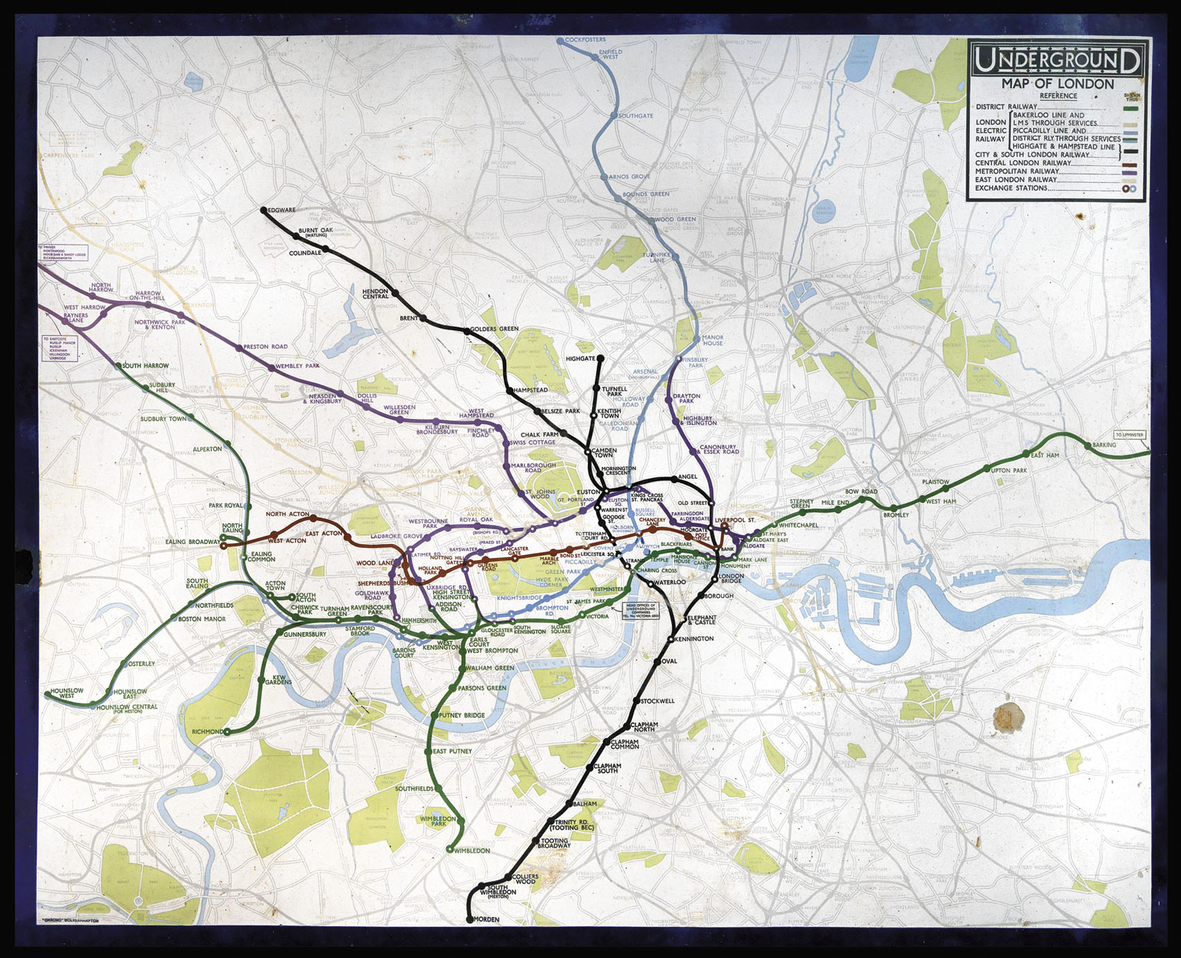
Underground Map of London.
- Author: GOSSOP, Reginald Percy
- Publication place: Wolverhampton
- Publication date: Summer, 1933
- Physical description: Chromolithograph map printed on metal, key and title upper right, small loss lower right.
- Dimensions: 1010 by 1270mm (39.75 by 50 inches).
- Inventory reference: 2421
Notes
Large and detailed map of 1930’s London and her Underground Railway printed on metal.
The map superimposes the Underground network on a geographical map of London, and was drawn by Reginald Percy Gossop (1876-1951) who studied at the Hammersmith School of Art and produced maps and posters for the London Underground between 1916 and 1933.
The present map can be dated to around the summer of 1933, as it shows the Piccadilly line extending to Cockfosters, but does not mark Alesbury on the Metropolitan Line.
Related items


Sign up to hear about our latest acquisitions, exhibitions and events
Find Us
New York
PO Box 329, Larchmont, NY, USA
Opening hours, London Gallery
Monday to Friday: 10:00 – 18:00
Saturday: by appointment
Closed: all bank holidays and 1-31 August
Opening hours, New York
By appointment only