 Rare Maps
  Rare Atlases
  Rare Books
  Rare Prints
  Globes and Planetaria
 Sign up to hear about our latest acquisitions, exhibitions and events


Find Us
New York
PO Box 329, Larchmont, NY, USA
Opening hours, London Gallery
Monday to Friday: 10:00 – 18:00
Saturday: by appointment
Closed: all bank holidays and 1-31 August
Opening hours, New York
By appointment only
Opening hours

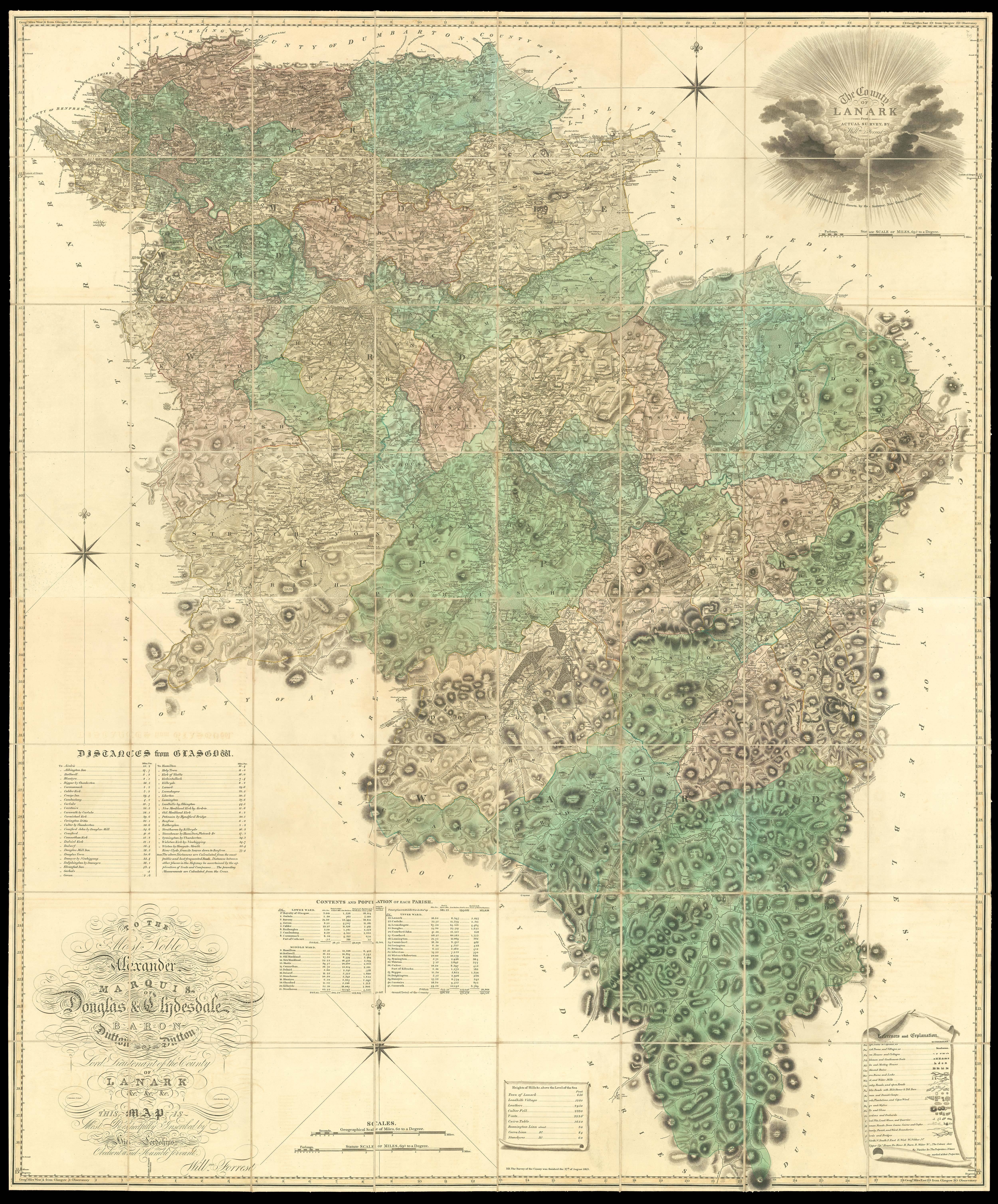
The County of Lanark from Actual Survey by Will[ia]m Forrest. To the Right Honourable John, Earl of Hopetown, Viscount Atherley, Lord Hope, … and Lord Lieutenant of the County of Linlithgow etc. This map is Most Respectfully Inscribed by His Lordship’s Most Obedient and Humble Servant, William Forrest.
- Author: FORREST, Will[ia]m
- Publication place: Edinburgh
- Publisher: W. Forrest
- Publication date: 1818.
- Physical description: Large engraved map, fine original full-wash colour, dissected and mounted on linen, in two sections, housed in original green morocco slipcase, spine in compartments and lettered in gilt.
- Dimensions: 1780 by 1280mm (70 by 50.5 inches).
- Inventory reference: 10787
To scale:

Notes
An outstanding example of a scarce Scottish large-scale survey.
A superb map of the area now know as West Lothian and embracing the old parishes of Torphichen, Bathgate, Whitburn, Bo’ness, Kirkliston, Linlithgow, Uphall, Abercon, Dalmeny and Cramond, etc. Much detail is shown including kirks, burns and lochs, Roman and Danish camps, and the Antonine Wall.
Bibliography
- NLS EMS.s.33.
Related items


Sign up to hear about our latest acquisitions, exhibitions and events
Find Us
New York
PO Box 329, Larchmont, NY, USA
Opening hours, London Gallery
Monday to Friday: 10:00 – 18:00
Saturday: by appointment
Closed: all bank holidays and 1-31 August
Opening hours, New York
By appointment only