 Rare Maps
  Rare Atlases
  Rare Books
  Rare Prints
  Globes and Planetaria
 Sign up to hear about our latest acquisitions, exhibitions and events


Find Us
New York
PO Box 329, Larchmont, NY, USA
Opening hours, London Gallery
Monday to Friday: 10:00 – 18:00
Saturday: by appointment
Closed: all bank holidays and 1-31 August
Opening hours, New York
By appointment only
Opening hours

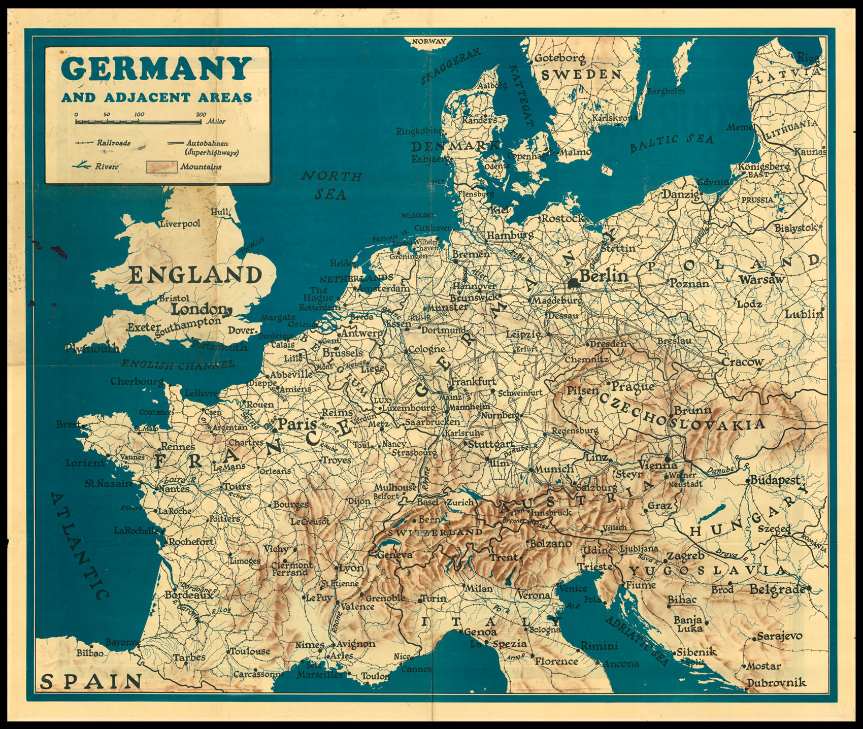

Germany and Adjacent Areas; Your War from D-Day On.
- Publication place: London
- Publication date: 1944.
- Physical description: Double sided chromolithographed map.
- Dimensions: 950 by 1140mm. (37.5 by 45 inches).
- Inventory reference: 11481
Notes
A double sided map of western Europe. One side shows a normal map, with major cities, railways, rivers, mountains and motorways marked. The other side shows the same area, with differently coloured shaded areas representing various stages of the war. These include D-Day, the allied invasion of Normandy on 6 June 1944 via airborne and naval landings, helped by French Resistance; the Falaise Pocket, August 1944, where the German army was surrounded by the Allies and cut off, a key part of the Liberation of Paris; and the Battle of the Hedgerows, where Allied troops fought Germans as they retreated back into Normandy (Battle de Bocage). A small inscription at the lower edge encourages the owner to keep the map up to date by adding their own inscriptions showing the latest state of the war.
Image gallery
Related items


Sign up to hear about our latest acquisitions, exhibitions and events
Find Us
New York
PO Box 329, Larchmont, NY, USA
Opening hours, London Gallery
Monday to Friday: 10:00 – 18:00
Saturday: by appointment
Closed: all bank holidays and 1-31 August
Opening hours, New York
By appointment only