 Rare Maps
  Rare Atlases
  Rare Books
  Rare Prints
  Globes and Planetaria
 Sign up to hear about our latest acquisitions, exhibitions and events


Find Us
New York
PO Box 329, Larchmont, NY, USA
Opening hours, London Gallery
Monday to Friday: 10:00 – 18:00
Saturday: by appointment
Closed: all bank holidays and 1-31 August
Opening hours, New York
By appointment only
Opening hours

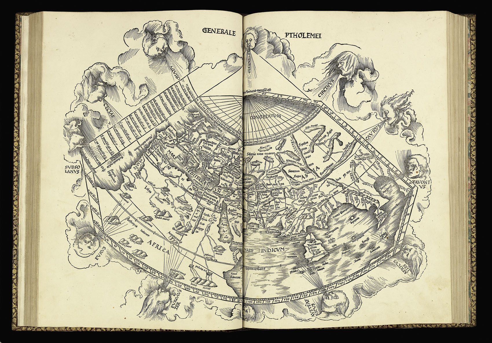
Conical projection of the world
Generale Ptholemei
- Author: PTOLEMAEUS, Claudius; and Martin WALDSEEMULLER
- Publication place: Strassburg:
- Publisher: Johannes Schott, 12th March
- Publication date: 1513
- Physical description: Woodcut map
- Dimensions: 445 by 580mm. (17.5 by 22.75 inches).
- Inventory reference: 5307
Notes
A map of the world on a traditional conical projection. The variegated wind heads make it one of the most decorative Ptolemaic world maps. The continents follow Ptolemy, apart from the Indian Ocean which is not cut off by a strip of land between Africa and Asia.
Bibliography
- Phillips 359
- Sabin 66478
- Shirley 34
- Nordenskiold 205 (incomplete)
- Adams P2219.
Related items


/
Sign up to hear about our latest acquisitions, exhibitions and events
Find Us
New York
PO Box 329, Larchmont, NY, USA
Opening hours, London Gallery
Monday to Friday: 10:00 – 18:00
Saturday: by appointment
Closed: all bank holidays and 1-31 August
Opening hours, New York
By appointment only