 Rare Maps
  Rare Atlases
  Rare Books
  Rare Prints
  Globes and Planetaria
 Sign up to hear about our latest acquisitions, exhibitions and events


Find Us
New York
PO Box 329, Larchmont, NY, USA
Opening hours, London Gallery
Monday to Friday: 10:00 – 18:00
Saturday: by appointment
Closed: all bank holidays and 1-31 August
Opening hours, New York
By appointment only
Opening hours

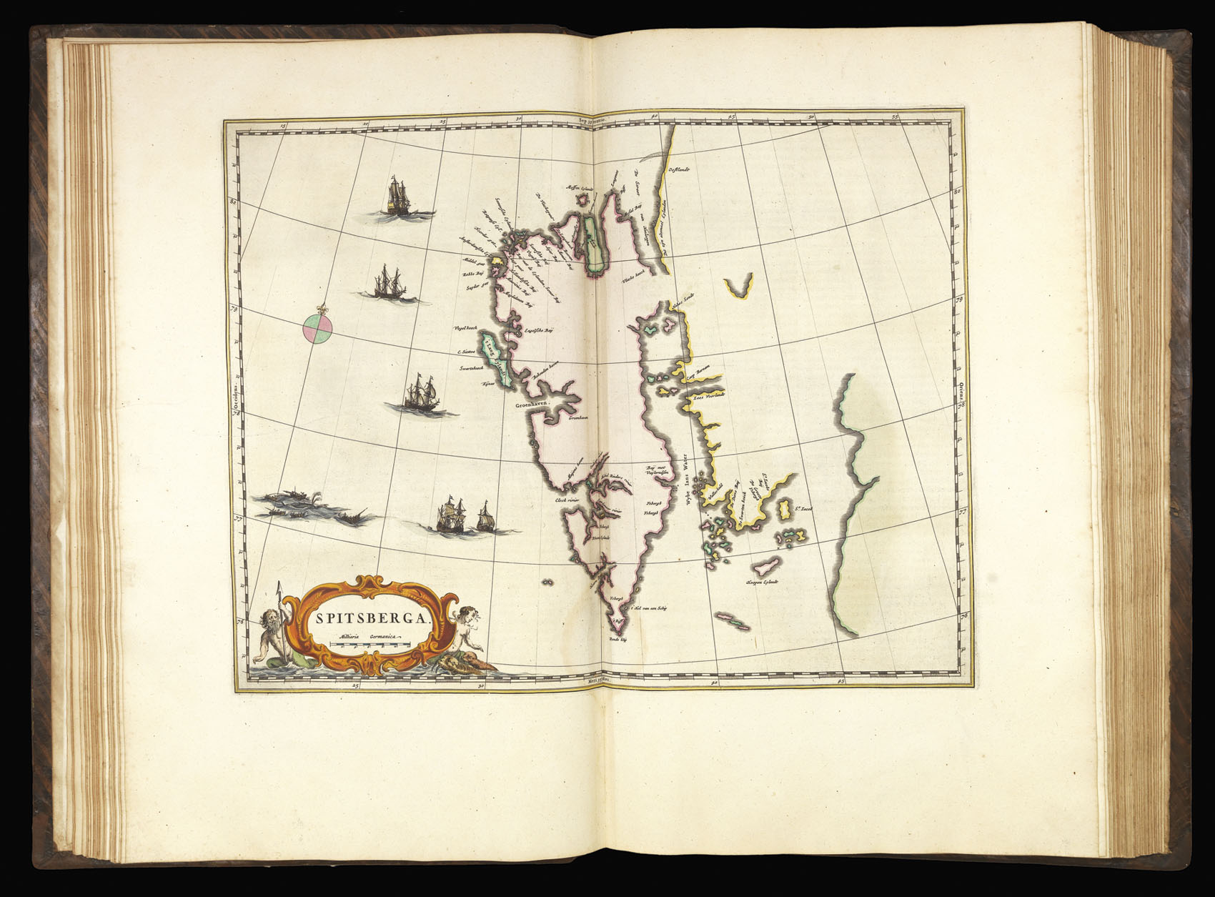
Spitsberga.
- Author: BLAEU, Johannes
- Publication place: Amsterdam
- Publication date: 1665.
- Physical description: Engraved map in contemporary hand-colour, heightened in gold.
- Dimensions: 380 by 490mm. (15 by 19.25 inches).
- Inventory reference: 9689
Notes
Based on the Muscovy Company’s map of 1625, Blaeu’s map of Spitsbergen introduces a number of new place names along the north coast and marks and names the Hinlopen straight.
The map appeared in the ‘Atlas Major’, which, in its various editions, was the largest atlas ever published. It was justly famed for its production values, its high typographic standard, and the quality of its engraving, ornamentation, binding and colouring. The atlas frequently served as the official gift of the Dutch Republic to princes and other authorities. It is one of the most lavish and highly prized of all seventeenth-century illustrated books.
Bibliography
- Van der Krogt
- Shirley, British Library.
- Brotton, 265-290
- S. Kramer, 'Ex bibliotheca Reisachiorum', Scriptorium 34 (1980), pp.91-95
Related items


Sign up to hear about our latest acquisitions, exhibitions and events
Find Us
New York
PO Box 329, Larchmont, NY, USA
Opening hours, London Gallery
Monday to Friday: 10:00 – 18:00
Saturday: by appointment
Closed: all bank holidays and 1-31 August
Opening hours, New York
By appointment only