 Rare Maps
  Rare Atlases
  Rare Books
  Rare Prints
  Globes and Planetaria
 Sign up to hear about our latest acquisitions, exhibitions and events


Find Us
New York
PO Box 329, Larchmont, NY, USA
Opening hours, London Gallery
Monday to Friday: 10:00 – 18:00
Saturday: by appointment
Closed: all bank holidays and 1-31 August
Opening hours, New York
By appointment only
Opening hours

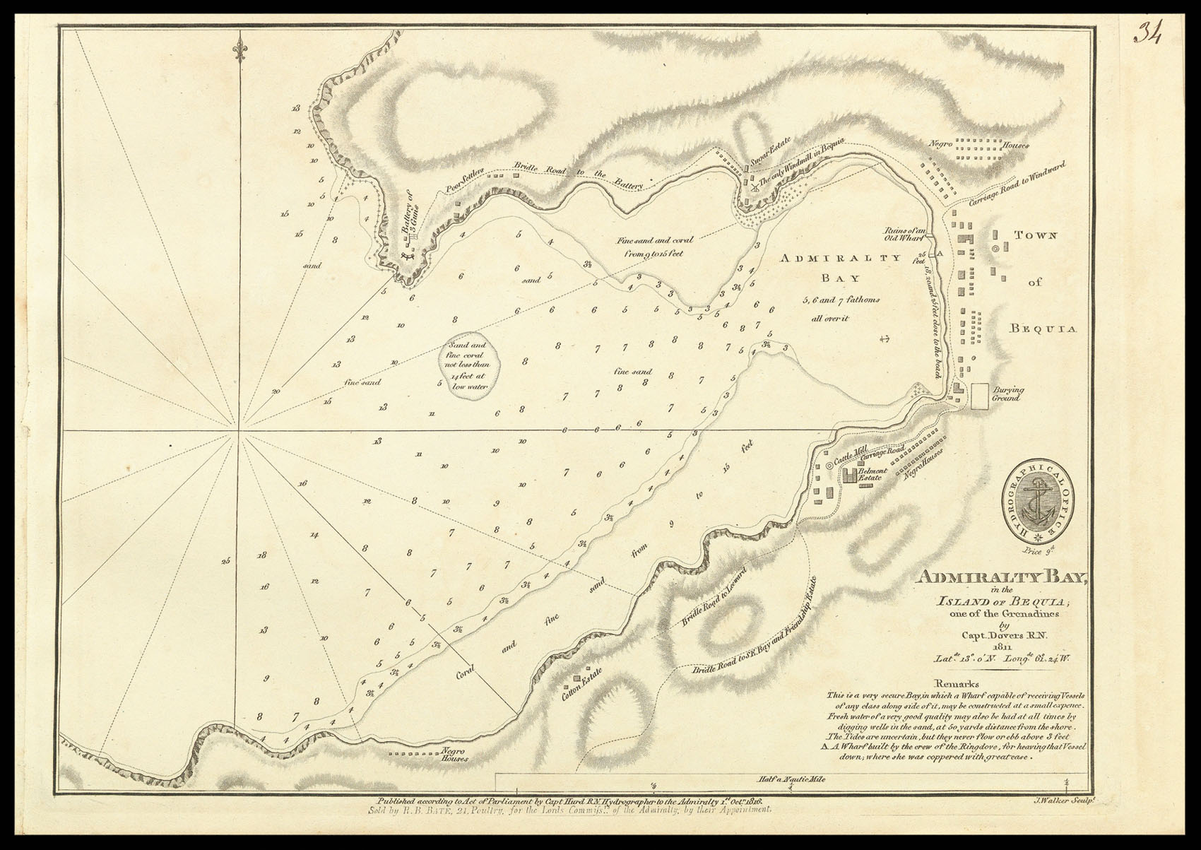
Admiralty Bay, in the Island of Bequia; one of the Grenadines By Capt. Dovers R.N. 1811.
- Author: DOVERS, Captain
- Publication place: London
- Publisher: Capt. Hurd R.N. Hydrographer to the Admiralty
- Publication date: 1st Oct 1816.
- Physical description: Engraved chart.
- Dimensions: 210 by 285mm. (8.25 by 11.25 inches).
- Inventory reference: 11644
Notes
Rare Admiralty chart of Port Elizabeth, Bequia.
The survey was carried out by Captain Dovers R.N.
John Walker, founding member of the Royal Geographic Society, was a leading mapmaker and engraver working in London in the first half of the nineteenth century. He is known to have produced numerous charts for James Horsburgh and the Admiralty.
Related items


Sign up to hear about our latest acquisitions, exhibitions and events
Find Us
New York
PO Box 329, Larchmont, NY, USA
Opening hours, London Gallery
Monday to Friday: 10:00 – 18:00
Saturday: by appointment
Closed: all bank holidays and 1-31 August
Opening hours, New York
By appointment only