 Rare Maps
  Rare Atlases
  Rare Books
  Rare Prints
  Globes and Planetaria
 Sign up to hear about our latest acquisitions, exhibitions and events


Find Us
New York
PO Box 329, Larchmont, NY, USA
Opening hours, London Gallery
Monday to Friday: 10:00 – 18:00
Saturday: by appointment
Closed: all bank holidays and 1-31 August
Opening hours, New York
By appointment only
Opening hours

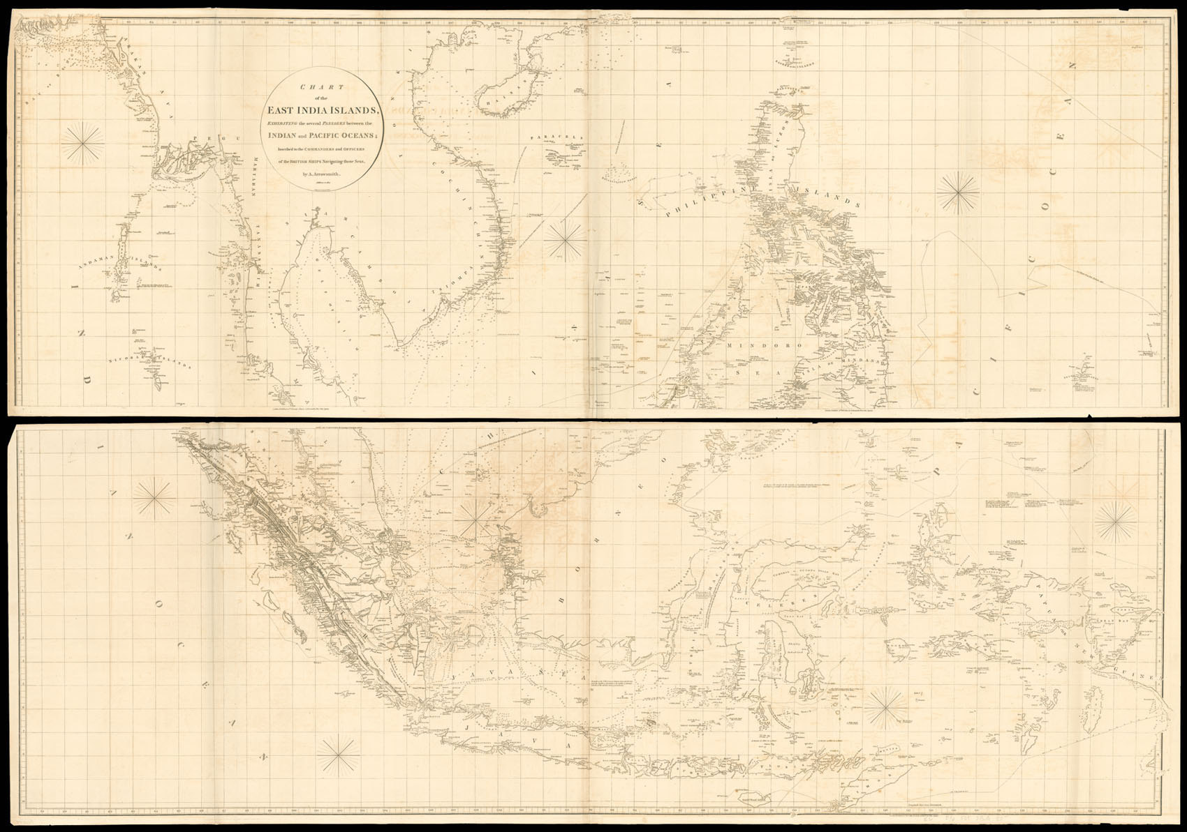
Chart of the East India Islands. Exhibiting several passages between the Indian and Pacific Oceans; Inscribed to the Commanders and Officers of the British Ships navigating those seas, by A. Arrowsmith.
- Author: ARROWSMITH, Aaron
- Publication place: London
- Publisher: A. Arrowsmith, No.10 Soho Square
- Publication date: 20th Feb., 1800. Additions to 1812.
- Physical description: Engraved chart, on four sheets, joined as two, some minor offsetting, first sheet slightly creased.
- Dimensions: 1310 by 1870mm (51.5 by 73.5 inches).
- Inventory reference: 2265
Notes
Aaron Arrowsmith (1750-1823), ”easily the foremost cartographer of his time” (R.V. Tooley), was the founder of the Arrowsmith dynasty of cartographers. Born in County Durham, he was in London by 1777 when he witnessed the will of Andrew Dury, a mapseller and publisher, and was probably training with him; he may have trained with William Faden, Geographer to the King, but was certainly employed by John Cary in 1782, as he is credited with the survey work for ’Cary’s Actual Survey, of the Great Post Roads between London and Falmouth’, published in 1784; he is frequently credited with some of the survey work for Cary’s county atlas, ’Cary’s New and Correct English Atlas: being a set of county maps from actual surveys’ (1787), but the sources are silent on this and by this time Arrowsmith had established his own business.
Arrowmsith’s maps set a new standard; he was assiduous in analysing and verifying his sources, discarding not only the fictional but also the uncertain, going to printed and manuscript sources for his information, and engraved in a clear and highly legible style. Arrowsmith was also diligent in revising and improving his maps to keep them current, and served as an inspiration for the next generation of (particularly American) surveyors.
Related items


Sign up to hear about our latest acquisitions, exhibitions and events
Find Us
New York
PO Box 329, Larchmont, NY, USA
Opening hours, London Gallery
Monday to Friday: 10:00 – 18:00
Saturday: by appointment
Closed: all bank holidays and 1-31 August
Opening hours, New York
By appointment only