 Rare Maps
  Rare Atlases
  Rare Books
  Rare Prints
  Globes and Planetaria
 Sign up to hear about our latest acquisitions, exhibitions and events


Find Us
New York
PO Box 329, Larchmont, NY, USA
Opening hours, London Gallery
Monday to Friday: 10:00 – 18:00
Saturday: by appointment
Closed: all bank holidays and 1-31 August
Opening hours, New York
By appointment only
Opening hours

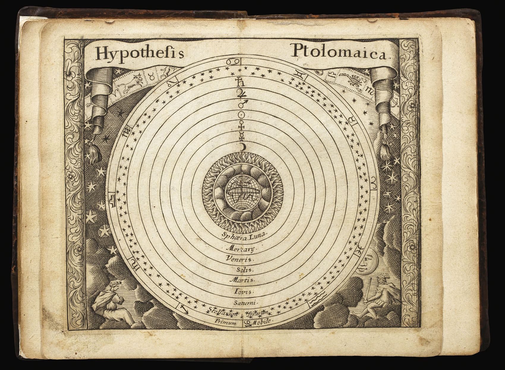


Atlas Coelestis containing the Systems and Theoryes of the Planets, the Constellations of the starrs, and other Phenomina’s of the Heavens with necessary tables relating thereto collected by John Seller.
- Author: SELLER, John
- Publication place: [London
- Publication date: c1690].
- Physical description: Quarto (140 by 95mm), engraved title, engraved allegorical title and 58 mostly double-page plates (including diagrams, celestial charts and tables), 72pp. text, contemporary calf, first few pages detached, some occasional browning, rebacked.
- Inventory reference: 14522
Notes
The first pocket celestial atlas published in England.
This is an unrecorded second edition of Seller’s pocket celestial, now reprinted as Atlas coelestis, rather than Atlas caelestis, with the contents unchanged. The plate “This table readily sheweth ye exact day of ye New and full Moone” in a second state, with the start date amended to 1680 and the finishing date now 1700. The double-page astrological chart engraved by Samuel Moore is not present here, but there is no indication it was ever present; otherwise the plate count and order match the first edition.
The atlas is essentially composite in nature; but the volume is built around thirty-one engravings of the constellations, a double-page celestial hemisphere, two double-page engraved maps of the Moon, and a map of the constellations around the North Pole.
John Seller (c1632-1697) is one of the most important figures in English map-publishing, but his reputation has suffered at the hands of later critics.
He was a mapmaker, chartmaker, compass-maker and mathematical instrument-maker; an author, mapseller, bookseller and globeseller and cartographic publisher, successively Hydrographer to Charles II and James II.
His greatest legacy was a series of chart-books to be published under the heading ‘The English Pilot’, covering all the navigations of the world from 1671 to 1675. By the fifth volume, it seems that Seller’s ambitions had exceeded his resources; by 1677 Seller had taken William Fisher, John Thornton, John Colson and James Atkinson into partnership. The partnership was short-lived, and several titles passed out of Seller’s hands.
In the meantime, Seller was publishing the ‘Atlas Maritimus’, the first English sea-atlas published to compete with the Dutch, using plates from the ‘English Pilot’ and others from his general stock. He also announced plans for a new survey of the counties of England and Wales, with several maps prepared on two sheets, and single-sheet reductions made to be assembled as an atlas; the project failed, and only two copies of the atlas, mocked up as sample books survive, although later printings of the maps are known.
After the end of the partnership, Seller concentrated principally on pocket atlases, notably ‘A Book of Geography shewing all the Empires, Monarchies Kingdomes, Regions Dominions Principalities and Countries, in the Whole World’, re-issued as ‘The Atlas Minimus’, ‘Atlas Cælestis’ (1680), ‘Atlas Maritimus: or, a Sea-Atlas’ (1682), ‘A New Systeme Of Geography’ (1684), ‘Atlas Terrestris’ (1685) and ‘Anglia Contracta’ (1694).
Seller had an important output of separately published maps, notably his map of New Jersey (1674), the present map, New England (1676) and a pair of celestial charts, the Southern Hemisphere drawn by Sir Edmund Halley (1678).
Provenance
Ownership inscription of John Stafford Smith (1750-1836) dated 1786 above engraved title. Composer of the music to the Star Spangled Banner and early musicologist.
Image gallery
Related items


Sign up to hear about our latest acquisitions, exhibitions and events
Find Us
New York
PO Box 329, Larchmont, NY, USA
Opening hours, London Gallery
Monday to Friday: 10:00 – 18:00
Saturday: by appointment
Closed: all bank holidays and 1-31 August
Opening hours, New York
By appointment only