 Rare Maps
  Rare Atlases
  Rare Books
  Rare Prints
  Globes and Planetaria
 Sign up to hear about our latest acquisitions, exhibitions and events


Find Us
New York
PO Box 329, Larchmont, NY, USA
Opening hours, London Gallery
Monday to Friday: 10:00 – 18:00
Saturday: by appointment
Closed: all bank holidays and 1-31 August
Opening hours, New York
By appointment only
Opening hours

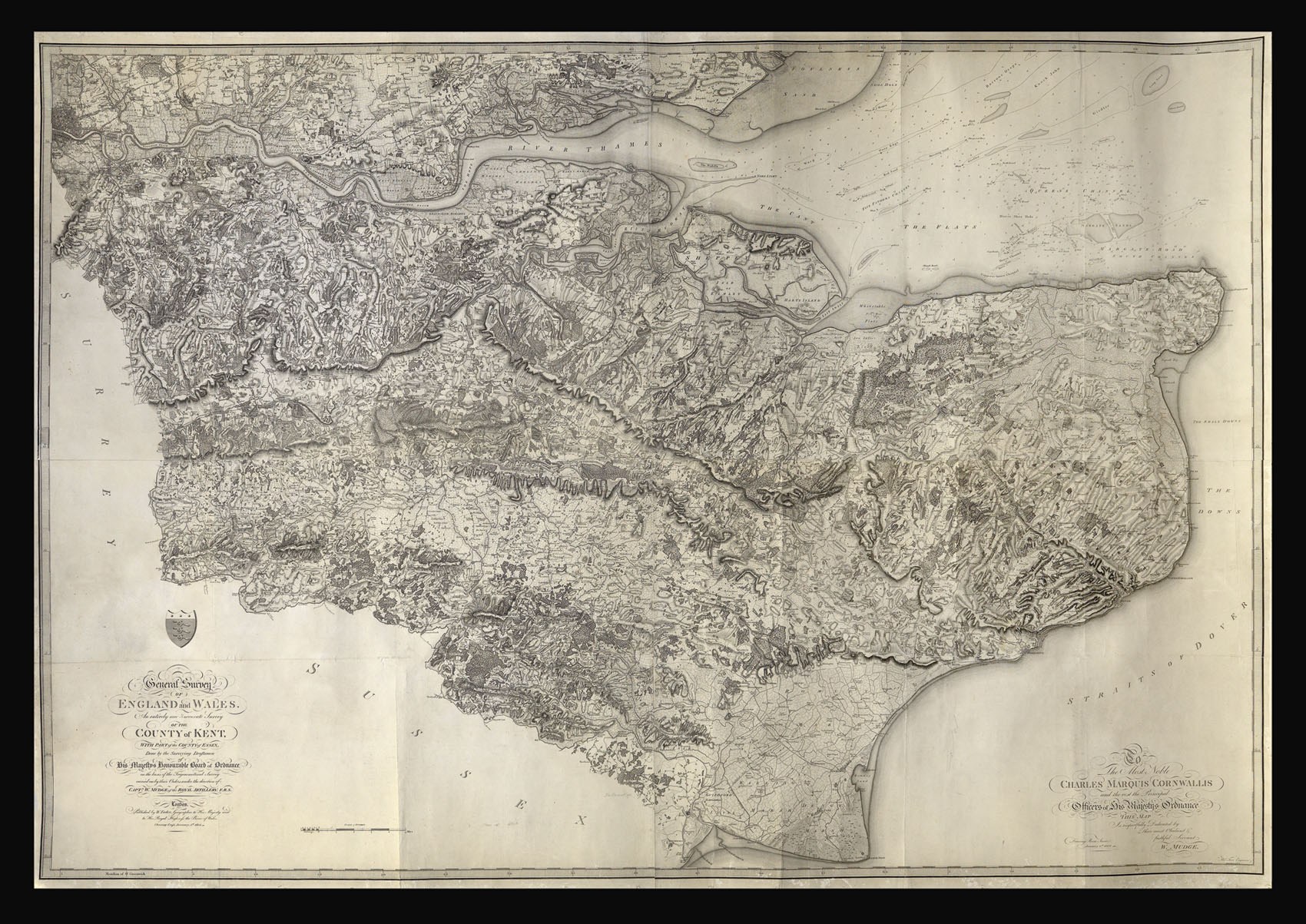
A General Survey of England and Wales An entirely new accurate Survey of Kent with parts of the County of Essex…
- Author: MUDGE, Captain William
- Publication place: London
- Publisher: W. Faden, Charing Cross
- Publication date: 1801.
- Physical description: Engraved map on four sheets joined, mounted on linen.
- Dimensions: 1200 by 1660mm. (47.25 by 65.25 inches).
- Inventory reference: 12744
Notes
Mudge’s map of Kent was the first Ordnance Survey map to be published, and is often known as the ‘Mudge Map’. The survey was initiated in response to fears of invasion by the newly republican French.
Colonel William Mudge (1762-1820) began his career as a lieutenant in the Royal Artillery, and was appointed to the Ordnance Survey in 1791, becoming Superintendent in 1798. In the same year, he was elected to the Royal Academy.
Related items


Sign up to hear about our latest acquisitions, exhibitions and events
Find Us
New York
PO Box 329, Larchmont, NY, USA
Opening hours, London Gallery
Monday to Friday: 10:00 – 18:00
Saturday: by appointment
Closed: all bank holidays and 1-31 August
Opening hours, New York
By appointment only