 Rare Maps
  Rare Atlases
  Rare Books
  Rare Prints
  Globes and Planetaria
 Sign up to hear about our latest acquisitions, exhibitions and events


Find Us
New York
PO Box 329, Larchmont, NY, USA
Opening hours, London Gallery
Monday to Friday: 10:00 – 18:00
Saturday: by appointment
Closed: all bank holidays and 1-31 August
Opening hours, New York
By appointment only
Opening hours

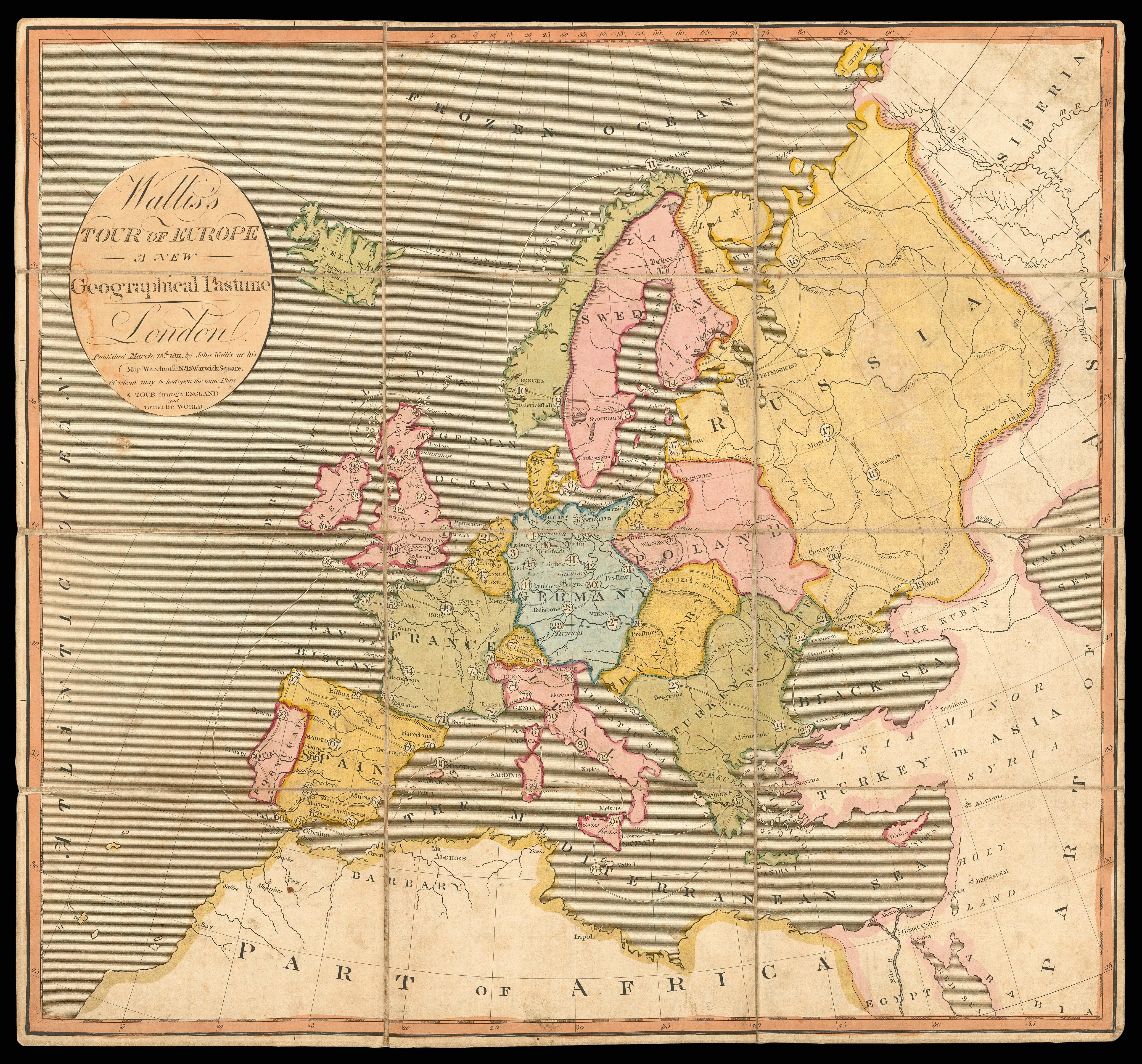
[Game map] Wallis's Tour of Europe
- Author: WALLIS, John
- Publication place: [London]
- Publisher: John Wallis, No. 13 Warwick Square
- Publication date: March 13th 1811.
- Physical description: Engraved map with original hand colour, dissected and mounted on linen, with a booklet of rules.
- Dimensions: 480 by 510mm. (19 by 20 inches).
- Inventory reference: 15698
Notes
This geographical game map from 1811 recreates the contemporary tradition of the “Grand Tour”, where wealthy young men were sent around Europe to acquire culture and experience of different countries.
It is suitable for two to three players but up to six can play “if a double set of counters and pyramids are purchased”. Each player takes a pyramid and four counters, which are meant to represent the tourist and their servants. They start at Harwich (No. 1), then spins a totem to see how many cities they can advance. Each subsequent roll is added to the total, so the last city (London) must be landed on with an exact roll to win the game. If for various reasons they miss a turn, they leave a counter (or servant) at the city, and have to retrieve them before they can advance.
John Wallis (1745?-1818) was a British map and book maker, seller and publisher. After his first business Wallis & Stonehouse went bankrupt in 1778, he became well-known for producing games and puzzles for children. His business was based at 16 Ludgate Street, where the game map was published, from 1778-1805. From 1813 he worked in collaboration with his son Edward Wallis (1787?-1868), who continued the business after his death in 1818.
Related items


Sign up to hear about our latest acquisitions, exhibitions and events
Find Us
New York
PO Box 329, Larchmont, NY, USA
Opening hours, London Gallery
Monday to Friday: 10:00 – 18:00
Saturday: by appointment
Closed: all bank holidays and 1-31 August
Opening hours, New York
By appointment only