 Rare Maps
  Rare Atlases
  Rare Books
  Rare Prints
  Globes and Planetaria
 Sign up to hear about our latest acquisitions, exhibitions and events


Find Us
New York
PO Box 329, Larchmont, NY, USA
Opening hours, London Gallery
Monday to Friday: 10:00 – 18:00
Saturday: by appointment
Closed: all bank holidays and 1-31 August
Opening hours, New York
By appointment only
Opening hours

Hessel Gerritsz
(1581 - 1632)
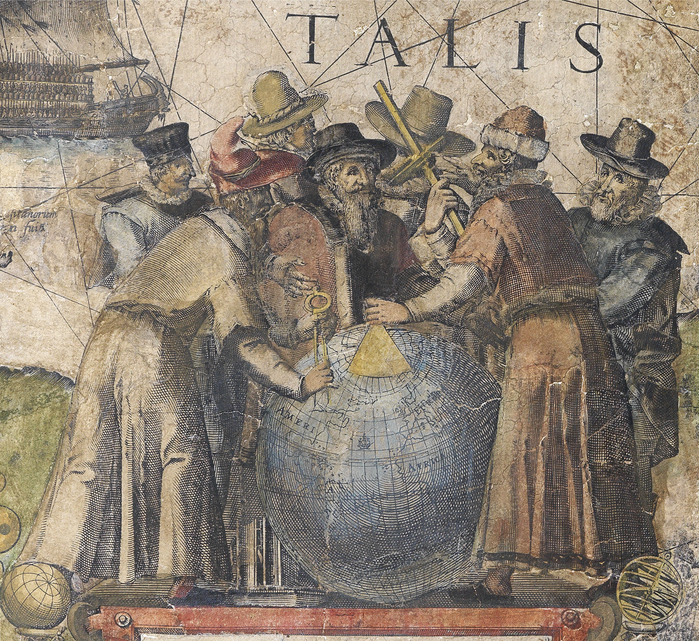
“Perhaps the greatest figure in seventeenth century Dutch cartography” (Martin Woods)
Recommended for the position by Petrus Plancius, the VOC’s scientific adviser, Hessel Gerritsz, was chief cartographer of the VOC from 1617 until his death in 1632. This gave him unprecedented access to all journals, maps and drawings from Dutch voyages, including the discoveries of Willem Janszoon in the Duyfken, Jan Castenszoon, Dirk Hartog, Jacob Le Maire, Willem Cornelisz. Schouten, Jaspar Jansz. de Jonghe, Henry Hudson, and others. He used this information to correct the VOC’s highly secret navigational charts, and to gain a more accurate understanding of the Pacific Ocean, which he compiled into one magnificent untitled chart of the ocean in 1622, now at the BnF.
Gerritsz is probably best known as the first cartographer to piece together a recognizable coastline for Australia. However, he was also responsible for the ongoing appearance of the continent as an extension of New Guinea on Dutch maps, which would be proliferated on maps for most of the rest of the seventeenth century.
Gerrtisz’s position at the VOC was subsequently filled by three generations of the powerful Blaeu family, the leading firm of Dutch cartographers of the seventeenth century; a nice irony, as in his youth, Gerritsz had served an apprenticeship with Willem Jansz. Blaeu, the founder of the dynasty. Gerritsz’s early work finds its way into a number of Blaeu’s maps, including his separately published wall map America…, of 1608. Blaeu had trained as an instrument and globe-maker with Danish astronomer Tycho Brahe; and Gerritsz emulated him by starting his own firm.
“His growing reputation as a cartographic engraver of supreme precision and accuracy soon attracted the attention of the Dutch admiralty. In 1612 he was appointed, along with Blaeu, to test theories that had been proposed for finding latitude and longitude at sea. The same year, inspired by Henry Hudson’s attempts to find a north-east passage to China above the Arctic Circle, Gerritsz published a navigational test in which he proposed a northern expedition to the East Indies. Among the advantages he claimed for his new route was the opportunity it would offer to locate the uncharted southern continent” (Woods).
The first printed record of Hudson’s fourth and final voyage contains Gerritsz’s map Tabula Navtica, qua repraesentantur orae maritimae, meatus, ac freta, noviter a H Hudsono Anglo ad Caurum supra Novam Fanciam indagata Anno 1612, and is the first to show Hudson’s Bay.
Gerritsz engraved the maps that accompanied Johannes de Laet’s Nieuwe Wereldt ofte Beschrijvinghe van West Indien, 1625 and 1630. The most accurate description of the Americas available at the time, and arguably the finest published in the seventeenth century. As a director of the newly formed Dutch West India Company, de Laet had access to a vast wealth of original material related to the Americas and Africa. The resulting maps are the “first to depart from the heavier style of the Mercator and Ortelius period. The more open style of engraving was one that both Blaeu and Janssonius would use in their atlases” (Burden).
Possibly inspired by his work for de Laet, in 1628 Gerritsz travelled to the West Indies and South America in the Zutphen. He spent some time charting the islands of the Antilles, Puerto Rico, the Cayman Islands, and the north coast of Cuba. It is possible that he also visited Virginia on the same voyage, as his subsequent map, De Eylanden ende Vastelanden van Westindien op de Noordzee,… (c1631), charts the coastline with great accuracy, and the information repeated in subsequent maps by Blaeu, Janssonius and others.
Sign up to hear about our latest acquisitions, exhibitions and events
Find Us
New York
PO Box 329, Larchmont, NY, USA
Opening hours, London Gallery
Monday to Friday: 10:00 – 18:00
Saturday: by appointment
Closed: all bank holidays and 1-31 August
Opening hours, New York
By appointment only