 Rare Maps
  Rare Atlases
  Rare Books
  Rare Prints
  Globes and Planetaria
 Sign up to hear about our latest acquisitions, exhibitions and events


Find Us
New York
PO Box 329, Larchmont, NY, USA
Opening hours, London Gallery
Monday to Friday: 10:00 – 18:00
Saturday: by appointment
Closed: all bank holidays and 1-31 August
Opening hours, New York
By appointment only
Opening hours

Rare Atlases
We are the world’s leading dealer in rare atlases by mapmakers such as Blaeu, Mercator, Ortelius, Ptolemy, Speed, and Waghenaer.
(39 results)

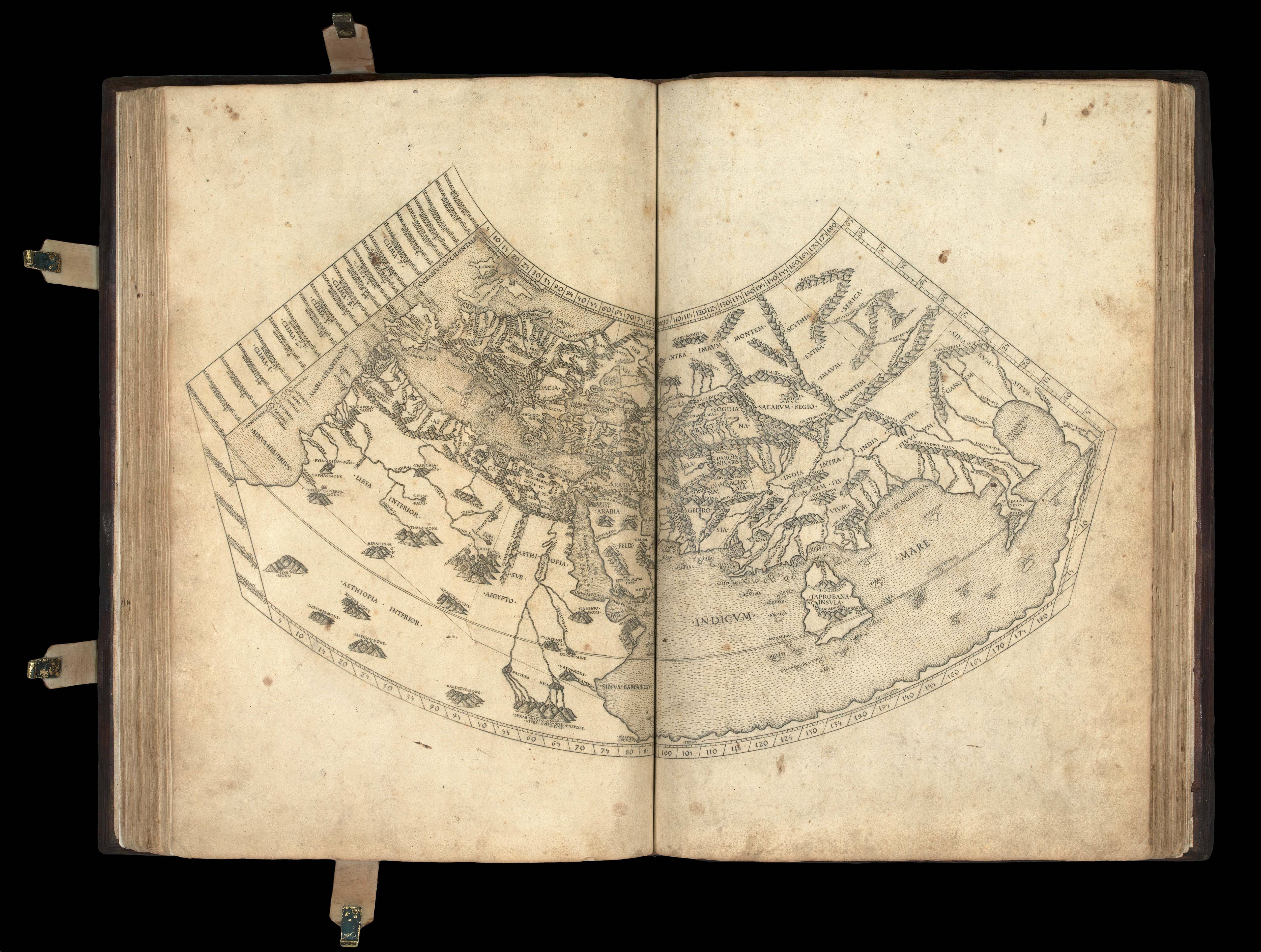
The first atlas illustrated with woodcut maps
PTOLEMAEUS, Claudius; translated by ANGELUS, Jacobus, and edited by Nicolaus GERMANUS.
£1,200,000
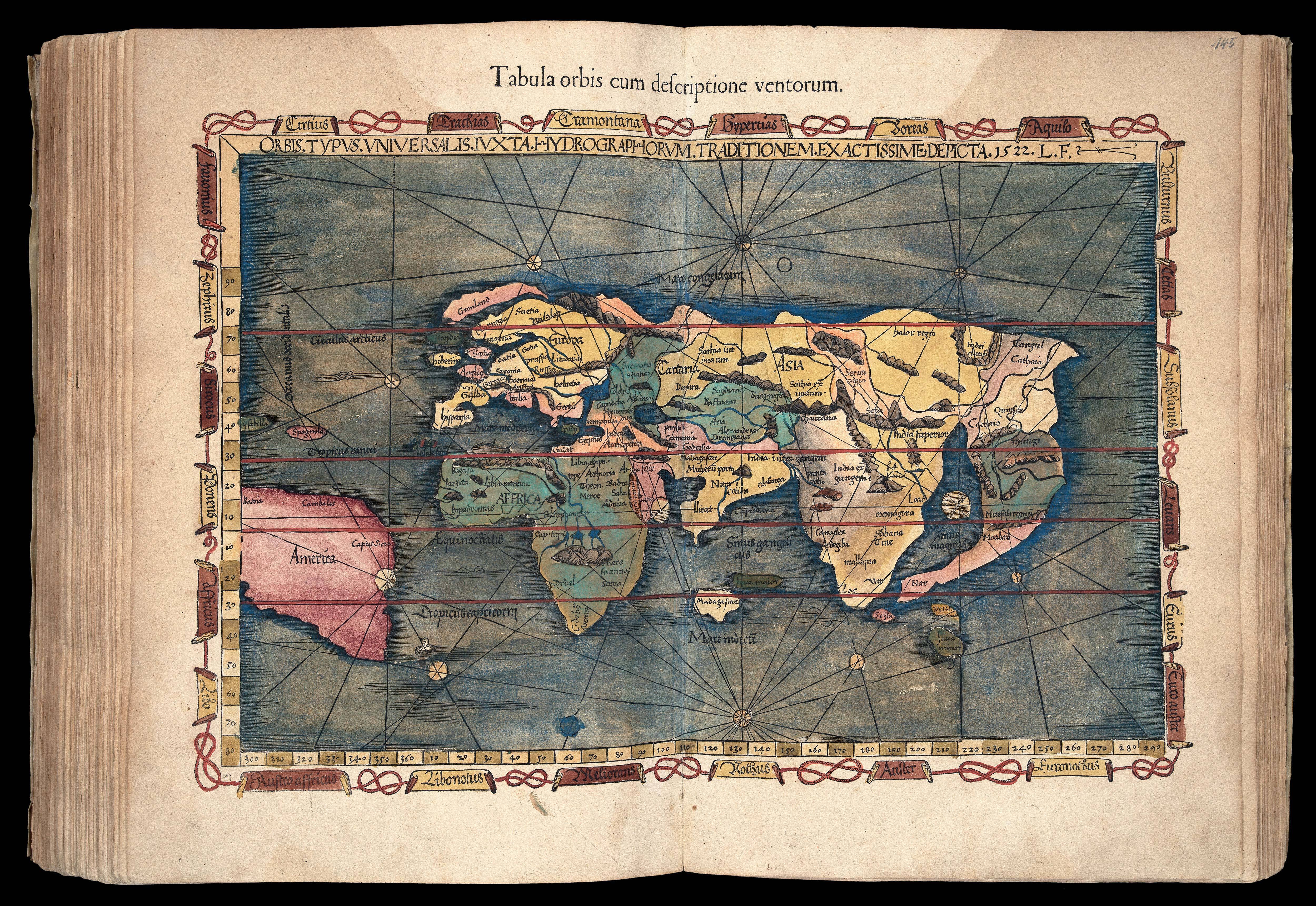
Second Rome edition with the “finest Ptolemaic plates produced until Gerard Mercator”
PTOLEMAEUS, Claudius
£300,000

The first atlas printed in Venice, the first wholly printed in colours, incorporating the first map to indicate Japan
PTOLEMAEUS, Claudius; Bernardus SYLVANUS
£150,000
Servetus – the expurgated edition – with contemporary hand-colour
PTOLEMAEUS, Claudius; and Michael VILLANOVANUS, known as 'SERVETUS'
£200,000

A Scottish astronomer of considerable reputation
BASSANTIN, Jacques
£120,000
Bordone’s Isolario in contemporary binding
BORDONE, Benedetto di
£40,000

A rare portolan atlas showing the shift in focus from the Mediterranean to northern Europe
DOSSAIGA, Jaime [DOUSAIGO, Jacques]
£385,000

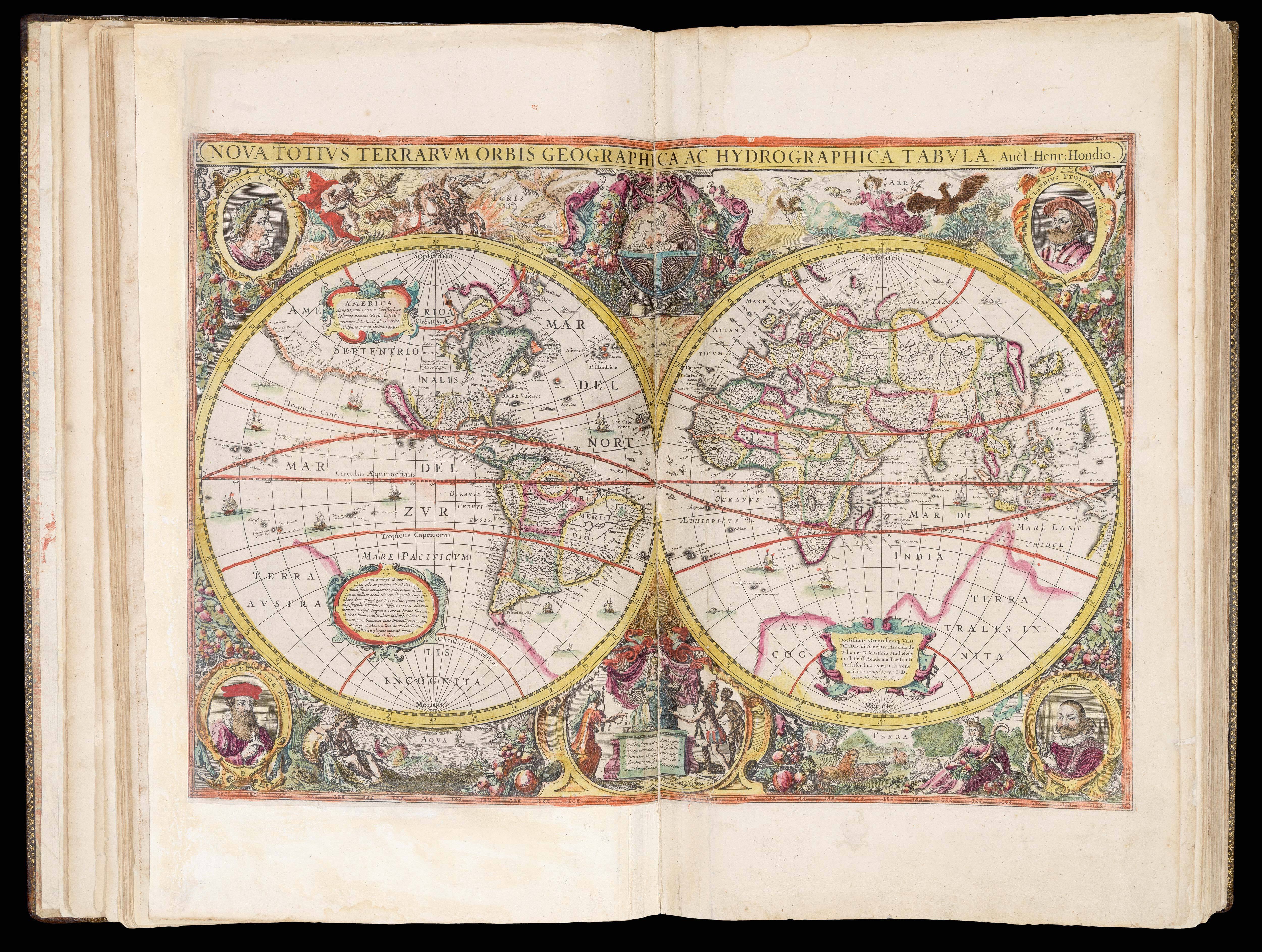
The first ‘atlas’
MERCATOR, Gerard; Jodocus HONDIUS
£100,000

First edition of Magini’s Italia
MAGINI, Giovanni Antonio, and Fabio
£40,000

The first world atlas published by an Englishman
SPEED, John
£95,000

From the inventory of the Van Keulen family of cartographers
CLOPPENBURG, Johannes
£60,000
The scarce English edition of the Mercator/Hondius atlas in original colour
MERCATOR, Gerard
£250,000
Sign up to hear about our latest acquisitions, exhibitions and events
Find Us
New York
PO Box 329, Larchmont, NY, USA
Opening hours, London Gallery
Monday to Friday: 10:00 – 18:00
Saturday: by appointment
Closed: all bank holidays and 1-31 August
Opening hours, New York
By appointment only