 Rare Maps
  Rare Atlases
  Rare Books
  Rare Prints
  Globes and Planetaria
 Sign up to hear about our latest acquisitions, exhibitions and events


Find Us
New York
PO Box 329, Larchmont, NY, USA
Opening hours, London Gallery
Monday to Friday: 10:00 – 18:00
Saturday: by appointment
Closed: all bank holidays and 1-31 August
Opening hours, New York
By appointment only
Opening hours

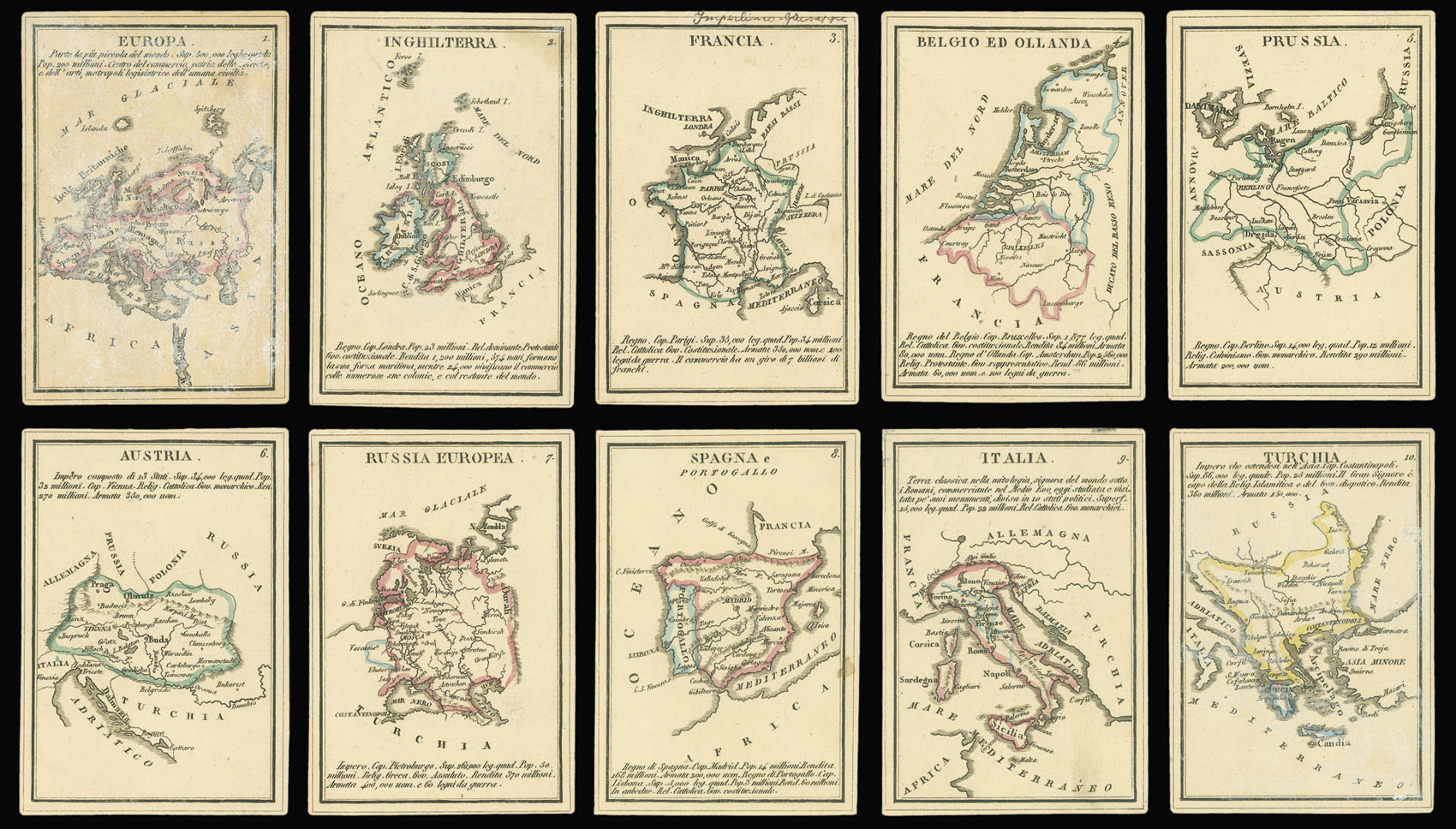


Piccolo Atlante per la Gioventu composte di 40 tavole geografiche con la descrizione delle Superficie, popolazioni, religioni, forma di governo, rendite, armate, ed altre notizie storico statistiche.
- Author: VALLARDI, Pietro & Giuseppe
- Publication place: Milan
- Publisher: Pietro & Giuseppe Vallardi
- Publication date: c.1830
- Physical description: Set of forty cards together with title, housed within in a chemise, in original blue paper slipcase, with green publisher's label, rubbed.
- Dimensions: 110 by 85mm (4.25 by 3.25 inches).
- Inventory reference: 2878
Notes
Unrecorded miniature atlas.
The atlas consists of a title and forty maps each printed on thick card. The cards are divided into four sets: Europe, Asia, America, and Africa; with each set containing nine regional maps of the most prominent countries. As the title states, each map gives information upon the geography, population, religion, government, revenues and military strength.
Although the atlas is not dated, an approximate date maybe ascertained from the map of Argentina and Uruguay. Upon the map Argentina is named the ‘Confederazione del Rio della Plata’. The United Provinces of Rio de la Plata was an early name for the newly independent Argentina. The name was dropped by the end of the 1820s in favour of Argentina. The map also shows an independent Uruguay, which gained its independence at the Treaty of Montevideo in 1828.
We are unable to trace any institutional example of the present atlas.
Contents
Europe
1. Europe
2. England
3. France
4. The Low Countries
5. Prussia
6. Austria
7. Russia
8. Spain
9. Italy
10. Turkey (Turkey in Europe – Balkans and Greece)
Asia
1. Asia
2. Siberia
3. Independent Tartary (Kazakhstan, Uzbekistan, Turkmenistan)
4. China
5. Japan
6. Turkey in Asia
7. Arabia
8. Persia
9. Tibet
10. India
America
1. America
2. Canada
3. United States
4. Mexico
5. Columbia
6. Guinea
7. Brazil
8. Peru
9. Chile
10. La Plata (United Provinces of Rio de la Plata – Argentina)
Africa
1. Africa
2. Egypt
3. Nubia and Abissinia
4. Barbary
5. Morocco
6. Sahara Desert
7. Sudan and Nigeria
8. Northern Guinea
9. South Guinea
10. Canary Islands
Image gallery
Related items


Sign up to hear about our latest acquisitions, exhibitions and events
Find Us
New York
PO Box 329, Larchmont, NY, USA
Opening hours, London Gallery
Monday to Friday: 10:00 – 18:00
Saturday: by appointment
Closed: all bank holidays and 1-31 August
Opening hours, New York
By appointment only