 Rare Maps
  Rare Atlases
  Rare Books
  Rare Prints
  Globes and Planetaria
 Sign up to hear about our latest acquisitions, exhibitions and events


Find Us
New York
PO Box 329, Larchmont, NY, USA
Opening hours, London Gallery
Monday to Friday: 10:00 – 18:00
Saturday: by appointment
Closed: all bank holidays and 1-31 August
Opening hours, New York
By appointment only
Opening hours


Germania Inferior id est, XVII Provinciarum ejus novæ et exactæ Tabulæ Geographicæ, cum Luculentis Singularum descriptionibus additis.
- Author: KAERIUS, Petrus [Pieter van den Keere] and Petrus MONTANUS.
- Publication place: Amsterdam
- Publisher: Pieter van der Keere
- Publication date: 1617.
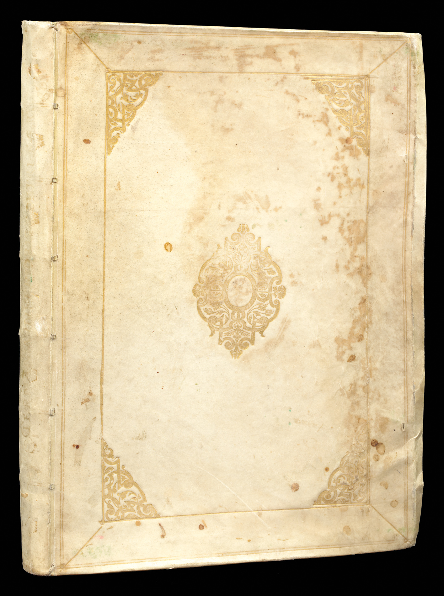
- Physical description: Folio (425 by 300mm), engraved title-page and 24 engraved double-page maps, original vellum gilt.
- Inventory reference: 11503
Notes
A magnificent example of the first edition of the first folio atlas of the Netherlands.
Pieter van den Keere dedicated the atlas of the Netherlands to the States General of the United Provinces. The text was written by Van der Keere’s brother in law Petrus Montanus, while Petrus Scriverius, Daniel Heinsius and Petrus Bertius contributed with an introductory elegy and Latin and Greek poems. Van den Keere’s maps were not entirely original. Some, including the famous Leo Belgicus, were printed from revised copperplates purchased a few years earlier at the auction of Cornelis Claesz. Others were inspired by maps by Abraham Ortelius, Gerard Mercator and Jodocus Hondius. The value of these maps of the provinces did not lie in their geographical originality but in a skilful mixture of exceptional engraving with a standardized way of showing town views and costumed figures, within the concept of the first national atlas.
The lion map is the third incarnation of the Aitzinger form of the Leo Belgicus: the lion rampant facing right, with the right paw raised. The text to the verso acknowledges the lion’s pedigree. Below the lion are depictions of Benelux nobility and gentry, and to the right, in an elaborate cartouche, the following text:
“A skilfully made geographical map representing the XVII Provinces of the Netherlands in the form of a lion, showing also the coats-of-arms of the provinces, their boundaries and their governors, as defined and appointed by the supreme authorities in 1559”.
The map was not in fact the work of van den Keere, but of Hendrik Floris van Langren, whose imprint can sometimes be faintly seen upon the map. It would appear that van den Keere purchased the plate sometime after 1609, as van Langren is known to have lived and worked in Amsterdam up until that date. One should also note the cartouche text is almost identical to the language used in van Doetecum’s work, even though Langren’s map does not depict any of the governors.
Unlike some examples of the first edition, the present atlas does include the map of East Friesland – bearing no text to the verso and inserted here between pages 84 and 85. In the second Latin edition of 1622 the map of East Friesland has text on the back and has been put at the end of the atlas, with the page number 93, and signature Nn. After 1623 the plates were sold, probably to Claes Jansz. Visscher. They resurfaced in many similar atlases that were to follow.
Provenance
1. Bookplate of Van der Heijden
2. Manuscript device of “Conto meo navigem” (“Sail at your own risk”) and inscription of ownership by Job Hartmann von Enenkel (1576-1627), an Austrian collector and historian, and a leading Protestant noble in the Holy Roman Empire.
Bibliography
- van den Krogt, Koeman's Atlantes Neerlandici, 364:01
- Schilder, Monumenta Cartographica Neerlandica VII, pp. 413-424.
- Koeman, "Pieter van den Keere, Germania Inferior, Amsterdam 1617," in: Miscellenae Cartographica, pp. 67-83
Image gallery
Related items


Sign up to hear about our latest acquisitions, exhibitions and events
Find Us
New York
PO Box 329, Larchmont, NY, USA
Opening hours, London Gallery
Monday to Friday: 10:00 – 18:00
Saturday: by appointment
Closed: all bank holidays and 1-31 August
Opening hours, New York
By appointment only